More Info :- Satopanth Trek :: Trekking in Uttarakhand
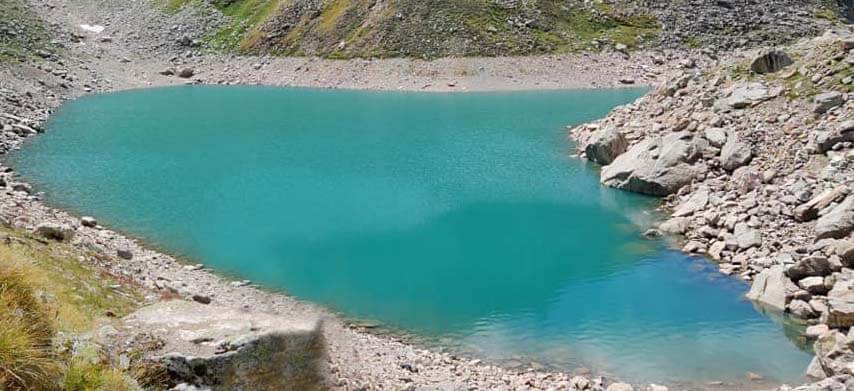
Satopanth lake Trek is a challenging high-altitude trek located in the Indian state of Uttarakhand, near the holy town of Badrinath. It’s a less-traveled route, known for its stunning beauty and demanding terrain. The trek usually begins from Mana village, the last inhabited village near the Indo-China border. It involves passing through scenic landscapes, glacial moraines, and steep climbs. The highlight of the trek is the pristine glacial lake called Satopanth Tal, surrounded by snow-clad peaks.

Satopanth Trek Itinerary
Day 1:- Rishikesh to Badrinath.
Day 2:- Badrinath to Laxmiban (12,000 ft) – 8.5 km
Day 3:- Laxmiban to Chakrateerth (13658 ft) – 9.5 km
Day 4 :- Chakrateerth to Satopanth Lake (14258 ft) to Chakrateerth – 7.5 km
Day 5:- Chakrateerth to Chamtoli (11745 ft) – 11 km
Day 6:- Chamtoli to Mana – 6.5 km. Drive to Joshimath.
Day 7:- Joshimath to Rishikesh
How To Reach Satopanth Lake
From Joshimath or Badrinath:- Both towns serve as a base for Satopanth Trek. You can reach either of these places by road from Haridwar or Dehradun.Shared or private taxis, as well as buses, ply between Joshimath/Badrinath and Mana village, the last motorable point. From Mana, trekking to Satopanth Lake begins.
The nearest airport is the Jolly Grant Airport in Dehradun. From there, you can hire a taxi or take a bus to reach Joshimath or Badrinath.
The nearest major railway station is in Haridwar. From Haridwar, you can hire a taxi or take a bus to reach Joshimath or Badrinath.
More Info :- How to Reach Mana Vilage
