Swargarohini Trek FAQs

1. Where is the Swargarohini Trek located?

The Swargarohini Trek is located in the Garhwal region of Uttarakhand, India. The trek takes you through the Yamunotri region, starting from Syanachatti or Barkot and leading to Swargarohini Peak at 6,252 meters (20,505 feet), as well as other nearby summits.

    2. What is the difficulty level of the Swargarohini Trek?

    The Swargarohini Trek is considered a moderate to difficult trek. It involves steep ascents, high-altitude conditions, and challenging terrain. While not as tough as some extreme treks, it still requires good physical fitness, stamina, and experience at high altitudes.

      3. How long does the Swargarohini Trek take?
      • The trek typically takes about 8-9 days, depending on the specific itinerary and pace. It involves multiple days of trekking, acclimatization, and exploration at various campsites.
      4. What is the best time to do the Swargarohini Trek?
      • The best times to undertake the Swargarohini Trek are during summer (May to June) and autumn (September to October). During these months, the weather is relatively stable, the trail is clear, and the snow is not as heavy, making the trek accessible and more enjoyable.
      • Monsoon season (July-August) should be avoided due to slippery trails, risk of landslides, and unpredictable weather.
      • Winter (November to February) brings heavy snowfall, making it a challenging and dangerous time to trek, especially for beginners.
      5. What is the highest point on the Swargarohini Trek?

      The highest point of the trek is the Swargarohini Pass at 4,200 meters (13,780 feet). The summit of Swargarohini Peak itself rises to 6,252 meters (20,505 feet), but the trek typically does not involve summiting the peak.

        6. What is the significance of the Swargarohini Trek?

        The Swargarohini trek is deeply rooted in Hindu mythology. According to the Mahabharata, the Pandavas (the heroes of the epic) traveled through this route as part of their final journey to heaven. It is believed that the Swargarohini mountain range is where the Pandavas ascended to Swarga (heaven). As a result, the trek is also considered a pilgrimage for many.

          7. How do I reach the starting point of the trek?

          The trek starts from Syanachatti or Barkot:

          • By Road: From Dehradun (around 6-7 hours by road), you can reach Syanachatti or Barkot, where the trek begins. These are well-connected by road, and taxis or buses can take you there.
          • By Train: The nearest railway station is Dehradun or Haridwar, both of which are well connected to major cities like Delhi, Mumbai, and Chandigarh. From there, you can take a bus or taxi to the starting point.
            8. What is the level of physical fitness required for the Swargarohini Trek?
            • You should be in good physical condition with a reasonable level of stamina and endurance to complete the trek. If you’re not already an experienced trekker, you should engage in cardio and strength training exercises, focusing on leg strength, before embarking on this trek.
            • Some experience with high-altitude trekking will be beneficial.
            9. Is the Swargarohini Trek safe for beginners?
            • Swargarohini Trek is not recommended for beginners due to its challenging terrain, steep climbs, and high-altitude conditions. It’s more suitable for trekkers who have prior experience in high-altitude trekking or at least some multi-day trekking experience.
            • If you’re a beginner, you can start with lower-altitude treks and gradually build your stamina and experience before attempting this one.
            10. What are the highlights of the Swargarohini Trek?
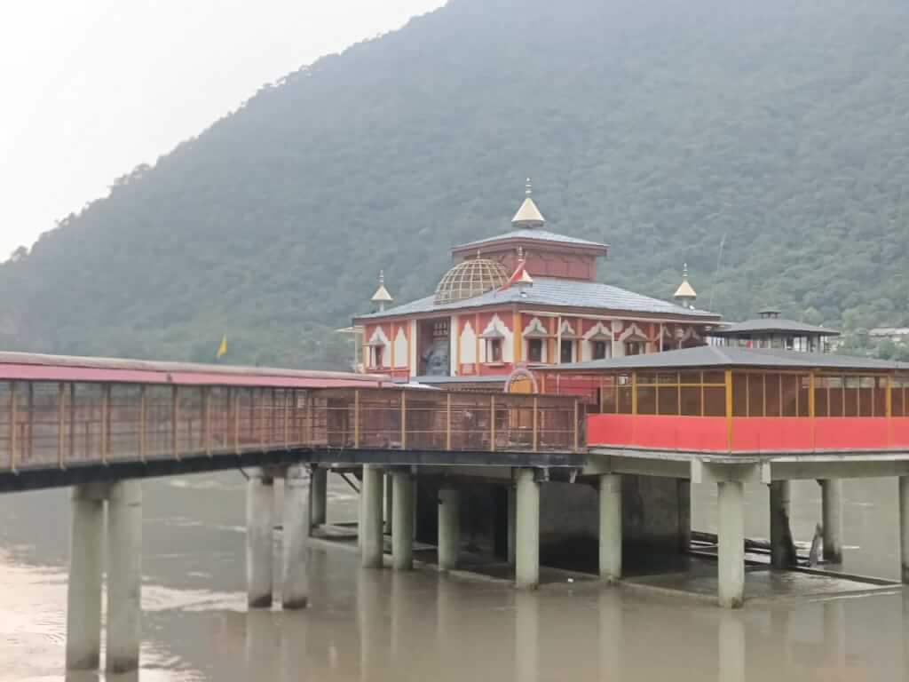
            • Yamunotri Temple: The trek passes near the sacred Yamunotri Temple, which is part of the Char Dham Yatra.
            • Swargarohini Peak and Pass: Offering dramatic views of the Swargarohini mountain range and other surrounding peaks like Bandarpunch, Kalanag, and Rupin Pass.
            • Spiritual Significance: The trek has strong religious importance as the believed route of the Pandavas’ ascent to heaven.
            • Breathtaking Views: Majestic views of the Garhwal Himalayas, lush green valleys, alpine meadows, and high-altitude lakes.
            • Campsites: Beautiful campsites at places like Dhatmir, Himalaya Dhar, and Swarna Sarovar Lake.
            11. What should I pack for the Swargarohini Trek?
            • Clothing: Layered clothing for varying temperatures (light woolens, thermals, trekking jackets, windproof jackets, and waterproof clothing).
            • Footwear: Sturdy trekking shoes with good grip, sandals for campsites, and extra pairs of socks.
            • Trekking Gear: Trekking poles, a good-quality backpack (40-50L), and a sleeping bag rated for cold weather.
            • Other Essentials: Sunscreen, sunglasses, water bottles, energy bars, dry fruits, a first-aid kit, a headlamp, camera, and a water purification method (tablets or filters).
            • Personal Items: Toiletries, ID proof, and any personal medications you need.
            12. Are there any accommodations along the way?
            • Accommodation during the Swargarohini Trek is camping-based. There are no permanent lodges or guesthouses along the route, so you’ll be camping in tents at designated campsites. Some campsites may be at higher altitudes, so sleeping bags suited for cold temperatures are essential.
            13. What are the common challenges trekkers face during the Swargarohini Trek?
            • Altitude Sickness: Given the high-altitude nature of the trek, altitude sickness is a potential risk. Proper acclimatization is essential to avoid symptoms like dizziness, nausea, and headaches.
            • Weather Conditions: Weather in the mountains can change rapidly, with rain, snow, or sudden temperature drops, so trekkers must be prepared for all conditions.
            14. Is there a mobile network on the Swargarohini Trek?

            Mobile network coverage is limited along the trek. You may have reception in lower-altitude areas like Barkot or Yamunotri, but once you ascend into the mountains, the signal becomes weak or unavailable. It’s best to disconnect and enjoy the trek without relying on mobile phones.

              15. What permits do I need for the Swargarohini Trek?
              • Since the trek passes through protected areas, you’ll need to obtain the necessary permits from the Uttarakhand Forest Department. Most trekking agencies handling the Swargarohini Trek will help you with the paperwork.
              • You may also need a char dham yatra permit if you plan to visit the Yamunotri Temple during your trek.

              Baraadsar Lake Trek FAQs

              1. Where is Baraadsar Lake located?


              Baraadsar Lake is located in the northeastern part of Uttarakhand, between the Rupin and Supin valleys. It lies near the Himachal Pradesh border, heading east and then south from the central Uttarakhand region. The lake is at an altitude of approximately 4,150 meters (13,615 feet) above sea level.

              2. What is the difficulty level of the Baraadsar Lake Trek?


              The trek is classified as moderate to difficult. It involves challenging terrain, high-altitude conditions, and some steep ascents. The route is remote, and trekkers need to be physically fit and have some prior experience in trekking at higher altitudes.

                3. How long is the Baraadsar Lake Trek?


                The trek usually takes 7 to 9 days to complete, depending on the itinerary and acclimatization. The distance covered is around 60-70 kilometers. Trekkers generally spend around 5-6 days trekking through the mountains, with a day or two for acclimatization.

                4. When is the best time to go for the Baraadsar Lake Trek?


                The best time for the trek is during the summer (May to June) and autumn (September to October) months when the weather is relatively stable and the snow on the trail has melted.
                Winter (November to March) is extremely cold, with heavy snow and challenging conditions, making it difficult to navigate. The monsoon season (July to August) should be avoided due to slippery trails and the risk of landslides.

                  5. What is the altitude of Baraadsar Lake?


                  The lake is situated at an elevation of 4,150 meters (13,615 feet) above sea level, so proper acclimatization is crucial to avoid altitude sickness.

                  6. What are the major highlights of the Baraadsar Lake Trek?


                  Baraadsar Lake: A pristine, high-altitude lake surrounded by snow-capped peaks and alpine meadows.
                  Scenic Views: Panoramic views of peaks like Swargarohini, Black Peak, and Rupin Pass.
                  Rugged Terrain: The trek traverses through beautiful alpine forests, meadows, river crossings, and high mountain passes.
                  Wildlife and Flora: The trek passes through areas rich in biodiversity, with opportunities to spot wildlife like Himalayan Monal, musk deer, and various species of birds.
                  Campsites: Scenic campsites with views of snow-covered peaks and lush valleys.

                  7. How do I reach the starting point of the trek?


                  The trek typically starts from Purola or Naitwar, depending on the chosen route.
                  By Road: From Dehradun, you can take a bus or hire a taxi to reach Purola (about 5-6 hours from Dehradun). From there, the trek begins.
                  By Train: The nearest railway station is Dehradun, which is well-connected by trains from major cities like Delhi, Mumbai, and Chandigarh. From Dehradun, you can take a bus or taxi to reach Purola.

                  8. What is the level of physical fitness required for the trek?


                  The trek is suitable for those who are moderately fit and have some prior trekking experience at high altitudes. The trail involves steep ascents, river crossings, and rocky paths, so trekkers should have good stamina and endurance. Regular cardio and leg-strengthening exercises are recommended.

                  9. Is there any accommodation on the trek?


                  Accommodation is mostly camping during the trek. You will stay in tents at various campsites. Some areas might have small shelters or makeshift huts, but most of the trek involves camping in remote locations.

                  10. Are there water sources along the trek?


                  Yes, there are natural water sources along the trail, such as streams and rivers. However, it’s always recommended to carry a water purifier or purification tablets to ensure the water is safe to drink.

                  11. What should I pack for the Baraadsar Lake Trek?


                  Clothing: Warm clothes for layering, including thermals, a waterproof trekking jacket, gloves, hats, and rain gear.
                  Trekking Gear: A sturdy backpack, trekking poles, waterproof trekking boots, a sleeping bag (appropriate for cold weather), and a headlamp.
                  Personal Items: Sunscreen, sunglasses, first-aid kit, camera, toiletries, and water purification tablets.
                  Snacks: Energy bars, dry fruits, and other lightweight high-energy foods.

                  12. What is the accommodation like on the trek?


                  Most of the trek involves tent camping. There are no permanent shelters, so you will camp in alpine meadows or near streams. Basic camping equipment such as tents, sleeping bags, and mats are generally provided by trekking agencies.

                    13. Is the trek safe?


                    The trek is generally safe, but due to its remote nature and high altitude, it’s important to be cautious and prepared. Altitude sickness can be a risk, so ensure proper acclimatization. Always trek with a guide, especially if you’re unfamiliar with the area, and carry adequate safety gear.

                      Kanakata Pass Trek FAQs

                      1. What is the Kanakata Pass Trek?

                      The Kanakata Pass Trek is a scenic trek in the Indian Himalayas, connecting the valleys of Himachal Pradesh and offering stunning views of the surrounding peaks.

                      2. How difficult is the trek?

                      The trek is considered moderate to challenging, requiring a good fitness level and some trekking experience due to its elevation and terrain.

                      3. What is the best time to visit?

                      The best time for the Kanakata Pass Trek is from May to June and September to October, when the weather is mild and trails are accessible.

                      4. What is the duration of the trek?

                      The trek typically takes about 6 to 8 days, depending on your pace and specific route.

                      5. What should I pack?

                      Essentials include sturdy trekking boots, warm clothing, a sleeping bag, a first-aid kit, a water bottle, and energy snacks.

                      6. Do I need a guide?

                      Yes, hiring a local guide is recommended for navigation, safety, and to enhance your trekking experience with local insights.

                      7. What accommodations are available?

                      Accommodation options include camping along the trek and basic guesthouses in nearby villages, depending on your itinerary.

                      8. What is the maximum altitude?

                      The highest point of the trek is around 4,700 meters (15,420 feet) at Kanakata Pass.

                      9. Are there any entry fees?

                      Yes, permits are required for trekking in this region. Check with local authorities or your trekking agency for details.

                      10. What wildlife can I expect to see?

                      You may encounter various wildlife, including Himalayan ibex, snow leopards, and diverse bird species, enhancing the trek’s natural beauty.

                      Sunderdhunga Glacier Trek FAQs

                      1. What is the Sunderdhunga Glacier Trek?

                      The Sunderdhunga Glacier Trek is a scenic trek in Uttarakhand, India, leading to the stunning Sunderdhunga Glacier, known for its breathtaking views of the Himalayas.

                      2. How difficult is the trek?

                      The trek is considered moderate to challenging, requiring good fitness levels and some prior trekking experience due to its altitude and terrain.

                      3. What is the best time to visit?

                      The ideal months for the trek are from April to June and September to October when the weather is pleasant and trails are clear.

                      4. What is the duration of the trek?

                      The trek typically takes around 7 to 9 days, depending on your pace and the specific route taken.

                      5. What should I pack?

                      Essentials include sturdy trekking shoes, warm clothing, a sleeping bag, a first-aid kit, a water bottle, and high-energy snacks.

                      6. Do I need a guide?

                      While not mandatory, hiring a local guide is advisable for navigation, safety, and enhancing your trekking experience.

                      7. What accommodations are available?

                      Accommodation options range from camping along the route to basic guesthouses in nearby villages, depending on your chosen itinerary.

                      8. What is the maximum altitude?

                      The highest point of the trek reaches approximately 4,600 meters (15,091 feet) at the glacier.

                      9. Are there any entry fees?

                      Yes, permits are required for trekking in this region. Check with local authorities or your trekking agency for current fees and regulations.

                      10. What wildlife can I expect to see?

                      The region is home to diverse wildlife, including Himalayan black bears, snow leopards, and various bird species, making it a nature lover’s paradise.

                      Bhagirathi Kharak Glacier Trek FAQs

                      1. What is the Bhagirathi Kharak Glacier Trek?

                      The Bhagirathi Kharak Glacier Trek is an adventurous trek in Uttarakhand, India, leading to the stunning glacier at the base of the Bhagirathi peaks.

                      2. How difficult is the trek?

                      The trek is considered challenging, suitable for experienced trekkers due to its high altitude, rugged terrain, and significant elevation gain.

                      3. What is the best time to visit?

                      The ideal months for the trek are May to June and September to October when the weather is stable and trails are accessible.

                      4. What is the duration of the trek?

                      The trek usually takes about 8 to 10 days, depending on your route and pace.

                      5. What should I pack?

                      Essentials include sturdy trekking boots, warm clothing, a sleeping bag, trekking poles, a first-aid kit, and high-energy snacks.

                      6. Do I need a guide?

                      Yes, hiring a local guide is highly recommended for navigation and safety, as the terrain can be challenging.

                      7. What accommodations are available?

                      Accommodation options include camping and basic guesthouses along the route, particularly in base camps.

                      8. What is the maximum altitude?

                      The highest point of the trek is around 4,500 meters (14,764 feet) at the glacier.

                      9. Are there any entry fees?

                      Yes, permits are required for trekking in this region. Check with local authorities or your trekking agency for details.

                      10. What wildlife can I expect to see?

                      You may encounter various wildlife, including snow leopards, Himalayan tahr, and diverse bird species, adding to the trek’s allure.

                      Binsar Trek FAQs

                      1. What is the Binsar Trek?

                      The Binsar Trek is a scenic trek located in Uttarakhand, India, known for its breathtaking views of the Himalayas, rich flora, and diverse wildlife.

                      2. How difficult is the trek?

                      The trek is considered moderate, making it suitable for both beginners and experienced trekkers, though a reasonable fitness level is recommended.

                      3. What is the best time to visit?

                      The best time for the Binsar Trek is from March to June and September to November, when the weather is pleasant and clear.

                      4. What is the duration of the trek?

                      The trek typically lasts 3 to 5 days, depending on your route and pace, with various options for exploration.

                      5. What should I pack?

                      Essentials include sturdy trekking shoes, warm clothing, a raincoat, a water bottle, snacks, and a first-aid kit.

                      6. Do I need a guide?

                      While not mandatory, hiring a local guide is advisable for navigation and to enrich your experience with local knowledge.

                      7. What accommodations are available?

                      There are several options, including guesthouses and homestays in nearby villages. Camping is also possible for a more immersive experience.

                      8. What is the maximum altitude?

                      The highest point on the trek is around 2,420 meters (7,938 feet) at Binsar Wildlife Sanctuary.

                      9. Are there any entry fees?

                      Yes, there is an entry fee for Binsar Wildlife Sanctuary. Fees may vary, so check with local authorities for the latest information.

                      10. What wildlife can I see?

                      The area is home to a variety of wildlife, including deer, leopards, and numerous bird species, making it a great spot for nature lovers.

                      Kalindi Khal Trek FAQs

                      1. What is the Kalindi Khal Trek?

                      The Kalindi Khal Trek is an adventurous high-altitude trek in the Indian Himalayas, connecting Gangotri and Badrinath via the Kalindi Pass.

                      2. How difficult is the trek?

                      The trek is considered challenging due to its altitude, rugged terrain, and the need for good physical fitness. It’s suitable for experienced trekkers.

                      3. What is the best time to go?

                      The best months for the trek are late June to early September, when the weather is relatively stable and the snow has melted.

                      4. What is the duration of the trek?

                      The trek typically takes around 10 to 12 days, depending on the route and pace.

                      5. What should I pack?

                      Essentials include warm clothing, trekking boots, a sleeping bag, a first-aid kit, a water bottle, snacks, and a camera.

                      6. Do I need a guide?

                      Yes, hiring a local guide is recommended for navigation and safety, as the terrain can be challenging.

                      7. What is the maximum altitude?

                      The highest point of the trek is Kalindi Khal Pass, which stands at approximately 5948 meters (19,482 feet).

                      8. Are there accommodations along the way?

                      Accommodation options are basic and typically include tents or homestays, especially in remote areas.

                      9. What about permits?

                      You will need a permit for trekking in this region. Check with local authorities or your trekking agency for details.

                      10. What wildlife can I expect to see?

                      You may encounter various wildlife, including Himalayan ibex, snow leopards, and numerous bird species. Respect their habitat during your trek.

                      Mahavatar Baba Cave Trek FAQs

                      1. What is the Mahavatar Babaji Cave?

                      The Mahavatar Babaji Cave is a sacred site located in the Himalayas, believed to be the meditation cave of Mahavatar Babaji, a legendary yogi and spiritual figure known for his teachings on Kriya Yoga.

                      2. How do I get to the cave?

                      The trek typically starts from the town of Mukteshwar or Kalap, with routes leading through beautiful Himalayan scenery. You may need to hire a local guide for navigation.

                      3. What is the best time to visit?

                      The ideal time for the trek is from April to June and September to November, when the weather is mild and the trails are clear.

                      4. What should I pack?

                      Essentials include trekking shoes, warm clothing, a water bottle, snacks, a first-aid kit, and a camera. Consider carrying a light backpack for ease.

                      5. Is the trek suitable for beginners?

                      While the trek can be challenging due to its elevation and terrain, beginners with a reasonable fitness level can manage it. Some prior trekking experience is beneficial.

                      6. How long does the trek take?

                      The trek can take anywhere from a few hours to a couple of days, depending on your starting point and pace. The ascent to the cave itself typically takes several hours.

                      7. Are there accommodations available?

                      Yes, there are various accommodation options in nearby towns like Mukteshwar. Camping is also an option for those who want a more immersive experience.

                      8. What kind of wildlife might I see?

                      The area is home to diverse wildlife, including various birds, monkeys, and possibly even deer. Respect the natural habitat and maintain distance.

                      9. Is there any entry fee?

                      There is generally no entry fee for the cave itself, but local trekking fees may apply. It’s best to check with local guides for any updates.

                      10. What should I know about the local culture?

                      Respect local customs and traditions. The region is known for its spiritual significance, so approach the trek with mindfulness and reverence.

                      Khaliya Top Trek FAQs

                      1. What is the Khaliya Top Trek?

                      The Khaliya Top Trek is a beautiful trek in the Kumaon region of Uttarakhand, offering stunning panoramic views of the Himalayas, lush meadows, and vibrant flora.

                      2. How do I reach the starting point?

                      The trek typically starts from the village of Munsiyari, which can be reached by road from cities like Kathgodam or Nainital.

                      3. What is the duration of the trek?

                      The Khaliya Top Trek usually takes about 2 to 4 days, depending on your itinerary and pace.

                      4. What is the difficulty level?

                      The trek is considered moderate, suitable for trekkers with some prior experience. Good physical fitness is recommended for the ascent.

                      5. When is the best time to trek?

                      The ideal time for the Khaliya Top Trek is from April to June and September to October, when the weather is pleasant and clear.

                      6. Are permits required for the trek?

                      Generally, no special permits are required for the Khaliya Top Trek, but it’s advisable to check local regulations before heading out.

                      7. What kind of accommodation is available?

                      Accommodation options include guesthouses and homestays in Munsiyari, as well as camping along the trek depending on your chosen itinerary.

                      8. What should I pack for the trek?

                      Key items to pack include trekking shoes, warm clothing, a sleeping bag, a first aid kit, snacks, and sufficient water.

                      9. Is there mobile network coverage?

                      Mobile coverage may be limited in certain areas, so it’s advisable to inform family or friends about your plans beforehand.

                      10. What wildlife might I see?

                      You may encounter various bird species and possibly some small mammals along the trail, as the region is rich in biodiversity.

                      Mayali Pass Trek FAQs

                      1. What is the Mayali Pass Trek?

                      The Mayali Pass Trek is a stunning trek in Uttarakhand that connects the valleys of Har ki Dun and the Tons River, offering breathtaking views of the Himalayas and diverse landscapes.

                      2. How do I reach the starting point?

                      The trek typically begins from the village of Osla, which can be reached by road from towns like Sankri. You can drive to Sankri from Dehradun or Rishikesh.

                      3. What is the duration of the trek?

                      The Mayali Pass Trek usually takes about 8 to 10 days, depending on your itinerary and pace.

                      4. What is the difficulty level?

                      The trek is considered moderate to challenging, suitable for experienced trekkers. Good physical fitness and prior trekking experience are recommended.

                      5. When is the best time to trek?

                      The ideal time for the Mayali Pass Trek is from May to June and September to October, when the weather is pleasant and the trails are accessible.

                      6. Are permits required for the trek?

                      Yes, you may need to obtain permits for certain areas, especially in protected zones. It’s advisable to check with your trekking agency, which can assist with permits.

                      7. What kind of accommodation is available?

                      Accommodation options range from campsites to local guesthouses, depending on your trekking agency’s arrangements.

                      8. What should I pack for the trek?

                      Essential items include sturdy trekking boots, warm clothing, a sleeping bag, trekking poles, a first aid kit, and personal essentials.

                      9. Is there mobile network coverage?

                      Mobile network coverage can be limited in remote areas, so it’s a good idea to inform friends or family about your plans and carry a power bank.

                      10. What about altitude sickness?

                      Acclimatization is important. If you experience symptoms of altitude sickness, inform your guide and descend to a lower altitude immediately.

                      Contact Us