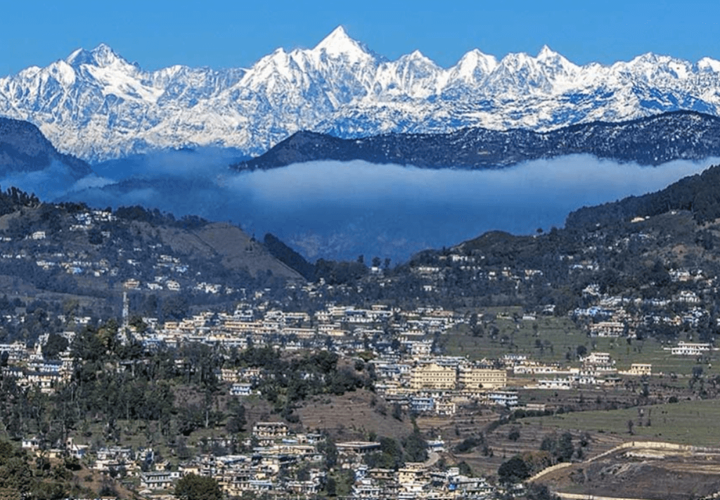
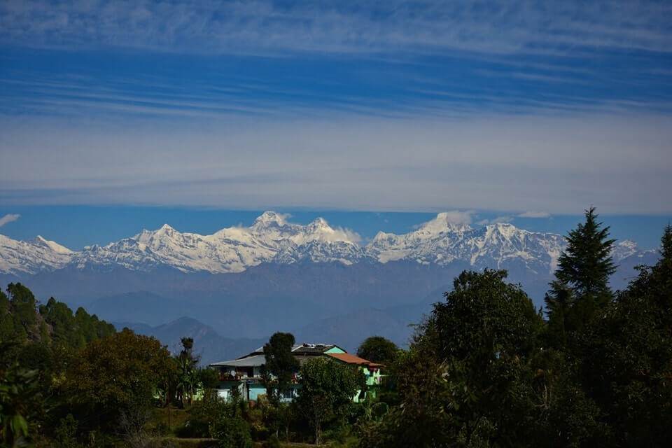
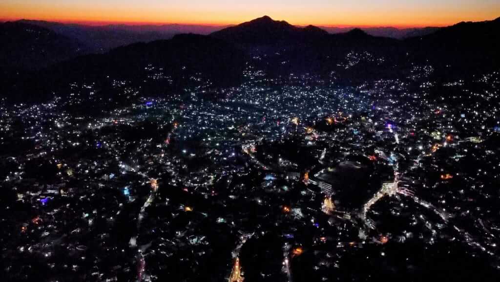
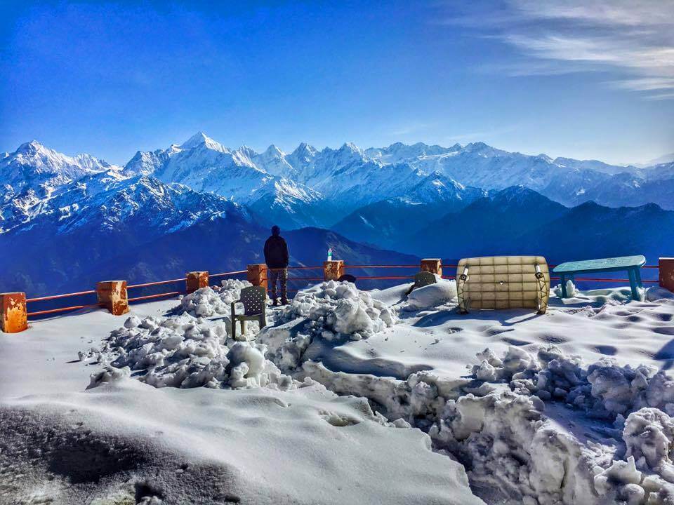
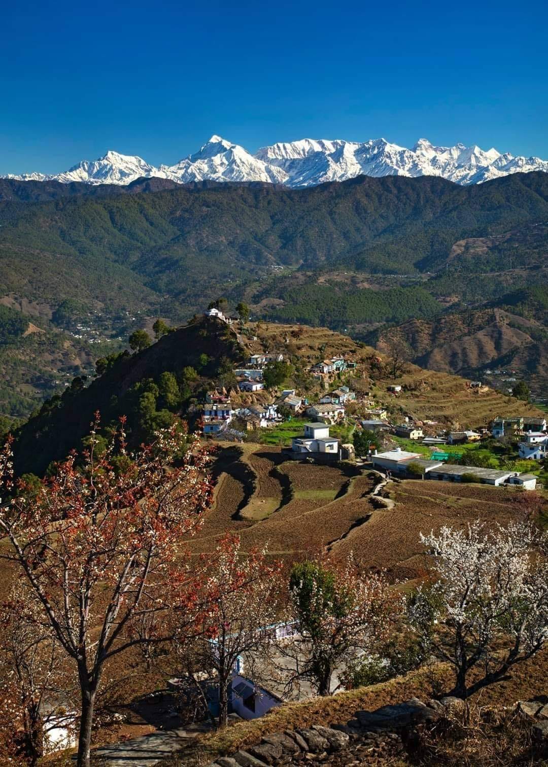
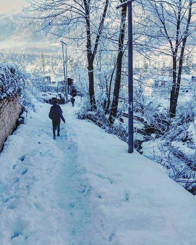
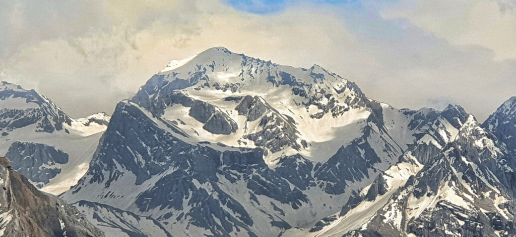
Known for its strategic location and scenic beauty, Pithoragarh is the gateway to the Himalayan ranges. Explore the historic Pithoragarh Fort, soak in the views from Chandak, and embark on adventures in this picturesque district.
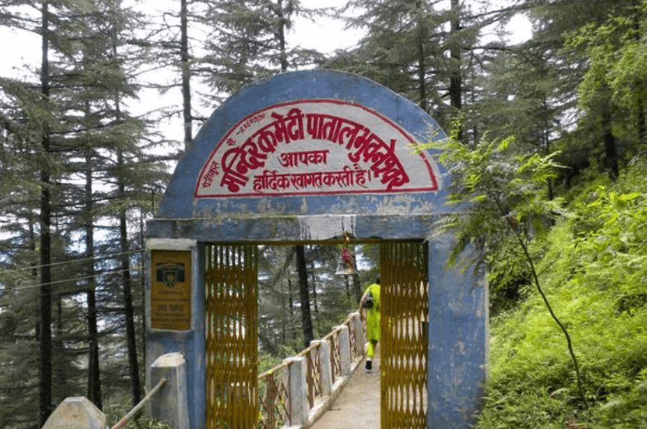
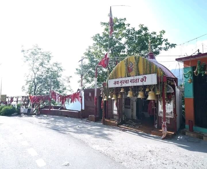
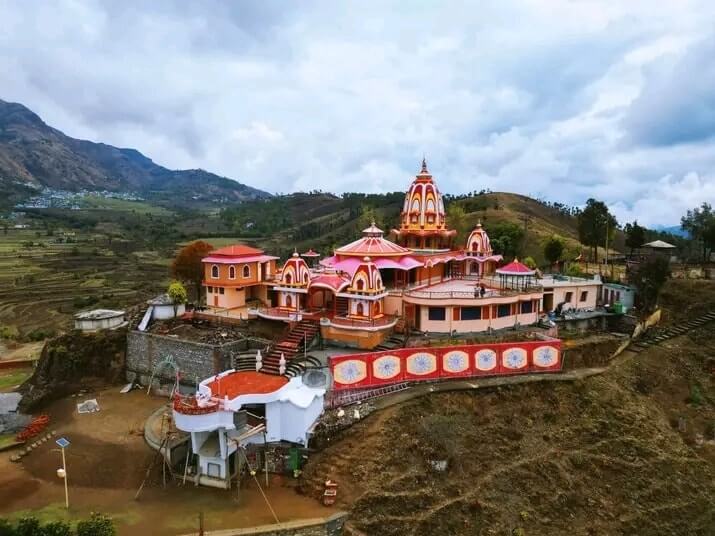
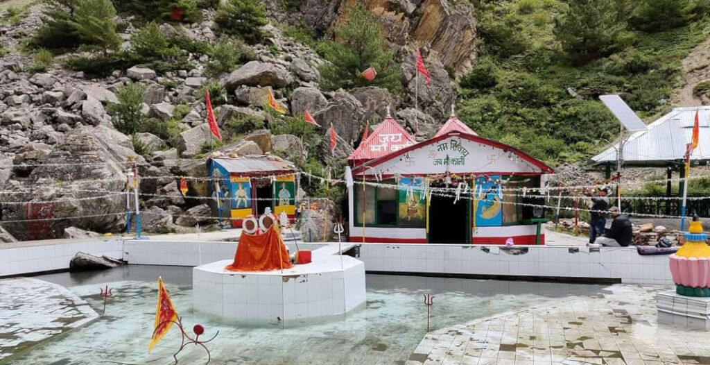
Patal Bhuvaneshwar is a sacred cave temple located in the Pithoragarh district of Uttarakhand, India. It is situated at an elevation of about 1,350 meters (4,429 feet) above sea level. The cave temple is dedicated to Lord Shiva and is considered one of the Char Dham pilgrimage sites in India.
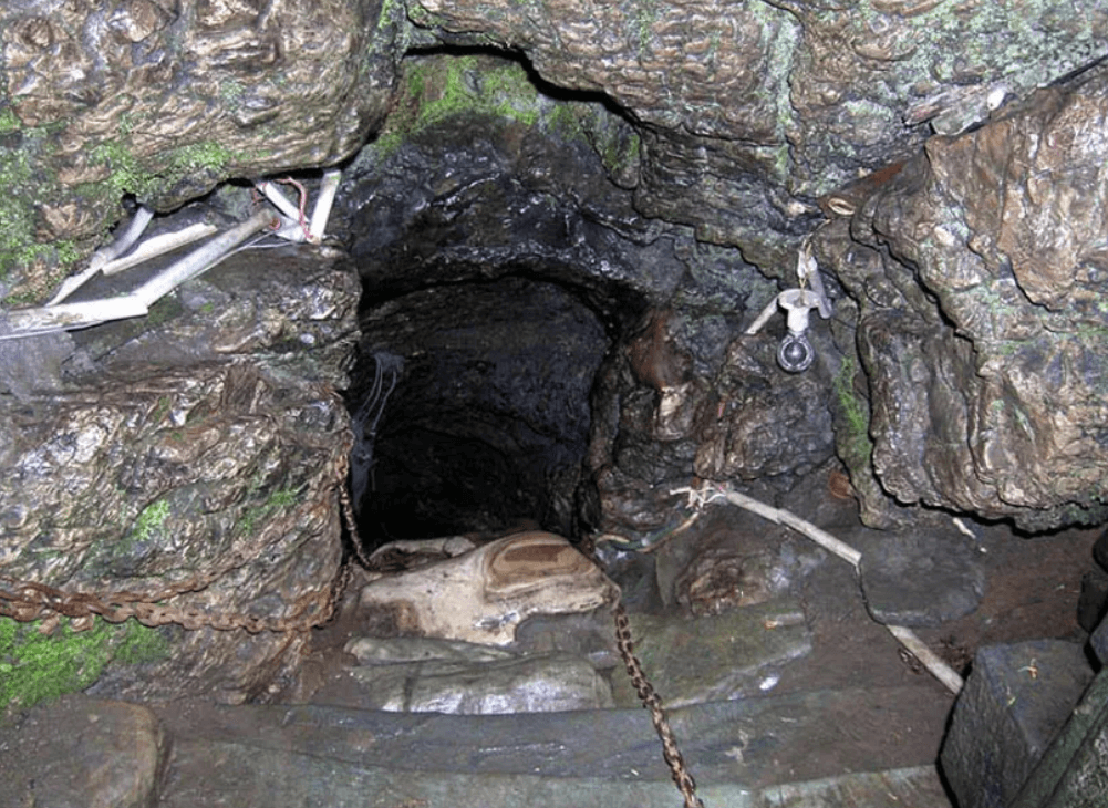
Patal Bhuvaneshwar Cave
Patal Bhuvaneshwar is a limestone cave temple located in the Pithoragarh district of Uttarakhand, India. It is situated in the village of Bhuvaneshwar, which is around 14 kilometers away from Gangolihat. The cave is considered to be one of the most mysterious and sacred in the region.
The temple is dedicated to Lord Shiva, and the cave has various stalactite and stalagmite formations that are believed to represent different deities. The inner sanctum of the cave is said to resemble the mythological serpent Sheshnag. The cave has a narrow tunnel-like entrance, and visitors need to descend through a series of steep stairs to reach the sanctum. Visitors to Patal Bhuvaneshwar often describe the experience as spiritual and awe-inspiring due to the natural beauty and religious significance of the cave.
Munsiyari is a picturesque hill station nestled in the Pithoragarh district of Uttarakhand, India. Situated at an elevation of around…
How To Reach Patal Bhuvaneshwar
By Road
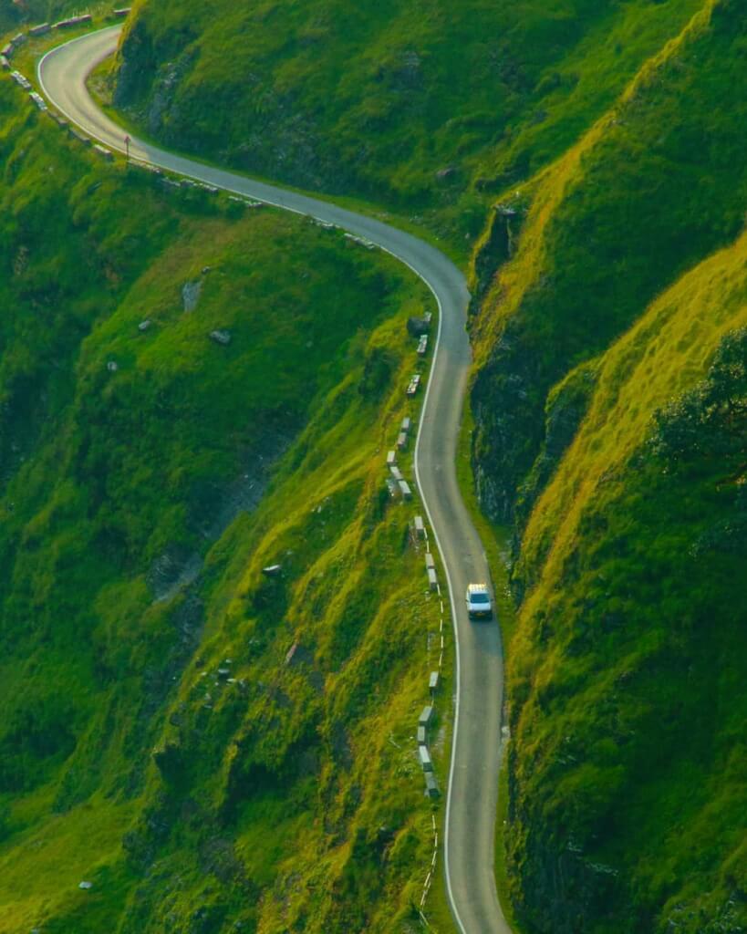
Patal Bhuvaneshwar is well-connected by road. You can reach Pithoragarh by bus or taxi and then hire a local taxi or take a shared cab to reach the cave. The roads may be narrow and winding, so be prepared for a scenic but sometimes challenging journey.
By Train
The nearest railway station is Tanakpur Railway Station, which is around 154 kilometers away. After reaching Tanakpur, you can hire a taxi or take a bus to Patal Bhuvaneshwar.
By Air
The nearest airport is Pantnagar Airport (PGH), which is approximately 244 kilometers away from Patal Bhuvaneshwar. You can take a taxi or hire a cab from the airport to reach your destination.
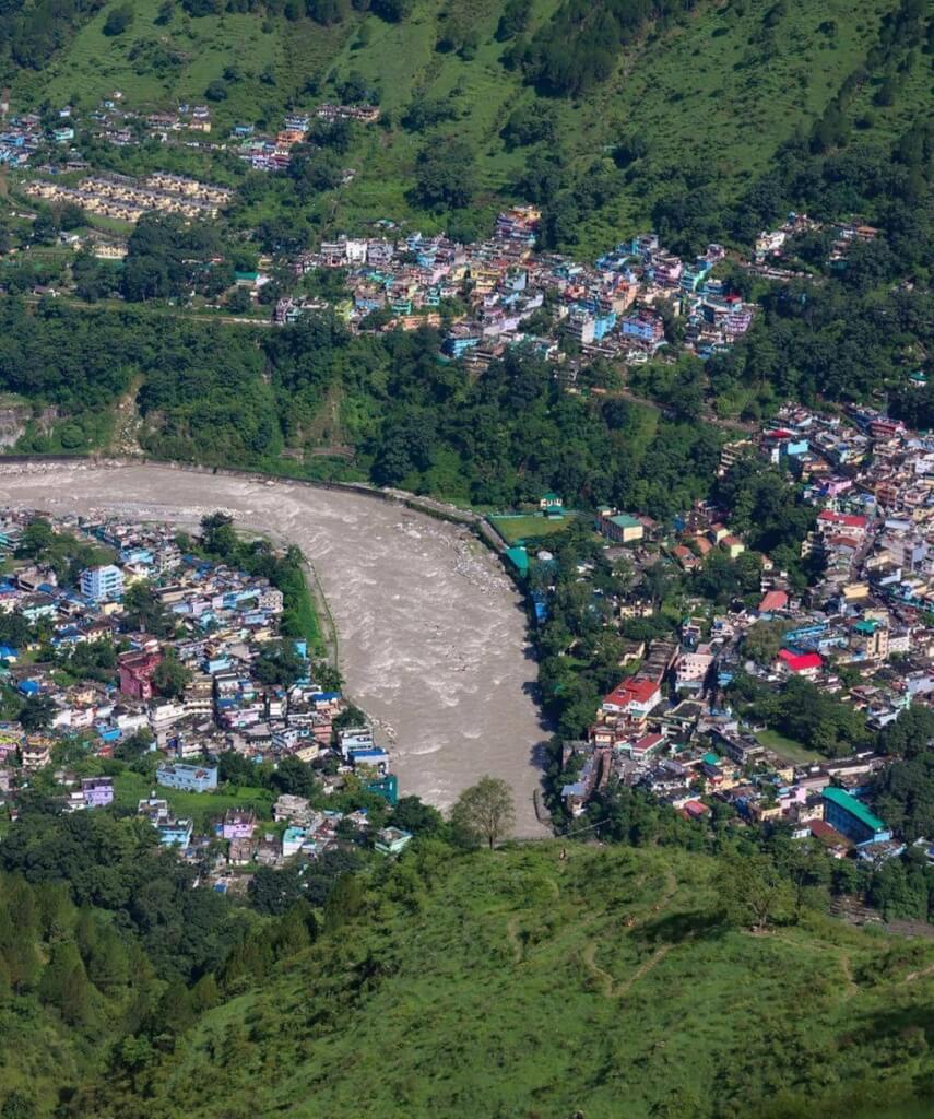
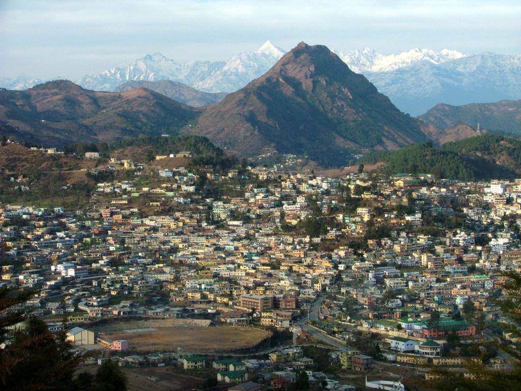
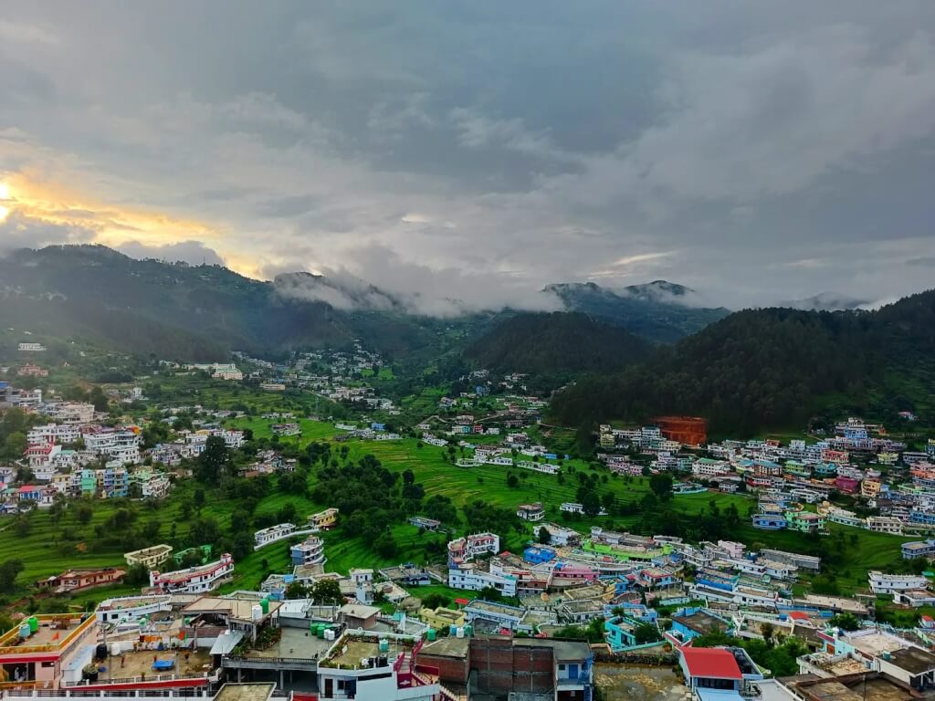
Pithoragarh is a district located in the northern state of Uttarakhand, India. It is situated in the Kumaon region and is known for its breathtaking landscapes, picturesque valleys, and proximity to the international borders with Nepal and China.The district is surrounded by the districts of Bageshwar, Champawat, and Almora within Uttarakhand.
uttarakhand Pithoragarh
Activities In Pithoragarh
Trekking and Hiking: Pithoragarh is surrounded by scenic mountains and offers various trekking opportunities. Popular trekking routes include the Pindari Glacier Trek, Kafni Glacier Trek, and the Namik Glacier Trek.
Sightseeing: Explore the town’s attractions, including the Pithoragarh Fort, which offers panoramic views of the surrounding mountains. You can also visit the Kapileshwar Mahadev Temple and the Chandak Hills.
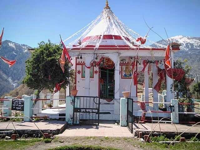
Religious Tourism: Pithoragarh has several temples and religious sites. Visit the Thal Kedar Temple, Dhwaj Temple, and Arjuneshwar Shiva Temple to experience the spiritual side of the region.
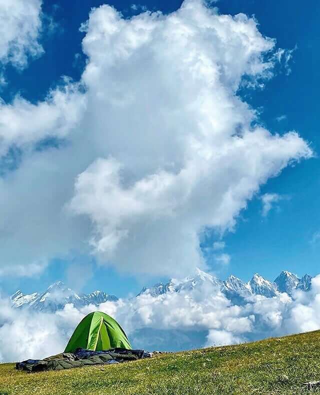
Camping: Enjoy the natural beauty of Pithoragarh by camping in the surrounding areas. There are various camping sites that provide a serene environment amidst the Himalayan landscape.
Wildlife Safari: Explore the nearby wildlife sanctuaries such as Askot Wildlife Sanctuary and the Musk Deer Sanctuary. These sanctuaries are home to diverse flora and fauna, offering opportunities for wildlife enthusiasts.
Photography: Capture the stunning landscapes, vibrant culture, and architectural marvels of Pithoragarh. The town and its surroundings provide ample opportunities for photography.
River Rafting: If you’re an adventure enthusiast, you can indulge in river rafting in the nearby rivers, such as the Kali River.
Bird Watching: The region around Pithoragarh is known for its diverse avian population. Bird watchers can enjoy spotting various species in the lush greenery surrounding the town.
History Of Pithoragarh
Pithoragarh has a significant historical importance due to its strategic location on the ancient trade routes connecting Tibet, Kumaon, and the Ganges plains. The Gorkhas, under the leadership of Amar Singh Thapa, captured Pithoragarh in the late 18th century. However, the British East India Company defeated the Gorkhas in the Anglo-Nepalese War (1814–1816), and Pithoragarh came under British control as part of the Treaty of Sugauli. Pithoragarh became an important administrative center during the British rule in India. It was a part of the United Provinces (now Uttarakhand) and played a role in the governance of the region. After India gained independence in 1947, Pithoragarh became a part of the state of Uttar Pradesh. Later, in 2000, when Uttarakhand was carved out as a separate state, Pithoragarh became one of its districts.
The region is home to various temples and historical sites that reflect the cultural diversity and religious practices of the area. Pithoragarh is also known for its fairs and festivals, which are celebrated with enthusiasm and highlight the rich cultural traditions of the region.
Book Online
Customer Care :- +91 8851072020 (7:00 Am to 7:00 PM)
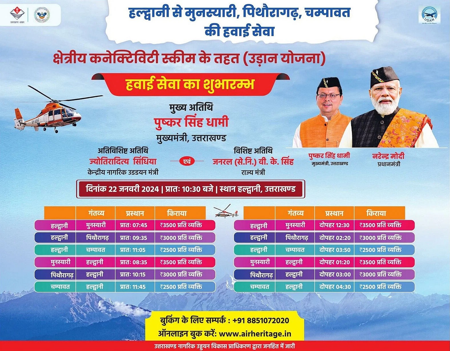
Air service is starting from Haldwani to Munsiyari, Pithoragarh
How To Reach Pithoragarh
By Road
From Delhi:Pithoragarh is approximately 500 km away from Delhi. You can take a bus from ISBT Anand Vihar or drive to Pithoragarh. The journey by road takes around 14-15 hours, depending on the mode of transportation and traffic conditions.
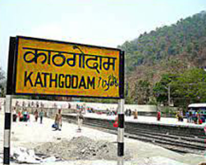
From Kathgodam:If you are coming from Kathgodam, you can take a bus or hire a taxi to reach Pithoragarh. The distance is around 250 km, and the journey takes approximately 8-9 hours.
By Train
The nearest major railway station to Pithoragarh is Tanakpur Railway Station (around 151 km away). From Tanakpur, you can hire a taxi or take a bus to reach Pithoragarh.
By Air
The nearest airport to Pithoragarh is Naini Saini Airport (IATA: NNS), which is a small domestic airport. However, flights to Naini Saini Airport may be limited.
Frequently Asked Questions Registrations
1. Where is Pithoragarh located?
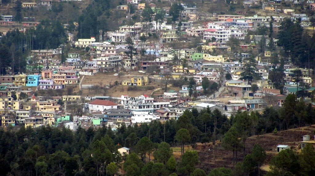
Pithoragarh is a town and a municipal board in the Pithoragarh district in the Indian state of Uttarakhand. It is situated in the eastern part of the state, near the Indo-Nepal border.
2. What is the altitude of Pithoragarh?
Pithoragarh is located at an altitude of approximately 1,650 meters (5,413 feet) above sea level. The town is nestled amidst the foothills of the Himalayas, offering panoramic views of the surrounding peaks.
3.What is Pithoragarh famous for?
Pithoragarh is renowned for its stunning natural beauty, including snow-capped Himalayan peaks, lush valleys, and scenic landscapes. It’s also known for its rich cultural heritage and historical significance.
4. What is the best time to visit Pithoragarh?
The best time to visit Pithoragarh is during the summer months (April to June) and the autumn months (September to November) when the weather is pleasant, and the skies are clear.
5. What are the main attractions in Pithoragarh?
Some of the main attractions in Pithoragarh include Pithoragarh Fort, Kapileshwar Mahadev Temple, Chandak Hills, Askot Wildlife Sanctuary, Ralam Glacier, and numerous trekking routes offering breathtaking views of the Himalayas.
Explore the enchanting vicinity of Adi Kailash and Om Parvat, with nearby attractions like Gauri Kund, Dharchulla, Pithoragarh, and Kachi Dham Temple. Immerse yourself in the spiritual and cultural tapestry of the region, discovering the mystique that surrounds these sacred sites. Gauri Kund, known for its religious significance, and Dharchulla, a charming town, offer unique experiences. Pithoragarh, with its historical Pithoragarh Fort, and the revered Kachi Dham Temple add to the allure. The area is brimming with fascinating places to explore, each with its own story to tell. Plan your itinerary wisely to make the most of your Adi Kailash journey, as you traverse through a landscape where every site holds a blend of history, spirituality, and natural beauty.
Sankri is a picturesque village located in the Uttarkashi district of the Indian state of Uttarakhand. It serves as a popular base camp for trekkers heading towards the
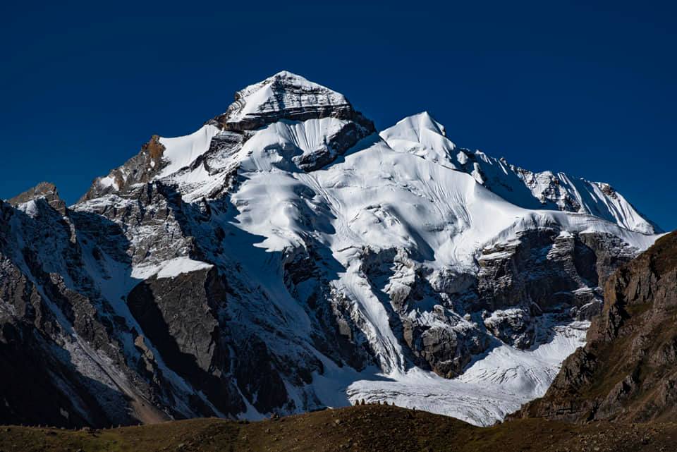
Adi Kailash, also known as Chhota Kailash, is a sacred mountain located in the Indian state of Uttarakhand. Standing tall at an elevation of approximately 6191 meters, it
Om Parvat, standing proudly in the Himalayan mountain range at 6191 meters, offers breathtaking views visible from Nabidag. Although unconquered to date, it adds to the majestic scenery.
Adi Kailash Om Parvat Yatra Package
Get up to 20% off on Adi Kailash packages from Kathgodam
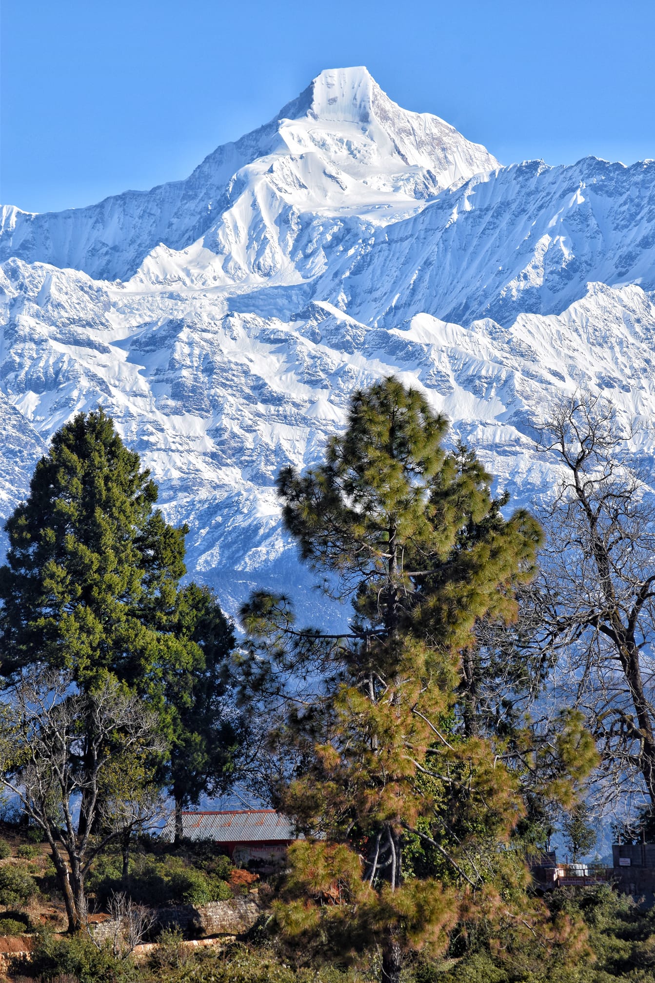
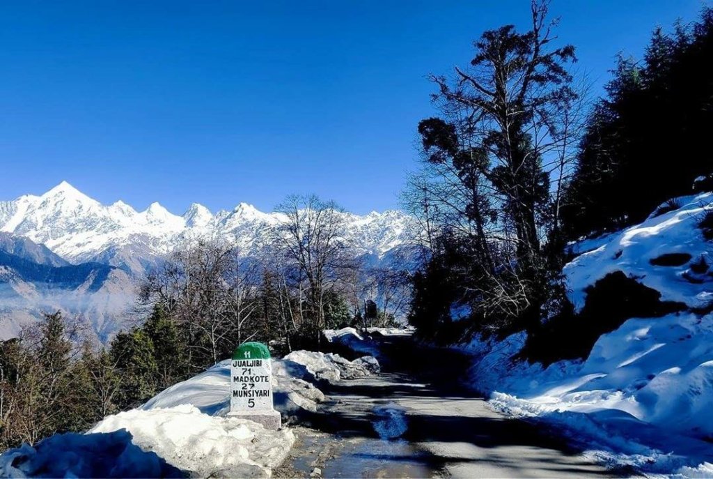
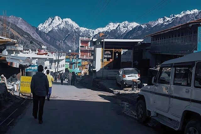
Munsiyari is a picturesque hill station nestled in the Pithoragarh district of Uttarakhand, India. Situated at an elevation of around 7,200 feet (2,200 meters) above sea level, it’s renowned for its stunning views of the Himalayan peaks, including the Panchachuli range. The name “Munsiyari” translates to “a place with snow,” and it aptly describes the snowy vistas it offers.
The region itself holds numerous tales from Hindu mythology that are linked to the Himalayas. The Himalayas are revered as the abode of the gods in Hindu mythology, and many stories revolve around various deities and their interactions with these majestic mountains. The mighty peaks are believed to be the home of Lord Shiva, one of the principal deities in Hinduism. According to mythology, it’s where Shiva sits in meditation and performs his divine dance, the Tandava. The rivers originating from these mountains, including the Ganges, have their own mythological significance and are considered sacred in Hinduism.
Book Online
Customer Care :- +91 8851072020 (7:00 Am to 7:00 PM)
Air service is starting from Haldwani to Munsiyari, Pithoragarh
History of Munsiyari
Historically, Munsiyari was an important stopover on the ancient salt route that connected Tibet with the plains of India. Traders would traverse these routes to trade salt, herbs, and other goods. This strategic location contributed to Munsiyari’s cultural diversity, as it became a melting pot of various cultures and traditions. The region has been inhabited by the indigenous Shauka tribe for centuries. They have played a crucial role in shaping the identity of Munsiyari. During the British colonial era, Munsiyari served as a gateway for expeditions into the high Himalayas. The town gained prominence as a base for explorers, mountaineers, and researchers venturing into the region.
Activities In Munsiyari
Munsiyari, nestled in the Himalayan region of Uttarakhand, offers a plethora of activities for nature lovers and adventure enthusiasts. Here are some activities you can enjoy in Munsiyari:
Trekking: Munsiyari is a gateway to various treks, including the Milam Glacier Trek, Nanda Devi Temple Trek, and the Khalia Top Trek. These treks offer stunning views of the Himalayas and an opportunity to explore the region’s natural beauty.
Bird Watching: The area is rich in birdlife. Birdwatchers can spot a variety of Himalayan avian species in and around Munsiyari.
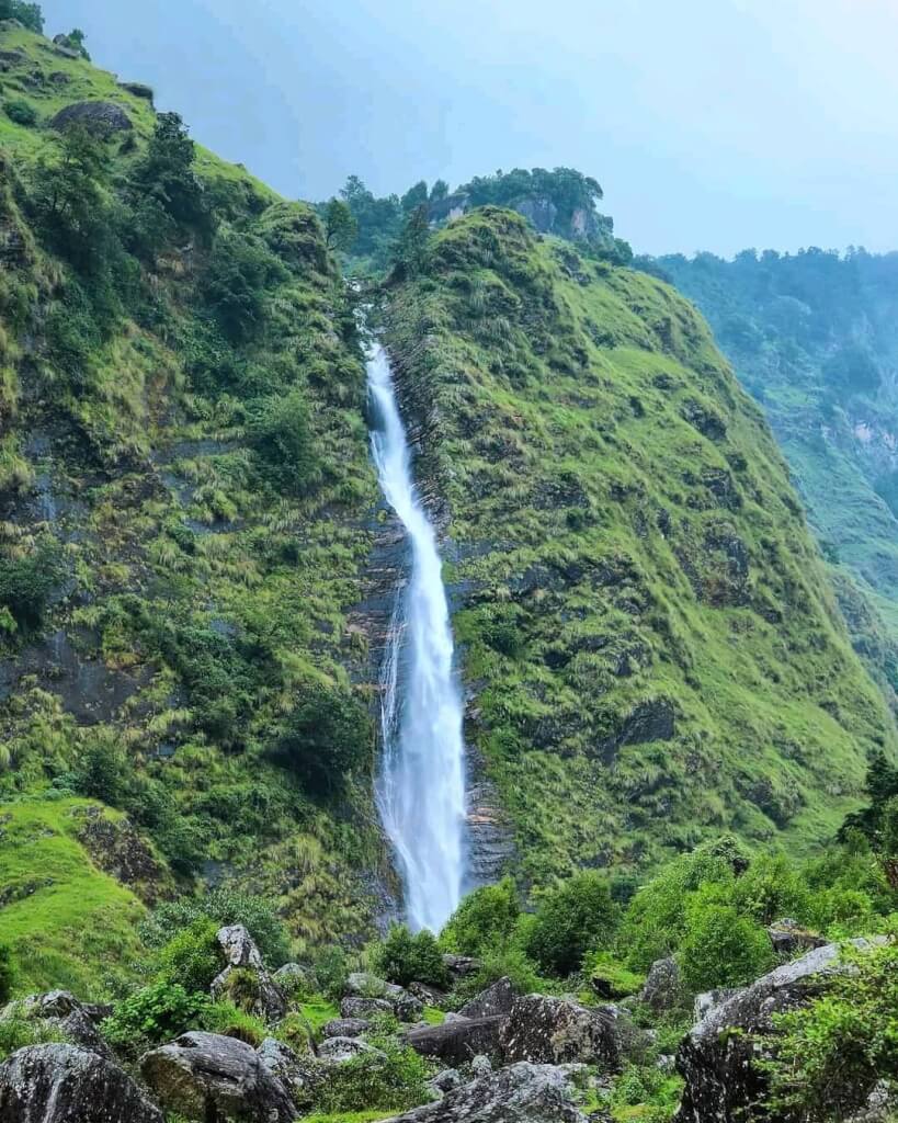
Exploring Waterfalls: Visit Birthi Falls, a picturesque waterfall near Munsiyari, to enjoy the serene surroundings and the beauty of cascading water.
Camping: There are several camping sites around Munsiyari that offer a chance to experience the raw beauty of the Himalayas. Camping under the stars in this region is an unforgettable experience.
Sightseeing: Explore the local attractions such as the Maheshwari Kund, Thamari Kund, and the tribal villages around Munsiyari to get a glimpse of the local culture and lifestyle.
Photography: Munsiyari offers stunning landscapes and panoramic views of the Himalayas, making it a paradise for photographers.
Nature Walks: Take leisurely strolls around the town or in nearby forests to soak in the natural beauty and serenity of the place.
Adventure Sports: Depending on the season, activities like skiing, snowboarding, and snow trekking are available in winter, while in summer, you can indulge in activities like river rafting, paragliding, and mountain biking.
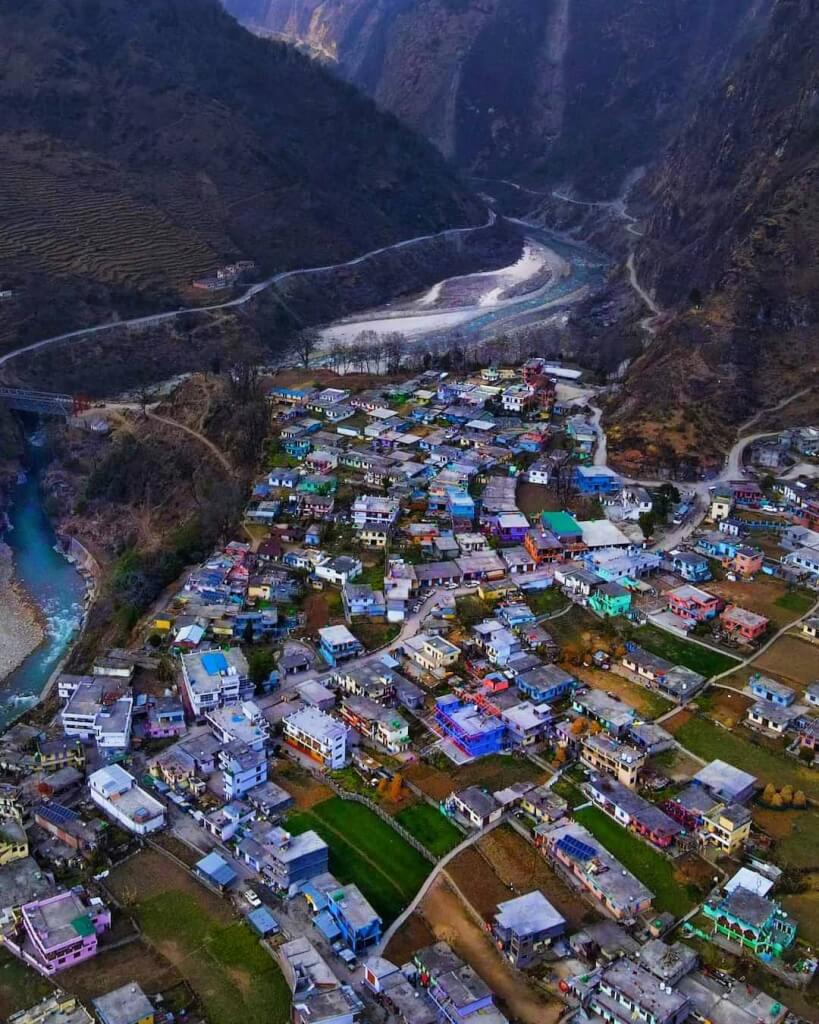
Dharchula is a pictures que town nestled in the northern part of the Indian state of Uttarakhand, near the border…
How To Reach Munsiyari
By Road
It is well-connected by road to major cities and towns in Uttarakhand. You can either drive or take a bus from places like Kathgodam, Almora, Nainital, or Haldwani to Munsiyari. The road journey offers stunning views of the Himalayas but involves traveling through winding mountain roads.
By Train
The nearest railway station is Kathgodam Railway Station (KGM). From Kathgodam, you can hire a taxi or Bus. approximately 284 kilometers, and the journey takes around 10-12 hours.
By Air
The nearest airport is Pantnagar Airport (PGH), located approximately 313 kilometers away. From the airport, you can hire a taxi or take a bus to reach there.
Frequently Asked Questions Registrations
1. Where is Munsiyari located?
Munsiyari is nestled in the Pithoragarh district of Uttarakhand, India, perched at an altitude of approximately 2,200 meters (7,200 feet) above sea level. It is situated in the Johar Valley, close to the borders of Nepal and Tibet.
2. When is the best time to visit Munsiyari?
The best time to visit Munsiyari is from April to June and from September to November. During these months, the weather is pleasant, and the skies are clear, offering stunning views of the Himalayas and ideal conditions for outdoor activities such as trekking, camping, and sightseeing.
3. What is the significance of Munsiyari?
Munsiyari holds significant importance as a gateway to several Himalayan peaks and glaciers, making it a paradise for trekkers and adventure enthusiasts.It offers breathtaking views of the Panchachuli Peaks and serves as the starting point for treks to Milan and Ralam Glaciers.
4. What are the nearby tourist attractions from Munsiyari?
Munsiyari is surrounded by several tourist attractions, including Birthi Falls, Darkot Village, Thamari Kund, and the ancient Narayan Ashram. These places offer opportunities for sightseeing, exploration, and cultural immersion.
5. What should I pack for a trip to Munsiyari?
Warm clothing, especially if visiting during the winter months.
Comfortable trekking shoes.
Rain gear (if traveling during the monsoon season).
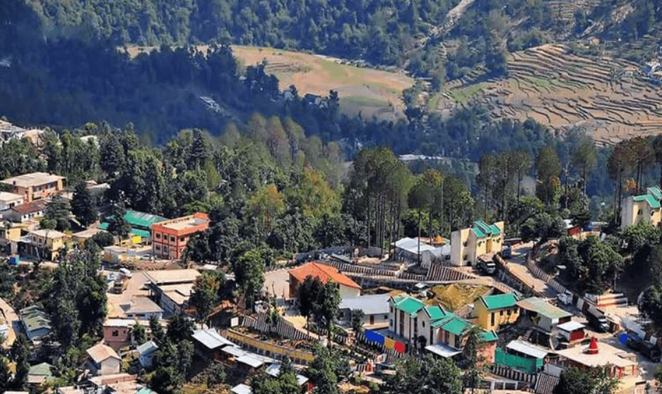
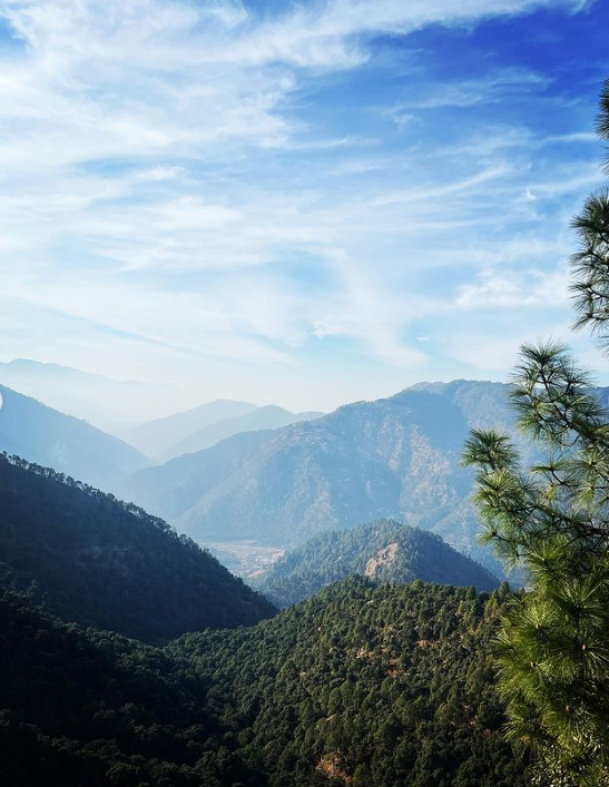
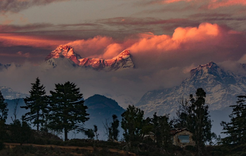
Chaukori is a serene hill station located in the Pithoragarh district of Uttarakhand, India. Situated at an altitude of around 2,010 meters (6,600 feet) above sea level, it offers breathtaking views of the Himalayas, including peaks like Nanda Devi, Nanda Kot, and Panchachuli.
Chaukori, located in Uttarakhand, India, is a serene hill station known for its picturesque beauty and tranquility. Here are some activities you might enjoy there:
Nature Walks: Explore the lush landscapes, walk through tea gardens, and enjoy the breathtaking views of the Himalayas.
Visit Tea Gardens: Chaukori is famous for its tea gardens. Take a tour to learn about tea cultivation and processing while enjoying the scenic surroundings.
Bird Watching: The region is a paradise for bird enthusiasts. Carry your binoculars and spot various Himalayan and migratory bird species.
Trekking: There are several trekking trails around Chaukori that offer stunning vistas of the mountains and valleys. Dharamghar, Patal Bhuvaneshwar, and Berinag are some nearby trekking spots.
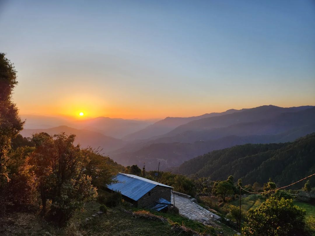
Sunrise/Sunset Viewing: Witness breathtaking sunrises and sunsets against the backdrop of the snow-capped peaks. The views are simply mesmerizing.
Village Tours: Interact with locals, experience their culture, and learn about their traditional way of life.
Photography: Capture the beauty of the Himalayas, tea gardens, valleys, and the serene ambiance, making lasting memories through your lens.
Ranikhet is a beautiful hill station in Uttarakhand, India, sitting about 6,132 feet above sea level. Its name means “Queen’s…
How To Reach Chaukori
By Road
Chaukori is well-connected by roads. Buses and taxis ply regularly from nearby towns like Almora, Nainital, and Kathgodam. You can also hire a private taxi if you prefer a more flexible schedule.
By Train
The nearest major railway station is Kathgodam, around 196 kilometers from Chaukori. Trains from Delhi and other major cities operate to Kathgodam regularly.
By Air
The nearest airport to Chaukori is Pantnagar Airport (PGH), approximately 205 kilometers away. From Pantnagar, you can hire a taxi or take a bus to reach Chaukori.
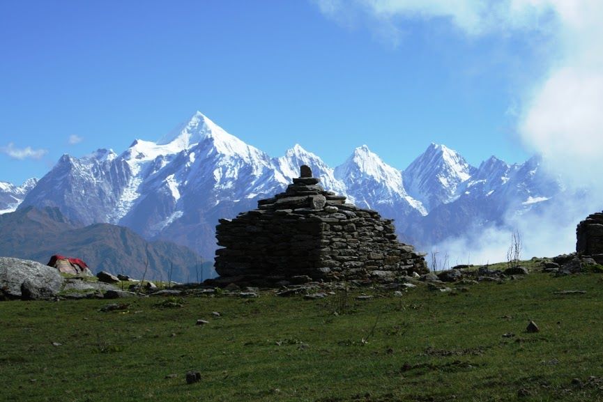
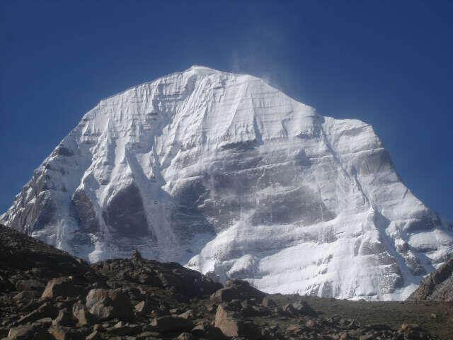
Om Parvat, standing proudly in the Himalayan mountain range at 6191 meters, offers breathtaking views visible from Nabidag. Although unconquered to date, it adds to the majestic scenery. From Nabidang, journeys lead to Little Kailash, Adi Kailash, and Baba Kailash via Kutty village. Alternatively, the route via Lipulekh Pass leads to Kailash Mansarovar in Tibet, placing this spot between Kailash and Adi Kailash. Nestled near the Nepal-Tibet border, it provides magnificent visuals, including glimpses of the towering peaks of Annapurna. Conveniently close to Dharchula, this destination promises awe-inspiring experiences for travelers.
The journey from Om Parvat to Adi Kailash covers about 26 kilometers. Mount Om can be seen from Nabhidang. To catch a glimpse of Adi Kailash, you can travel from Nabhi Dang to Joulikang through Kutty village. Travelers on the Kailash-Mansarovar Yatra from India can also spot the mountain from the camp under the Lipulekh Pass. Many explorers choose to take the route to Nabhidhang Camp for a closer view of Om Parvat. Join this spiritual journey and enjoy the beautiful landscapes of this sacred Himalayan region.
Reach Gunji/Nabhidhang, base for the Adi Kailash Yatra.
Overnight stay amidst the Himalayan peaks.
After a delightful dinner, rest at the guest house.
Day 02: Drive to Jyolingkong to visit Mount Adi Kailash
Depart after breakfast for a scenic drive to Jyolingkong.
Explore Mount Adi Kailash, absorbing spiritual vibes.
After a delicious dinner, rest at the guest house.
Day 03: Drive to Om Parvat via Kalapani/Dharchula
Morning departure after breakfast.
Scenic drive to Om Parvat via Kalapani.
Experience the spiritual significance.
After a delightful dinner, rest at the guest house.
How To Reach Om Parvat
By Road
The nearest town to Om Parvat is Dharchula, which is well-connected by road.
From Delhi, you can take a bus or hire a taxi to reach Dharchula. The journey usually takes around 20-24 hours depending on the mode of transport and road conditions.
From Dharchula, you may need to hire a local guide or arrange for a trek to reach Om Parvat, as it is not directly accessible by road.
By Train
The nearest railway station to Om Parvat is Tanakpur Railway Station (TPU), located in Tanakpur, Uttarakhand. From Tanakpur, you can hire a taxi or take a bus to reach Dharchula, which is about 218 km away and takes around 7-8 hours by road.
By Air
The nearest airport to Om Parvat is Pantnagar Airport (PGH), located in Pantnagar, Uttarakhand. From Pantnagar, you can hire a taxi or take a bus to reach Dharchula. The distance is around 330 km and takes approximately 10-12 hours by road.
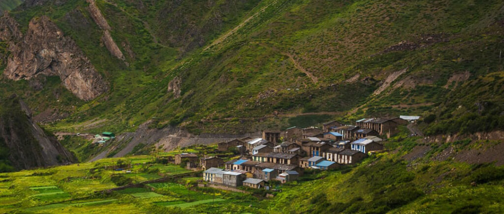
Gunji, a quaint village nestled in Uttarakhand, India, lies in proximity to the borders of Tibet and Nepal. Although administered by India, there exists a territorial dispute with Nepal over this region. Situated at the east end of the Kuthi Valley, Gunji is strategically positioned near the confluence of the Kuthi Yankti and Kalapani River. The village holds significance as it is situated on the traditional route taken by Indian and Nepalese pilgrims heading to Kailas–Manasarovar. Despite the ongoing border dispute, Gunji stands as a testament to the shared historical and cultural ties between India and Nepal in the context of this ancient pilgrimage route.
Gunji Village is not directly accessible by road. However, you can travel to nearby towns or villages like Munsyari, Dharchula, or Ghat and then trek to Gunji.
From major cities like Delhi or Dehradun, you can take a bus or hire a taxi to reach Munsyari or Dharchula, which are common starting points for treks to Gunji.
The road journey from these cities to Munsyari or Dharchula can take around 10-12 hours depending on the route and road conditions.
By Train
The nearest major railway station to Gunji Village is Kathgodam Railway Station, which is located in the town of Kathgodam in Uttarakhand. The distance from Kathgodam to Munsyari is around 285 kilometers and can take approximately 10-12 hours by road.
By Air
The nearest airport to Gunji Village is Pantnagar Airport, located in the town of Pantnagar in Uttarakhand. The distance from Pantnagar Airport to Munsyari is approximately 325 kilometers and can take around 10-12 hours by road.
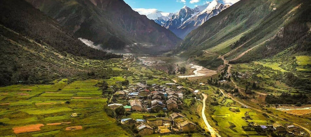
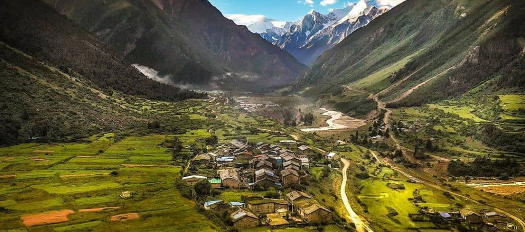
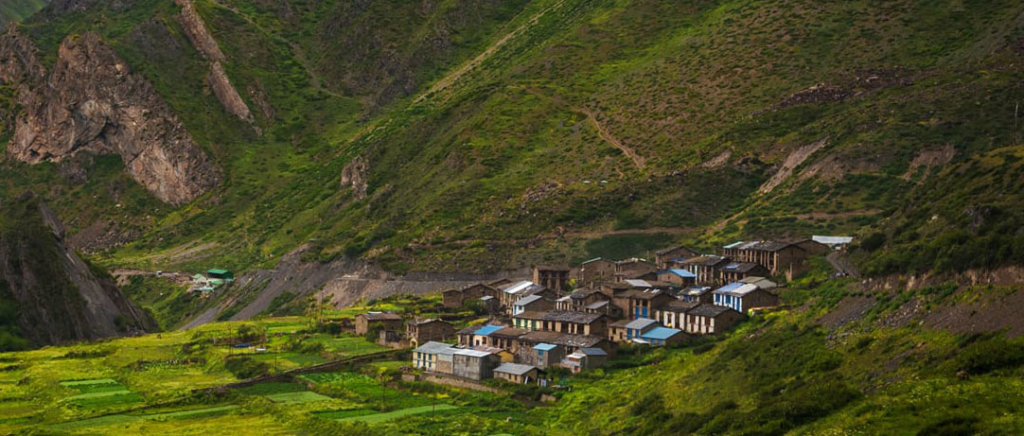
Kuti Village, nestled in the picturesque Kuti Valley near Pithoragarh in Uttarakhand, India, is a remote Himalayan settlement. Surrounded by the stunning landscapes of the Adi Kailash region, this village is inhabited mainly by the Byansi community. The valley is traversed by the Kuti Yankti River, a tributary of the Kali River.
Kuti Village holds cultural significance as one of the last inhabited areas before the border with Tibet. The region is accessible via the Pithoragarh-Lipulekh Pass Highway (PLPH), offering a challenging but rewarding journey for those seeking adventure. This serene Himalayan hamlet is part of the Pithoragarh district, providing a glimpse into the unique lifestyle and traditions of the Byansi people. The valley is also known for its proximity to the Limpiyadhura Pass and Adi Kailash peak, adding an element of spirituality to its natural beauty.
How To Reach Kuti Village
By Road
Take a bus or hire a taxi to reach the nearest town of Pithoragarh.
From Pithoragarh, you can hire a shared jeep or taxi to reach Dharchula, which is the last motorable point.
From Dharchula, trekking is the only option to reach Kuti Village. The trek takes around 3-4 days and involves crossing the Darma Valley and several suspension bridges.
By Train
The nearest major railway station is Kathgodam Railway Station (KGM). From Kathgodam, you can either hire a taxi or take a bus to reach Pithoragarh. Follow the road route mentioned above from Pithoragarh to Dharchula and then trek to Kuti Village.
By Air
The nearest airport to Kuti Village is Pantnagar Airport (PGH), located in Uttarakhand.
From Pantnagar, you can hire a taxi or take a bus to reach Pithoragarh.