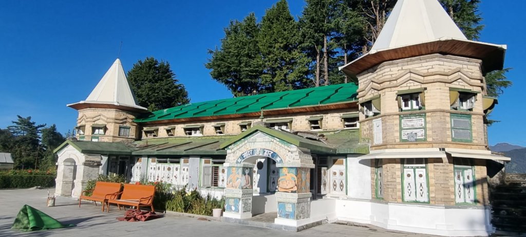
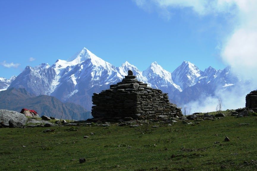
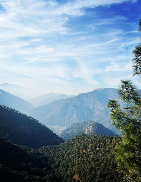
Narayan Ashram, situated approximately 136 kilometers north of Pithoragarh and 14 kilometers from Tawaghat, was founded by Narayan Swami in 1936. Nestled at an altitude of 2734 meters amid picturesque landscapes, this establishment serves as both a spiritual and socio-educational center.
Location
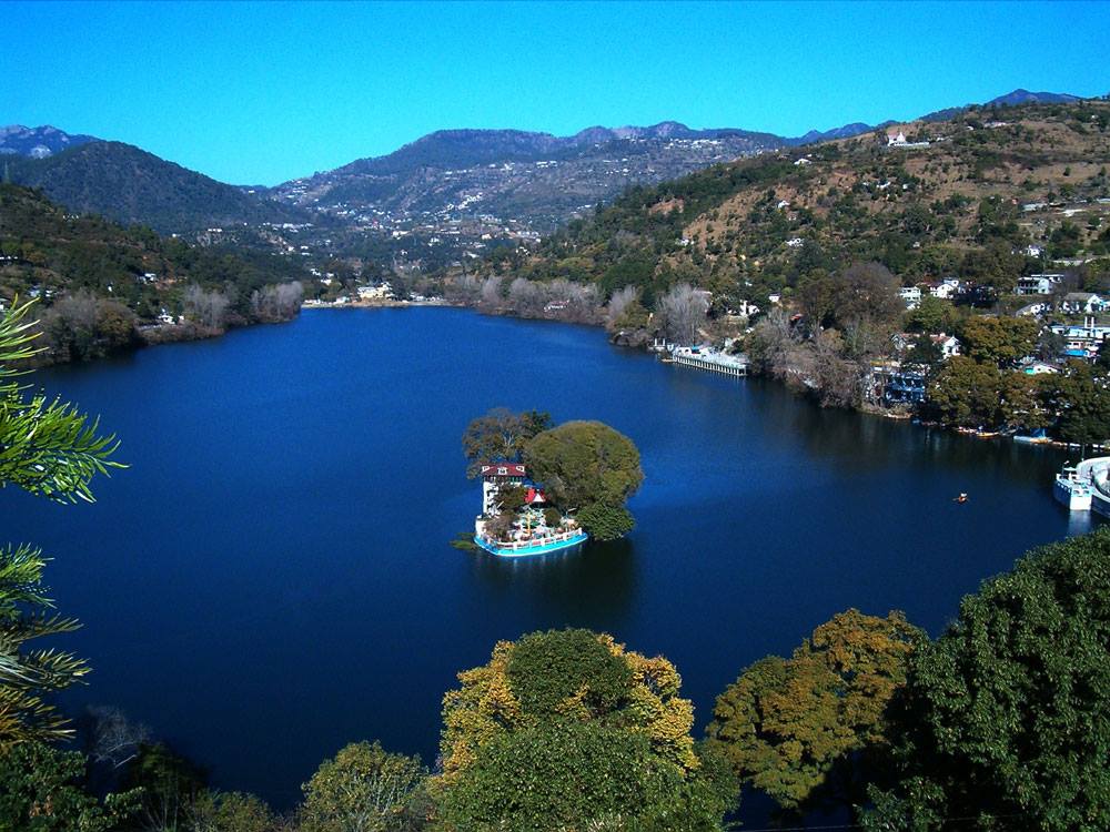
Dharchula
Established
1936 ( By Narayan Swami)
Famous For
Ashrams,Yoga, Medidation Centre
Narayan Ashram Location
Narayan Ashram is situated in Dharchula, along the route to Kailash Mansarovar near the India-Nepal border.
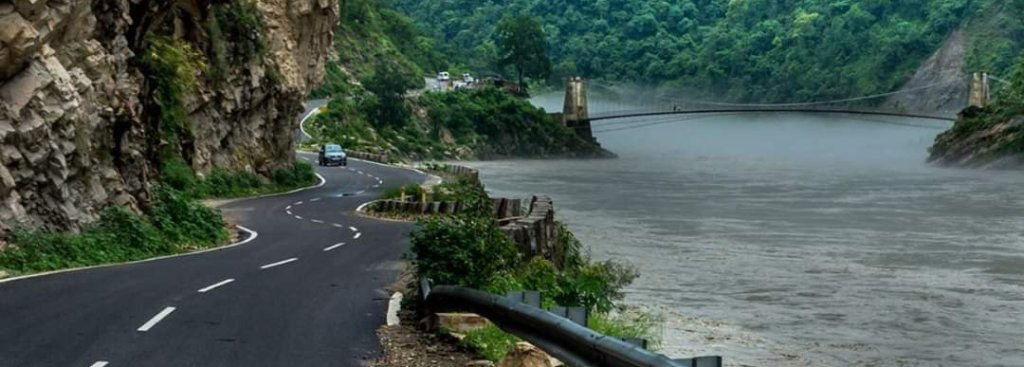
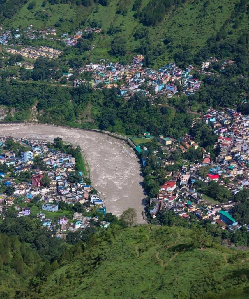
Kaudiyala is a picturesque town in the Indian state of Uttarakhand, situated along the banks of the Ganges River. It’s renowned for its natural beauty and serves as a popular destination for adventure enthusiasts, especially for river rafting. The region offers stunning views of the surrounding Himalayan peaks and lush greenery, making it a haven for nature lovers as well.
Kaudiyala- Beach Camping Site
Kaudiyala is a popular destination for camping and adventure activities in Uttarakhand, India, known for its stunning natural beauty and thrilling outdoor experiences. The beach camping site in Kaudiyala is situated along the banks of the Ganges River, offering picturesque views and a serene environment for visitors.
The camping experience typically includes setting up tents near the river, allowing campers to enjoy the soothing sound of flowing water and breathtaking sunsets. Activities at Kaudiyala often involve adventure sports such as river rafting, kayaking, cliff jumping, and trekking in the surrounding hills. The region is also known for its rich biodiversity, making it an excellent spot for nature enthusiasts and bird watchers.
it is situated 40 kilometers away from Rishikesh on the Srinagar road, is easily accessible by taxi or bus. Booking for rafting and camping can be conveniently made online or in Rishikesh, with transportation included. The closest railway station to reach Kaudiyala is the Rishikesh railway station, located 40 kilometers away, while the nearest airport is the Jolly Grant Airport in Dehradun, approximately 59 kilometers.
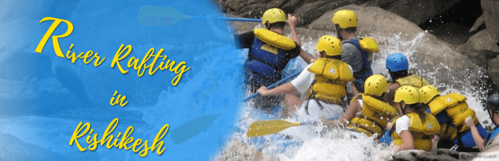
Byasi is a small village located near Rishikesh in the Indian state of Uttarakhand. It’s famous for its picturesque beauty and its significance as a hub for adventure sports, especially river rafting. Situated on the banks of the Ganges River, Byasi offers a serene and tranquil environment amidst nature.
Why Bysai is famous
Byasi in Rishikesh is a popular destination for rafting and camping enthusiasts. Situated about 30 kilometers from Rishikesh in Uttarakhand, India, It is renowned for its thrilling white-water rafting experiences along the Ganges River. The stretch between Byasi and Rishikesh offers varying grades of rapids, making it suitable for both beginners and experienced rafters.
Camping in Byasi is a fantastic way to experience the serene beauty of the Himalayas. Many campsites offer a range of amenities, from basic tent accommodations to more luxurious setups with facilities like bonfires, meals, and adventure activities
It is, situated 30 kilometers away from Rishikesh on the Badrinath road, is easily accessible by taxi or bus from Rishikesh. Booking options for thrilling rafting and camping experiences are available in Rishikesh as well. The Rishikesh railway station, located at a distance of 30 kilometers, serves as the closest railway point to reach there. Additionally, the Jolly Grant Airport in Dehradun is the nearest airport, situated approximately 49 kilometers away.
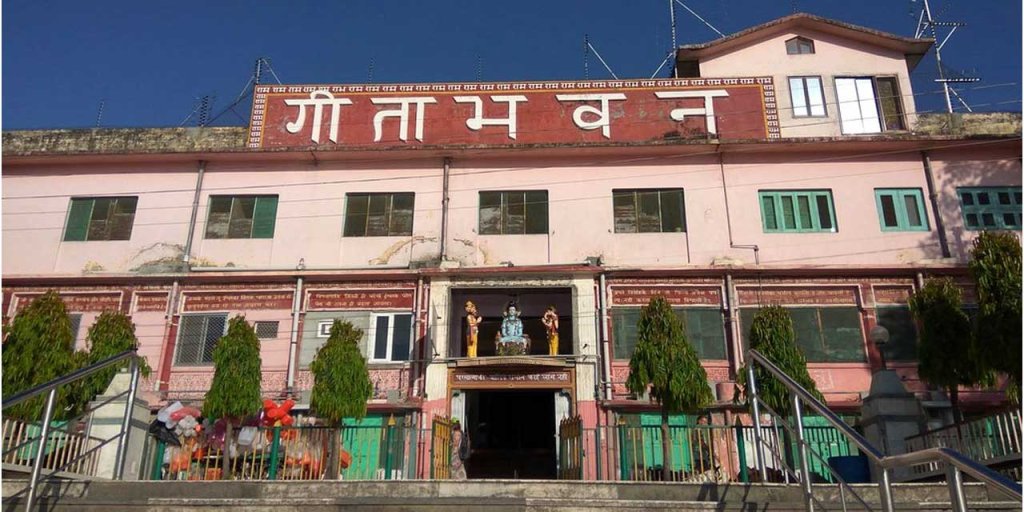
Geeta Bhawan stands as a sprawling complex on the banks of the sacred river Ganga in Swargashram, Rishikesh. This extensive facility includes numerous discourse halls and offers over 1000 rooms, providing devotees with comfortable accommodations at no cost. Geeta Bhawan holds significant importance for pilgrims from distant locations, as it offers free lodging during their sacred immersion in the Ganges, coupled with opportunities to engage in discourses and meditation.
Capable of accommodating more than 2000 devotees simultaneously, the Bhawan generously provides complimentary stay services. While the Bhawan attracts crowds throughout the year, the optimal time to visit is during the summer, especially for the day-long Satsang programs thoughtfully arranged by the management
Geeta Bhawan Book Shop
It is a renowned spiritual and cultural center in Rishikesh, India. It’s famous for its ashram, satsangs (spiritual gatherings), and bookshops offering a wide range of spiritual and religious literature. The bookshop at Geeta Bhawan typically stocks various texts related to Hinduism, yoga, meditation, philosophy, and spirituality. Visitors often find sacred texts like the Bhagavad Gita, Upanishads, Vedas, as well as books by spiritual leaders such as Swami Vivekananda, Paramahansa Yogananda, and others. These bookshops serve as valuable resources for spiritual seekers and tourists exploring Rishikesh’s spiritual ambiance.
Location & How to Reach Geeta Bhawan
It is situated in Swargashram, Rishikesh, and can be easily reached by walking or taking a cycle rickshaw from Ram Jhula. The nearest railway station to access Ram Jhula is the Rishikesh railway station, approximately 3 kilometers away
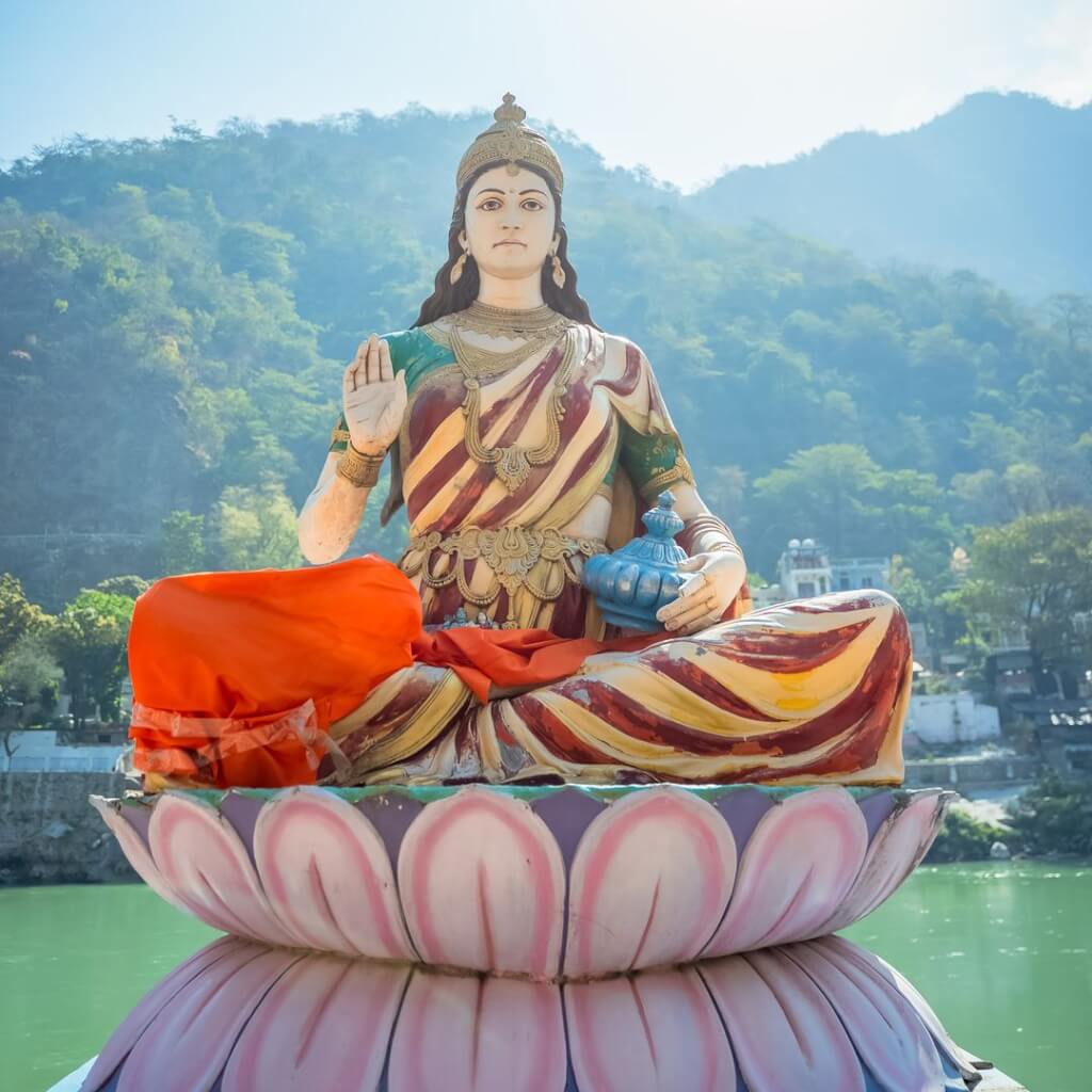
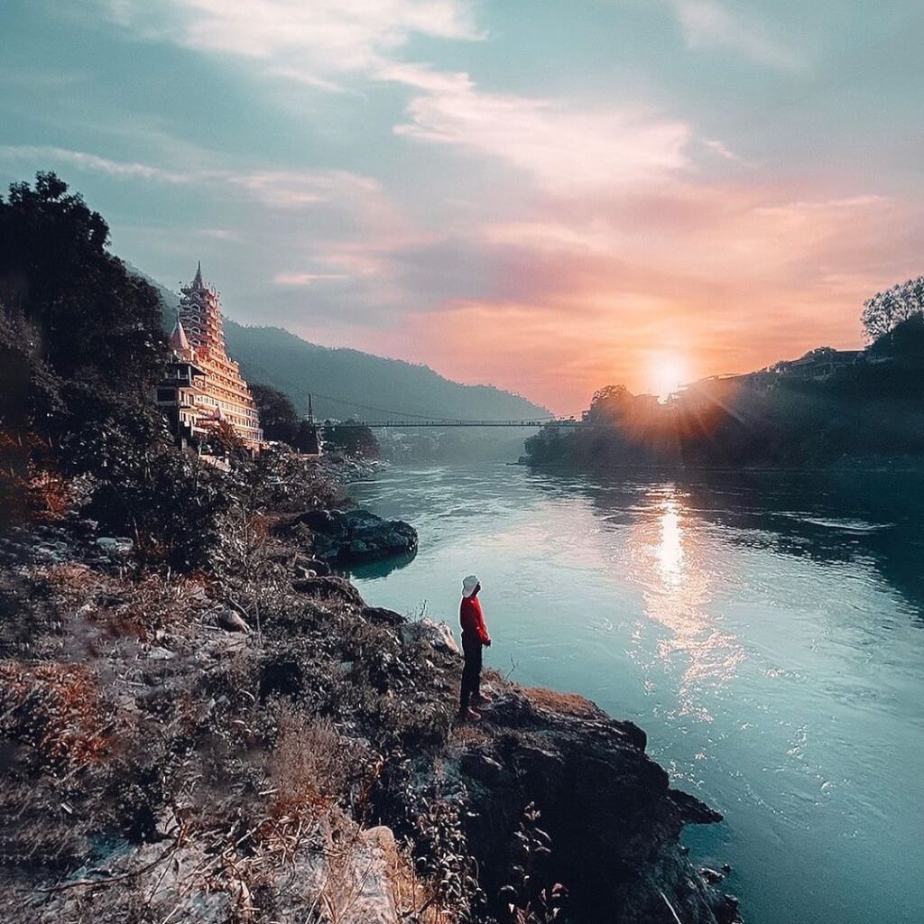
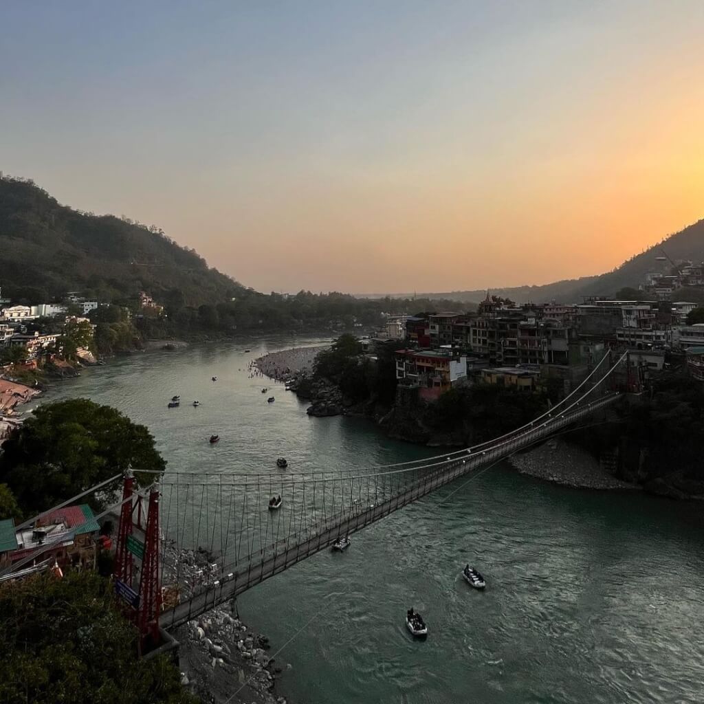
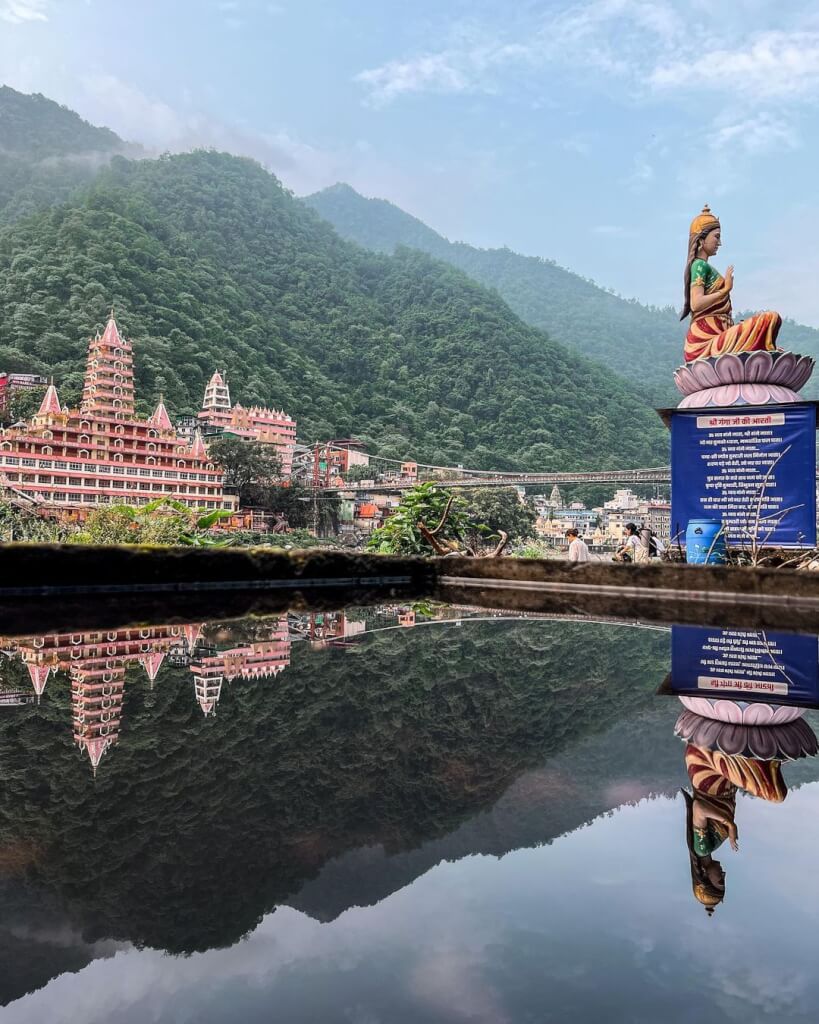
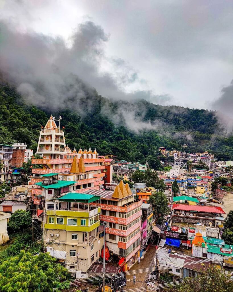
Rishikesh is a beautiful city in India, known as the “Yoga Capital of the World.” It’s situated in the northern state of Uttarakhand, nestled in the foothills of the Himalayas along the banks of the Ganges River. Rishikesh is revered for its spiritual significance, attracting yoga enthusiasts, spiritual seekers, and tourists from around the globe.
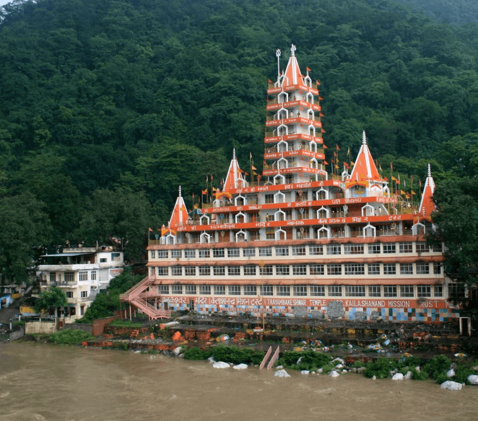
rishikesh tera manjila temple
Mythology About Rishikesh
Rishikesh known as the “Yoga Capital of the World” and has numerous stories associated with it:
Lord Rama’s Meditation: According to the Ramayana, Rishikesh is where Lord Rama did penance after defeating the demon king Ravana. He meditated here to absolve himself of any sin associated with killing Ravana, who was a Brahmin.
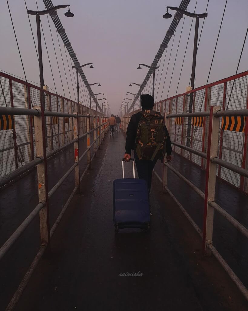
Lakshmana Jhula and Ram Jhula: These iconic suspension bridges in Rishikesh are named after Lord Rama’s brother, Lakshmana, and are believed to be where Lakshmana crossed the Ganges on jute ropes. It’s said that Lord Rama performed penance here after the battle of Lanka.
Sage Raibhya’s Tapasya (Meditation): The Skanda Purana mentions that sage Raibhya Rishi did severe penance on the banks of the Ganges in Rishikesh, seeking the blessings of Lord Vishnu. Impressed by his devotion, Lord Vishnu appeared before him.
Yoga Capital: It’s believed that sages and saints from ancient times used Rishikesh as a spot for meditation due to its serene and spiritual ambiance. It’s here that yoga and meditation techniques were believed to have been developed and passed down through generations.
Rishikesh’s spiritual significance and tranquil surroundings have attracted seekers and spiritual enthusiasts for centuries, making it not only a hub for mythology but also a living embodiment of spirituality and yoga practices.
Activities In Rishikesh
Here are some popular things to do in Rishikesh:
River Rafting: The Ganges River offers thrilling white-water rafting experiences with various rapids suitable for both beginners and experienced rafters.
Yoga and Meditation: Rishikesh is often referred to as the “Yoga Capital of the World.” Numerous ashrams and yoga centers offer classes, retreats, and courses for all levels of practitioners.
Visit Ashrams and Temples: Explore the spiritual side of Rishikesh by visiting ashrams like the Beatles Ashram (Maharishi Mahesh Yogi Ashram), Parmarth Niketan, and Triveni Ghat. Also, visit famous temples like the Neelkanth Mahadev Temple.
Bungee Jumping and Adventure Sports: Try adrenaline-pumping activities like bungee jumping, flying fox, giant swing, and rock climbing offered by adventure camps near Rishikesh.
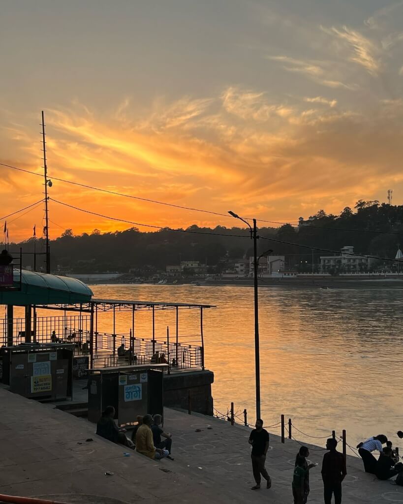
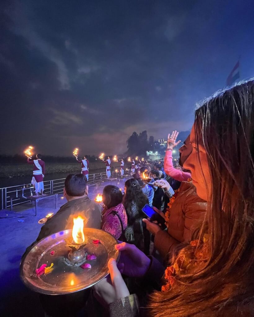
Attend Ganga Aarti: Witness the mesmerizing Ganga Aarti ceremony performed at the banks of the Ganges River in the evenings, a beautiful ritual of light and sound.
Trekking: Explore the Himalayan foothills with various trekking trails around Rishikesh, like the Neer Garh Waterfall trek, Patna Waterfall trek, or the trek to the Kunjapuri Devi Temple.
Ayurvedic Massages and Spa: Relax and rejuvenate with traditional Ayurvedic massages and spa treatments available in many wellness centers.
Camping: Experience the serenity of nature by camping along the banks of the Ganges or in the nearby hills. There are several campsites offering various amenities and activities.
How To Reach Rishikesh
By Road
From Delhi: Rishikesh is approximately 240 kilometers from Delhi, and the journey takes around 6-7 hours by road. You can take a bus from the Kashmiri Gate ISBT or hire a taxi/private car. From Haridwar: Rishikesh is around 25 kilometers from Haridwar. You can take a bus, taxi, or even an auto-rickshaw from Haridwar to reach Rishikesh. Once in Rishikesh, you can use auto-rickshaws, cycle rickshaws, taxis, or rented motorcycles/scooters to move around within the city.
By Train
Rishikesh has its own railway station, but it’s a small one with limited connectivity. The nearest major railway station is Haridwar Junction, about 25 kilometers away. From Haridwar, you can take a taxi, bus, or even a shared auto-rickshaw to Rishikesh.
By Air
The nearest airport to Rishikesh is the Jolly Grant Airport in Dehradun, located around 21 kilometers away. From there, you can hire a taxi or use public transportation to reach Rishikesh.
Frequently Asked Questions Registrations
1. Where is Rishikesh?
Rishikesh is located in the northern state of Uttarakhand in India. It is situated in the foothills of the Himalayas, on the banks of the Ganges River. Geographically, it lies at the foothills of the Garhwal Himalayan Range.
2. What is Rishikesh known for?
Rishikesh is situated at an altitude of approximately 372 meters (1,220 feet) above sea level. Being nestled in the foothills of the Himalayas, it provides a picturesque setting with the river Ganges flowing through it, surrounded by lush green hills.
3.When is the best time to visit Rishikesh?
The best time to visit Rishikesh is from February to mid-May and then from September to November. During these periods, the weather is pleasant, and the river rafting season (March to June and September to November) is at its peak.
4. What are the accommodation options in Rishikesh?
Rishikesh offers a wide range of accommodation options, including ashrams, budget guesthouses, mid-range hotels, and luxury resorts.
5. What are the popular tourist attractions in Rishikesh?
Rishikesh is famous for its ashrams, temples, and adventure sports. Some popular tourist attractions include the Beatles Ashram (Chaurasi Kutia), Triveni Ghat, Neelkanth Mahadev Temple, Ram Jhula, and Laxman Jhula.
Kanatal is a picturesque hill station located in the state of Uttarakhand, India. Situated at an altitude of around 8,500 feet above sea level, it offers breathtaking views of the snow-capped peaks of the Garhwal Himalayas and lush green forests. The serene environment and pleasant weather make it a popular destination for tourists seeking tranquility and natural beauty.
The region of Uttarakhand, including Kanatal, has a rich history dating back to Vedic times. It has been mentioned in various ancient scriptures and texts. The area was historically a part of the Kedar Khand region, named after Lord Shiva’s abode. During the colonial period, the British recognized the natural beauty and the pleasant climate of the region. They established hill stations in the vicinity for their administrative and leisure purposes. Kanatal, owing to its serene surroundings, became a favored destination for the British colonial officers to escape the scorching heat of the plains. Over the years, Kanatal has gradually gained popularity as a tourist destination due to its pristine natural beauty, pleasant climate, and panoramic views of the Himalayas.
Activities In Kanatal
Kanatal in Uttarakhand offers a serene and picturesque environment, perfect for various activities. Here are some popular things to do in Kanatal:
Trekking: Explore the stunning trails around Kanatal, such as the Surkanda Devi Temple Trek or the Kodia Jungle Trek, offering breathtaking views of the Himalayas.
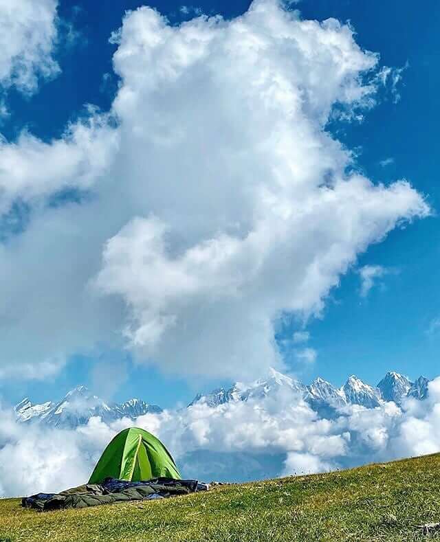
Camping: Enjoy camping amidst the Himalayan beauty, either in established campsites or in the midst of nature.
Adventure Sports: Engage in adventure activities like zip-lining, rock climbing, rappelling, and valley crossing offered by various adventure camps.
Photography: The scenic landscapes offer fantastic photography opportunities, capturing the beauty of the Himalayas and the surrounding nature.
Local Sightseeing: Visit Surkanda Devi Temple, Tehri Dam, and the Kodia Forest for a glimpse into the local culture and history.
Char Dham Yatra Do Dham Yatra Panch Kedar Yatra Adi…
How To Reach
From Delhi: Kanatal is about 300 kilometers away from Delhi. You can drive via NH334 or take a bus from Delhi to Dehradun or Mussoorie, and then another bus or taxi.
From Dehradun: it is approximately 80 kilometers away from Dehradun. You can hire a taxi or take a bus from Dehradun to reach There.
From Rishikesh: it is around 75 kilometers away from Rishikesh. You can hire a taxi or take a bus to reach Kanatal. Once you reach there, local taxis or rented cars are available for transportation within the town and nearby tourist spots.
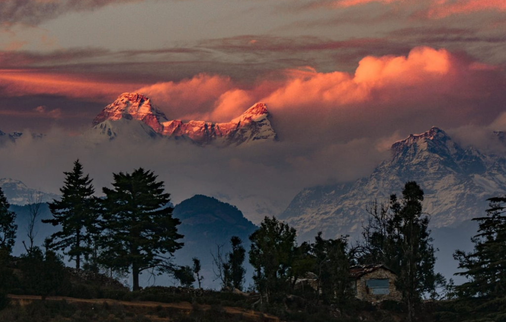
Kausani is a charming hill station nestled in the Bageshwar district of Uttarakhand, India. It’s renowned for its panoramic views of the Himalayan peaks, including Trishul, Nanda Devi, and Panchachuli. The serene and picturesque setting of Kausani has earned it the nickname “Switzerland of India.”
The region around Kausani has a historical connection to ancient texts like the Skanda Purana. It’s believed that the place was named after a sage named Kausik, who is said to have meditated here. In the late 19th century, Kausani gained attention due to its stunning views, and it’s reported that Mahatma Gandhi, mesmerized by its beauty, called it the “Switzerland of India.” He spent some days at the Anasakti Ashram in Kausani, where he penned his commentary on the ‘Gita-Anashakti Yoga.’
Activities in Kausani
Kausani, nestled in the Kumaon region of Uttarakhand, is known for its breathtaking views of the Himalayas and serene surroundings.
Visit Anashakti Ashram: This ashram is where Mahatma Gandhi stayed for some time and is a place of historical significance. It offers beautiful views of the Himalayas.
Explore Tea Gardens: Kausani is famous for its tea gardens. You can visit tea estates like Giria’s Uttaranchal Tea Estate to witness the tea-making process and enjoy scenic walks.
Himalayan Viewpoint: Sunrise and sunset views over the Himalayas are spectacular. Places like Viewpoint or Sunrise Point offer panoramic vistas.
Trekking: There are trekking trails around Kausani, like the Bageshwar Sundardhunga Trek or the Kafni Glacier Trek, which offer stunning views and a chance to explore the region.
Visit Baijnath Temple: This ancient temple complex dedicated to Lord Shiva is about 17 km from Kausani and is known for its historical and architectural significance.
Gandhi Ashram: Also known as the Anashakti Ashram, it’s a serene place to visit and explore its museum showcasing the life of Gandhi and his teachings.
Picnics: Enjoy peaceful picnics by the riverside or in scenic spots surrounded by nature.
Bird Watching: It is home to various species of birds. Bird watching can be enjoyed in places like Rudradhari Falls and Caves.
Gwaldam is a picturesque hill town located in the Chamoli district of Uttarakhand, India. Situated at an altitude of around…
How To Reach Kuasani
By Road
It is well-connected by roads to major cities like Delhi, Nainital, and Almora. You can drive to Kausani or take a bus from these cities. Buses and taxis are available from nearby towns and cities.
By Train
The nearest railway station is Kathgodam Railway Station. From Kathgodam, you can hire a taxi or take a bus. The distance between Kathgodam and Kausani is about 141 km, and the journey takes approximately 5-6 hours by road.
By Air
The nearest airport is Pantnagar Airport. From Pantnagar, you can hire a taxi or take a bus. The distance between Pantnagar Airport and Kausani is approximately 177 km, and it takes around 5-6 hours by road.
Frequently Asked Questions Registrations
1. Where is Kausani located?
Kausani is a picturesque hill station located in the Bageshwar district of Uttarakhand, India. It is situated at an altitude of about 1,890 meters (6,200 feet) above sea level.
2. What is the best time to visit Kausani?
The best time to visit Kausani is from March to June and September to November. During these months, the weather is pleasant with temperatures ranging from 10°C to 25°C, making it ideal for sightseeing and outdoor activities.
3. How far is Kausani from major cities like Delhi and Dehradun?
Kausani is approximately 420 kilometers (260 miles) from Delhi and around 450 kilometers (280 miles) from Dehradun. The travel time can vary depending on road conditions and mode of transportation.
4. What are the main attractions in Kausani?
Some popular tourist attractions in Kausani include: Anasakti Ashram (Gandhi Ashram) Baijnath Temple Rudradhari Falls and Caves Kausani Tea Estate Viewpoints like Gandhi Ashram viewpoint and Pant Museum viewpoint
5. What should I pack for a trip to Kausani?
Warm clothing, especially if visiting during the winter months.
Comfortable trekking shoes.
Rain gear (if traveling during the monsoon season).
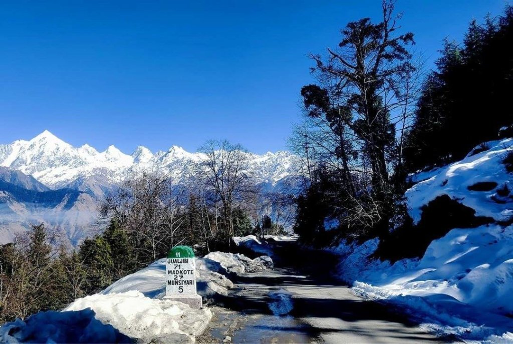
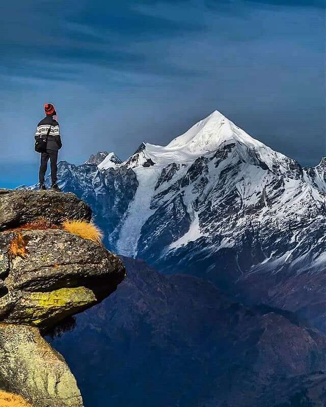
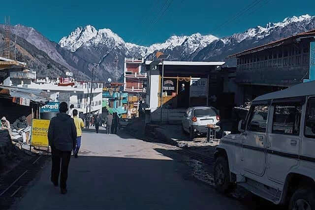
Munsiyari is a picturesque hill station nestled in the Pithoragarh district of Uttarakhand, India. Situated at an elevation of around 7,200 feet (2,200 meters) above sea level, it’s renowned for its stunning views of the Himalayan peaks, including the Panchachuli range. The name “Munsiyari” translates to “a place with snow,” and it aptly describes the snowy vistas it offers.
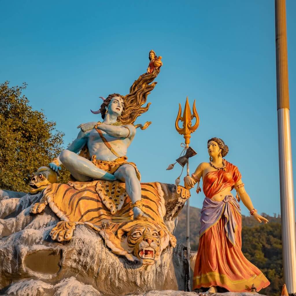
The region itself holds numerous tales from Hindu mythology that are linked to the Himalayas. The Himalayas are revered as the abode of the gods in Hindu mythology, and many stories revolve around various deities and their interactions with these majestic mountains. The mighty peaks are believed to be the home of Lord Shiva, one of the principal deities in Hinduism. According to mythology, it’s where Shiva sits in meditation and performs his divine dance, the Tandava. The rivers originating from these mountains, including the Ganges, have their own mythological significance and are considered sacred in Hinduism.
Book Online
Customer Care :- +91 8851072020 (7:00 Am to 7:00 PM)
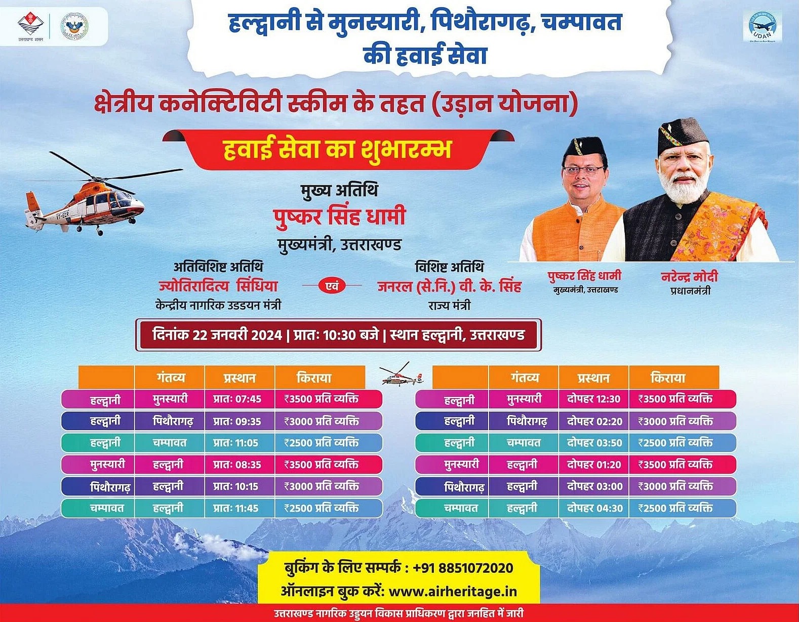
Air service is starting from Haldwani to Munsiyari, Pithoragarh
History of Munsiyari
Historically, Munsiyari was an important stopover on the ancient salt route that connected Tibet with the plains of India. Traders would traverse these routes to trade salt, herbs, and other goods. This strategic location contributed to Munsiyari’s cultural diversity, as it became a melting pot of various cultures and traditions. The region has been inhabited by the indigenous Shauka tribe for centuries. They have played a crucial role in shaping the identity of Munsiyari. During the British colonial era, Munsiyari served as a gateway for expeditions into the high Himalayas. The town gained prominence as a base for explorers, mountaineers, and researchers venturing into the region.
Activities In Munsiyari
Munsiyari, nestled in the Himalayan region of Uttarakhand, offers a plethora of activities for nature lovers and adventure enthusiasts. Here are some activities you can enjoy in Munsiyari:
Trekking: Munsiyari is a gateway to various treks, including the Milam Glacier Trek, Nanda Devi Temple Trek, and the Khalia Top Trek. These treks offer stunning views of the Himalayas and an opportunity to explore the region’s natural beauty.
Bird Watching: The area is rich in birdlife. Birdwatchers can spot a variety of Himalayan avian species in and around Munsiyari.
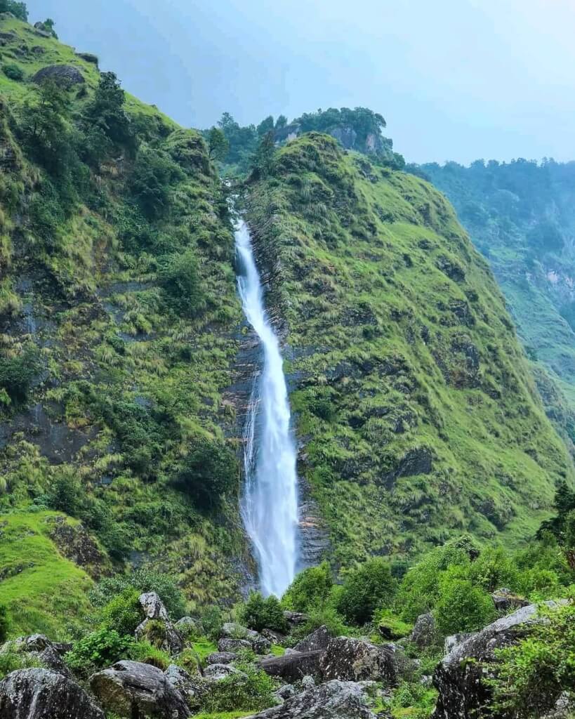
Exploring Waterfalls: Visit Birthi Falls, a picturesque waterfall near Munsiyari, to enjoy the serene surroundings and the beauty of cascading water.
Camping: There are several camping sites around Munsiyari that offer a chance to experience the raw beauty of the Himalayas. Camping under the stars in this region is an unforgettable experience.
Sightseeing: Explore the local attractions such as the Maheshwari Kund, Thamari Kund, and the tribal villages around Munsiyari to get a glimpse of the local culture and lifestyle.
Photography: Munsiyari offers stunning landscapes and panoramic views of the Himalayas, making it a paradise for photographers.
Nature Walks: Take leisurely strolls around the town or in nearby forests to soak in the natural beauty and serenity of the place.
Adventure Sports: Depending on the season, activities like skiing, snowboarding, and snow trekking are available in winter, while in summer, you can indulge in activities like river rafting, paragliding, and mountain biking.
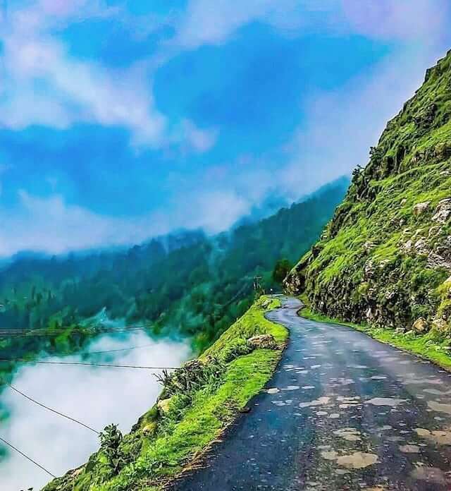
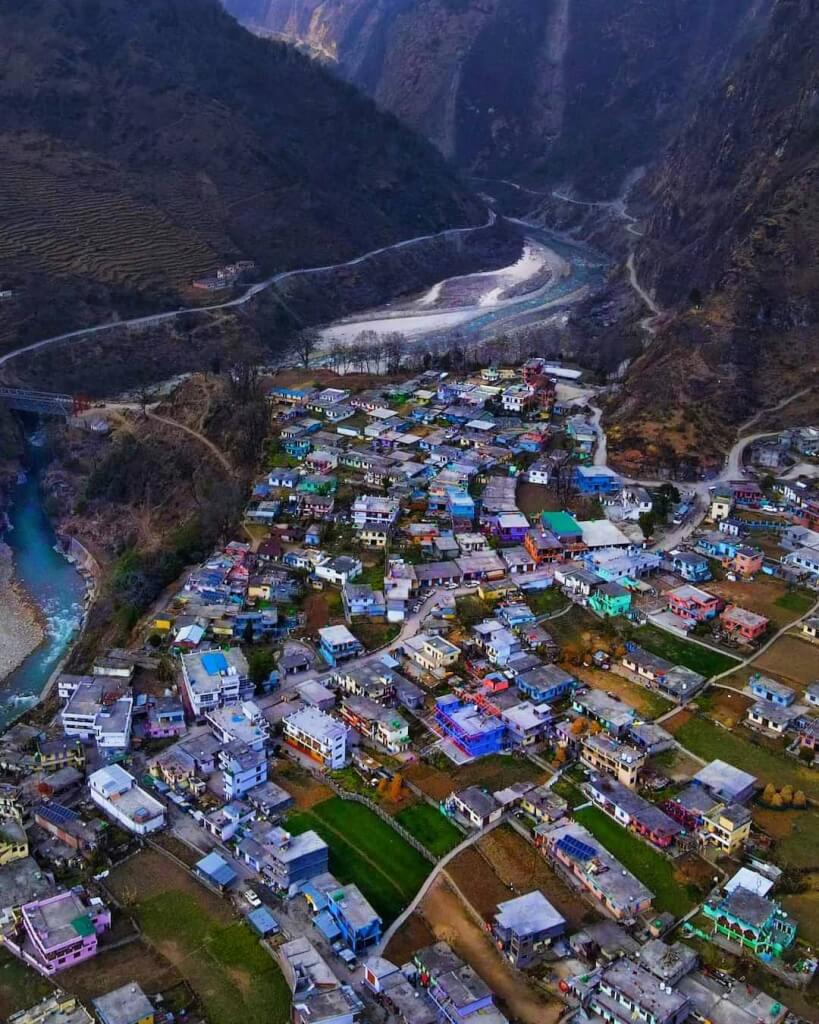
Dharchula is a pictures que town nestled in the northern part of the Indian state of Uttarakhand, near the border…
How To Reach Munsiyari
By Road
It is well-connected by road to major cities and towns in Uttarakhand. You can either drive or take a bus from places like Kathgodam, Almora, Nainital, or Haldwani to Munsiyari. The road journey offers stunning views of the Himalayas but involves traveling through winding mountain roads.
By Train
The nearest railway station is Kathgodam Railway Station (KGM). From Kathgodam, you can hire a taxi or Bus. approximately 284 kilometers, and the journey takes around 10-12 hours.
By Air
The nearest airport is Pantnagar Airport (PGH), located approximately 313 kilometers away. From the airport, you can hire a taxi or take a bus to reach there.
Frequently Asked Questions Registrations
1. Where is Munsiyari located?
Munsiyari is nestled in the Pithoragarh district of Uttarakhand, India, perched at an altitude of approximately 2,200 meters (7,200 feet) above sea level. It is situated in the Johar Valley, close to the borders of Nepal and Tibet.
2. When is the best time to visit Munsiyari?
The best time to visit Munsiyari is from April to June and from September to November. During these months, the weather is pleasant, and the skies are clear, offering stunning views of the Himalayas and ideal conditions for outdoor activities such as trekking, camping, and sightseeing.
3. What is the significance of Munsiyari?
Munsiyari holds significant importance as a gateway to several Himalayan peaks and glaciers, making it a paradise for trekkers and adventure enthusiasts.It offers breathtaking views of the Panchachuli Peaks and serves as the starting point for treks to Milan and Ralam Glaciers.
4. What are the nearby tourist attractions from Munsiyari?
Munsiyari is surrounded by several tourist attractions, including Birthi Falls, Darkot Village, Thamari Kund, and the ancient Narayan Ashram. These places offer opportunities for sightseeing, exploration, and cultural immersion.
5. What should I pack for a trip to Munsiyari?
Warm clothing, especially if visiting during the winter months.
Comfortable trekking shoes.
Rain gear (if traveling during the monsoon season).
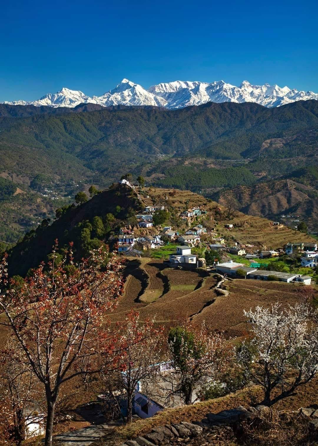
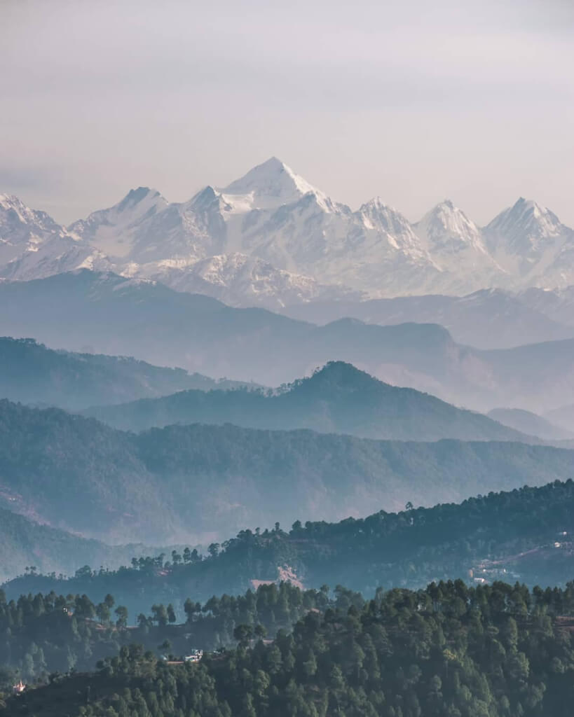
Chaukori is a serene hill station located in the Pithoragarh district of Uttarakhand, India. Situated at an altitude of around 2,010 meters (6,600 feet) above sea level, it offers breathtaking views of the Himalayas, including peaks like Nanda Devi, Nanda Kot, and Panchachuli.
Chaukori, located in Uttarakhand, India, is a serene hill station known for its picturesque beauty and tranquility. Here are some activities you might enjoy there:
Nature Walks: Explore the lush landscapes, walk through tea gardens, and enjoy the breathtaking views of the Himalayas.
Visit Tea Gardens: Chaukori is famous for its tea gardens. Take a tour to learn about tea cultivation and processing while enjoying the scenic surroundings.
Bird Watching: The region is a paradise for bird enthusiasts. Carry your binoculars and spot various Himalayan and migratory bird species.
Trekking: There are several trekking trails around Chaukori that offer stunning vistas of the mountains and valleys. Dharamghar, Patal Bhuvaneshwar, and Berinag are some nearby trekking spots.
Sunrise/Sunset Viewing: Witness breathtaking sunrises and sunsets against the backdrop of the snow-capped peaks. The views are simply mesmerizing.
Village Tours: Interact with locals, experience their culture, and learn about their traditional way of life.
Photography: Capture the beauty of the Himalayas, tea gardens, valleys, and the serene ambiance, making lasting memories through your lens.
Ranikhet is a beautiful hill station in Uttarakhand, India, sitting about 6,132 feet above sea level. Its name means “Queen’s…
How To Reach Chaukori
By Road
Chaukori is well-connected by roads. Buses and taxis ply regularly from nearby towns like Almora, Nainital, and Kathgodam. You can also hire a private taxi if you prefer a more flexible schedule.
By Train
The nearest major railway station is Kathgodam, around 196 kilometers from Chaukori. Trains from Delhi and other major cities operate to Kathgodam regularly.
By Air
The nearest airport to Chaukori is Pantnagar Airport (PGH), approximately 205 kilometers away. From Pantnagar, you can hire a taxi or take a bus to reach Chaukori.