Gwaldam

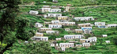
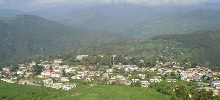
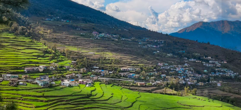
Gwaldam is a picturesque hill town located in the Chamoli district of Uttarakhand, India. Situated at an altitude of around 1,700 meters (5,600 feet) above sea level, it offers breathtaking views of the Himalayas. The town is surrounded by lush greenery, dense forests, and stunning mountain peaks, making it a popular destination for nature lovers and trekkers.

gwaldum, uttarakhand
 
LocationChamoli
Famous ForRoopkund Trek, Nanda Devi  raj Jat Yatra 
Altitude 1700 mts
Chamoli70-60km
Nearest Railway Station or    AirportKathgodam 169kms/ Panthnagar 205kms
Best time to visit In Winter (Dec to Jan) in Summer ( April to June) 

Activities in Gwaldam

Gwaldam, nestled in the Himalayas, offers several activities for nature lovers and adventure seekers:

  1. Trekking: Explore picturesque trails like the Roopkund Trek, Ali Bugyal Trek, and more, offering stunning views of the Himalayas.

  2. Camping: Set up camps amidst the serene beauty of Gwaldam, offering a chance to connect with nature and stargaze at night.

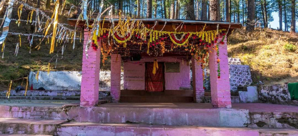
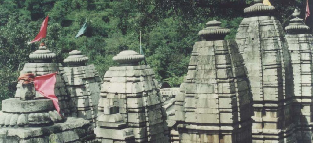
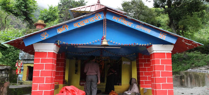
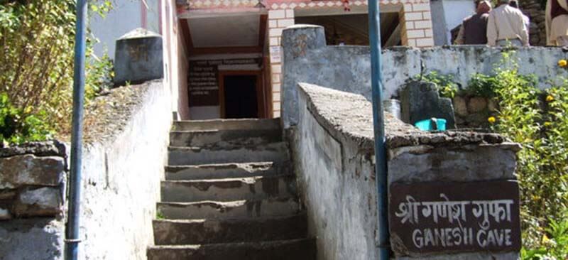
  3. Sightseeing: Visit places like Badhangarhi Temple, Gwalnaag, and the nearby scenic spots to witness the natural beauty and cultural heritage.

  4. Bird Watching: Gwaldam is home to diverse avian species; birdwatchers can enjoy spotting different birds amidst the Himalayan landscapes.

  5. Photography: Capture breathtaking landscapes, the play of light and shadows on the Himalayan peaks, and the local life for lasting memories.

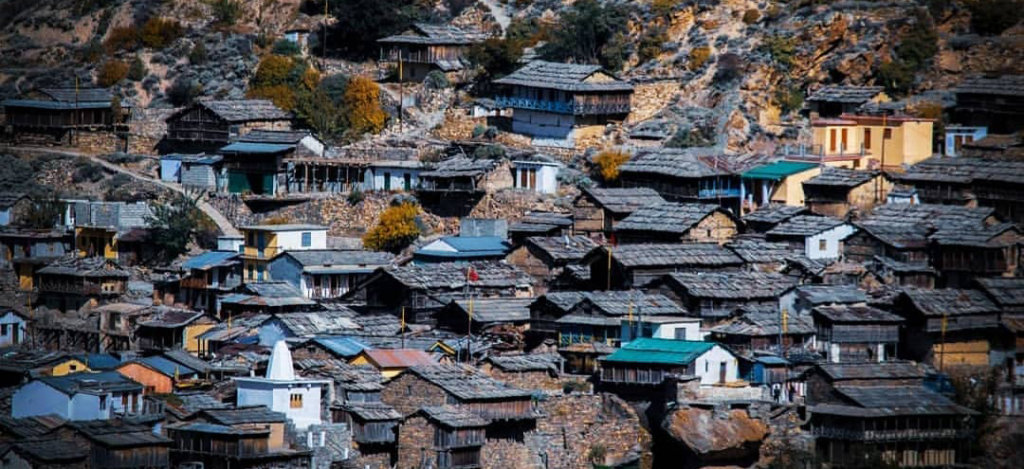
  6. Village Walks: Explore nearby villages to experience the local culture, interact with locals, and understand their traditional lifestyle.

  7. Nature Walks: Take leisurely walks amidst the lush forests, breathing in the fresh mountain air and enjoying the tranquility.

Places to See in Gwaldam

Kausani:

  • Though a bit farther, Kausani is renowned for its panoramic views of the Himalayas, including Nanda Devi and Trishul peaks. 
  • Karnaprayag:
    • A divine confluence of the Alaknanda and Pindar rivers, Karnaprayag is known for its spiritual significance and breathtaking landscapes.
  • Bageshwar:
    • Steeped in religious and cultural heritage, Bageshwar is adorned with ancient temples and offers a serene retreat amidst the Kumaon Himalayas.

Trek Near Gwaldam

  • Roopkund Trek:
    • Adventure enthusiasts are drawn to the Roopkund Trek, known for its mysterious high-altitude lake and panoramic mountain views.
  • Brahmatal Trek:
    • A scenic trek leading to Brahmatal, offering mesmerizing views of the snow-clad Himalayan peaks and a pristine alpine lake.
  • Pindari Glacier Trek:
    • Explore the stunning Pindari Glacier, a trek that unveils the beauty of remote Himalayan landscapes, charming villages, and icy wonders.

How To Reach Gwaldam

From Delhi Gwaldam is approximately 380 kilometers away from Delhi. You can drive via NH9 through Hapur, Moradabad, and Haldwani, and then take the route through Almora and Kausani to reach Gwaldam.  

The nearest airport to Gwaldam is Pantnagar Airport (PGH), which is approximately 250 kilometers away. From there, you can hire a taxi or use a bus service to reach Gwaldam. However, flights to Pantnagar might not be very frequent, so you might need to plan accordingly.

The nearest major railway station is Kathgodam Railway Station (KGM), which is about 230 kilometers away. From Kathgodam, you can take a taxi or a bus to reach Gwaldam. Trains to Kathgodam are more accessible from various parts of India.

More Info:- How to Reach Gwaldam

Wan village

Wan Village is a beautiful hamlet At 2,400 metres above sea level, the quiet village of Wan is found in Uttarakhand’s Chamoli district. Known for its scenic beauty and serene atmosphere, Wan Village serves as the base camp for the famous trek to the Roopkund trek and Hemkund Sahib.

wan Village
wan Village
Locationchamoli
Famous ForRoopkund trek, village Tourism 
Altitude 2800 mts
Lohajung15 km Lohajung
Nearest Railway Station or    AirportKathgodam 237kms/ Panthnagar 281kms
Best time to visit Round the Year 

Latu Devta Temple

Latu Devta Temple is a sacred site located in Wan Village in the Chamoli district of Uttarakhand, India. Dedicated to Latu, a local deity revered by the villagers, the temple holds cultural and religious significance. Pilgrims and locals visit the temple to seek blessings, especially before embarking on treks in the surrounding Himalayan region. The temple provides a serene and spiritual atmosphere, offering visitors a glimpse into the religious traditions of the area.

 Trekking Places from Wan Village

  • Bedni Bugyal – Ali Bugyal Trek: This trek takes you through the enchanting meadows of Bedni and Ali Bugyal. The trek starts from Wan Village and offers splendid views of the surrounding peaks.  
  • Brahmatal Trek: This trek takes you to the pristine Brahmatal Lake with stunning views of Mt. Trishul and Mt. Nanda Ghunti. The trek starts from Lohajung, not far from Wan Village.
  • Roopkund Trek :  Uttarakhand, is a thrilling journey through enchanting landscapes. Starting from Wan, trekkers traverse dense forests, picturesque meadows, and rugged terrains. The highlight is reaching Roopkund, a glacial lake with mysterious skeletal remains. This trek offers a blend of adventure,

How To Reach

Lohajung is well-connected by road, and you can reach there by bus or taxi. You can take a bus to Deval or hire a taxi from nearby towns such as Rishikesh, Haridwar, or Dehradun.

The nearest railway station is Kathgodam Railway Station.
From Kathgodam, you can hire a taxi or take a bus to reach Lohajung.
The journey from Kathgodam to Lohajung by road takes around 8-10 hours.

The nearest airport to Lohajung is Jolly Grant Airport in Dehradun.
From the airport, you can hire a taxi or use public transportation to reach Lohajung.
The drive from Dehradun to Lohajung takes approximately 10-12 hours.

Gairsain

Gairsain is a town located in the Chamoli district of Uttarakhand, India. It holds significance as it’s  the summer capital of the state. Gairsain is situated in the Chamoli district, nestled amidst the Himalayan ranges.

Gairsain, Uttarakhand
Gairsain
LocationChamoli
Famous ForSummer Capital of uttarakhand
Altitude 1650 mts
Nearest Railway Station or AirportKathgodam 173km/ 200 Km  From Airport
Best time to visit Round the Year

Gairsain Name

The name “Gairsain” is created by combining two words from the Garhwali language: ‘gair,’ which means at some depth, and ‘sain,’ meaning plains. While this combination may seem incorrect in Garhwali, in Kumaoni, it forms a proper term referring to ‘deep plains.’

Gairsain :-  Future Capital of Uttarakhand

Gairsain, strategically located in the heart of Uttarakhand, is pivotal for Garhwal and Kumaon. Boasting ample space for capital construction and tourism growth, it sits on a crucial route connecting the regions. Despite controversies, Gairsain is proposed as Uttarakhand’s future summer capital, offering proximity to both regions and an elevated hill setting.

Near place to visit Gairsain

  1. Karnaprayag: Located at the confluence of the Alaknanda and Pindar rivers, Karnaprayag is known for its scenic beauty and the Karna Temple dedicated to Karna from the Mahabharata.
  2. Rudraprayag: Another significant confluence town, Rudraprayag is where the Alaknanda and Mandakini rivers meet. The town is known for its spiritual significance and the Rudranath Temple.
  3. Kausani: A hill station known for its panoramic views of the Himalayas, Kausani offers a tranquil escape with its tea gardens and serene atmosphere.
  4. Ranikhet
  5. Known for its pleasant climate and beautiful landscapes, Ranikhet is a charming hill station with attractions like the Jhula Devi Temple and Chaubatia Gardens.

How To Reach

It is a town located in the Chamoli district of Uttarakhand, India. Here are some common ways to reach there

From Rishikesh/Haridwar:
It is accessible by road from Rishikesh or Haridwar. You can hire a taxi or use public buses that ply on the route.
The journey from Rishikesh to there takes approximately 8-10 hours by road.

The nearest airport is Jolly Grant Airport in Dehradun.
From the airport, you can hire a taxi or use public transportation to reach Gairsain.

The nearest railway station is Kathgodam Railway Station.
From Kathgodam, you can hire a taxi or take a bus to reach Gairsain.

Niti Valley

Niti Valley is a stunningly beautiful region located in the Indian state of Uttarakhand, nestled in the Himalayas. It’s known for its breathtaking landscapes, picturesque villages, and rich cultural heritage. The valley is named after the ‘Niti River’ that flows through it.

LocationChamoli 
Famous ForBorder Village 
Altitude 3600 mts
Joshimath 84.4 Km  Joshimath 
Nearest Railway Station or    AirportRishikesh, 346kms/ Jolly Grant Airport, 362 kms
Best time to visit Apr, May, Sep, Oct, 

Accommodation in Niti Valley

In the past, there were no hotels for tourists in this valley, and not many people explored it. You used to need permission to visit, and only locals could stay. Now, you don’t need permission except for the last village, “Niti.” There’s a new government guest house in Gamshali. Stay in Joshimath and plan your trip from there

How To Reach Niti village 

Delhi to Haridwar/Rishikesh: Start your journey from Delhi and travel to Haridwar or Rishikesh by road.
From Haridwar or Rishikesh, take a bus or hire a taxi to reach Joshimath.
The roads might be steep and winding, especially during the winter months.

Badrinath to Niti Village: Niti village is further ahead from Badrinath. You might need to arrange local transport or hire a guide to take you through the rough terrains towards Niti village.

The nearest Railways station is Rishikesh. From there, you can hire a cab or take a bus to reach Joshimath or Badrinath.

The nearest airport to Niti village is Jolly Grant Airport in Dehradun. From there, you can hire a cab or take a bus to reach Joshimath or Badrinath.

Click Here How to Reach Joshimath or Badrinath 

Malari Village

Malari is a tiny village in the Chamoli region of India, close to the border with Tibet. Situated at an elevation of 3048 metres in the Dhauli Ganga valley, Malari  is surrounded by rugged mountains covered in snow. Inhabitants of  village moves to the lower part of Himalayas during winters due to heavy snowfall. The route from Malari leads to the nearby China/Tibet border at Niti Village and Niti Pass.

LocationChamoli 
Famous ForVillage Tourism, Border Tourism 
Altitude 3048 Meters
 Joshimath 60 Km Joshimath 
Nearest Railway Station or    AirportRishikesh, 300kms/ Jolly Grant Airport, 320 kms
Best time to visit Apr, May, Jun, Sep, 

How To Reach Malari Village

Dehradun/Rishikesh to Joshimath:
Start your journey by reaching Joshimath, a major town in Uttarakhand.
You can travel to Joshimath by road from Dehradun or Rishikesh.
Joshimath to Badrinath:
From Joshimath, continue towards Badrinath, which is the last motorable point.
it is about 55 kilometers from Badrinath.

The nearest airport to Malari Village is Jolly Grant Airport in Dehradun. From there, you’ll have to travel by road to reach Malari.

The nearest major railway station is Rishikesh Railway Station. Again, from there, you’ll need to continue your journey by road via bus or taxi.
The road journey to Malari involves taking a route through Joshimath. 

Read More :- How to Reach Joshimath 

Tapovan joshimath

Tapovan is a beautiful and serene destination located near Joshimath in the Chamoli district of Uttarakhand, India. Situated at an elevation of around 14,200 feet above sea level, Tapovan is renowned for its breathtaking natural beauty, spiritual significance, and trekking opportunities.

Tapovan joshimath, Uttarakhand

Tapovan Joshimath

Tapovan in Joshimath, located in the Indian state of Uttarakhand, is a picturesque high-altitude meadow nestled amidst the stunning Garhwal Himalayas. This serene and scenic destination is famous for its natural beauty, offering breathtaking views of snow-capped peaks, lush greenery, and a tranquil environment ideal for meditation and spiritual pursuits. The area is also known for its trekking trails, especially the trek to the source of the Ganges River, which is considered sacred in Hindu mythology. Joshimath serves as a base camp for various treks and pilgrimages in the region, making it a popular destination for nature enthusiasts, adventure seekers, and those seeking spiritual solace.

Natural Hot Springs

Tapovan is renowned for its natural hot springs, where therapeutic warm water emerges from the earth. Locals believe in the medicinal properties, claiming it can alleviate various skin conditions. Positioned at an optimal height, these hot springs are not only considered healing but also provide a suitable environment for bathing

How To Reach Taopvan Joshimath

Tapovan in Joshimath, India, is a beautiful place but can be a bit challenging to reach due to its remote location. Here are the general directions to get there:

Filler text (also placeholder text or dummy text) is text that shares some characteristics of a real written text, but is random or otherwise generated.

Filler text (also placeholder text or dummy text) is text that shares some characteristics of a real written text, but is random or otherwise generated.

Filler text (also placeholder text or dummy text) is text that shares some characteristics of a real written text, but is random or otherwise generated.

Read More :- How To Reach Joshimath 

Bhavishya Badri

Bhavishya Badri is one of the Panch Badri temples located in the Indian state of Uttarakhand, specifically in the district of Chamoli. It is part of the famous Char Dham Yatra pilgrimage circuit in the Garhwal region.

Read More :- Badrinath Temple ::  Vriddha Badri :: Adi Badri ::  Dhyan Badri  :: Yogadhyan Badri ::  Ardh Badri 

LocationJoshimath 
Famous ForSapt Badri 
Altitude 2744 mtrs 
Joshimath 17 Km from Joshimath 
Bhavishya Badri
Bhavishya Badri dham uttarakhand

Sapt Badri Yatra                       Char Dham Yatra                                   Panch kedar Yatra  
Sapt Badri Route Map             Char Dham Yatra Route Map             Panch Kedar Route Map 

Bhavishya Badri – Future Home of Badrinath

In the future, the sacred site of Badrinath will undergo a significant transformation, as prophesied. Bhavishya Badri is situated in an undiscovered location along the Dhauliganga river. According to the prophecy, towards the conclusion of Kalyug, a catastrophic landslide will obstruct the route to Badrinath Dham. This event is foretold to take place when the right arm of the Narsing idol within the Narsingh Temple in Joshimath collapses

Bhawishya Badri Temple Mythology

Bhavishya Badri, also known as Bhabisya Badri, translates to the “Future Abode of Lord Badrinath.” According to Hindu mythology, a celestial proclamation was made when Guru Adi Shankaracharya transferred Badri Vishal from Tapta Kund. The prophecy foretells that during the era of Kal Yuga, the mountains of Nara and Narasimha will obstruct the path to Badrinath. In the event of the shrine becoming inaccessible, Lord Badri is predicted to manifest at Bhavishya Badri, establishing it as the new sacred site for worship. In another folk belief, it is recounted that Lord Vishnu initially resided in Tibet. However, as the inhabitants of Tibet indulged in consuming meat, alcohol, and became disorderly, Lord Vishnu departed from the region. During his quest for a suitable abode in the Himalayas, he was captivated by this particular place and vowed to make it his future home. Since that time, this location has been named Bhavishya Badri

How To Reach Bhawishya Badri

Bhavishya Badri is a sacred temple located in the Himalayas, around 17 km from Joshimath in Uttarakhand, India. 

Once in Joshimath, you can hire a taxi or take a bus towards the temple. The trek to Bhavishya Badri starts from Subhain village, which is around 17 km from Joshimath.

The nearest airport is Jolly Grant Airport in Dehradun, which is around 285 km from Joshimath. From there, you can hire a taxi or take a bus to Joshimath.

The nearest railway station is Rishikesh, around 256 km from Joshimath. From Rishikesh, you can travel by road to Joshimath.

Read More :- How to Reach Badrinath Temple

Adi Badri

It is considered one of the Panch Badri temples, a group of five holy shrines devoted to Vishnu in the region. Adi Badri refers to a cluster of ancient temples situated in the Indian state of Uttarakhand. It’s a complex consisting of 16 temples, constructed in different styles and dedicated to various Hindu deities. These temples are known for their historical significance and architectural beauty.

Read More :- Badrinath Temple ::  Vriddha Badri ::   Dhyan Badri  :: Yogadhyan Badri ::  Ardh Badri 

Adi Badri, Temple
Adi Badri, Temple
LocationChamoli 
Famous ForSapt Badri Temple 
Altitude 1800 mts
Badrinath Temple17 kms from Karanprayag
Nearest Railway Station or    AirportRishikesh, 192 kms/ Jolly Grant Airport, 220 kms
Best time to visit May, Jun, Sep, Oct, Nov
Mythology About Adi Badri

it was believed that Lord Vishnu made Adibadri his dwelling place during the Satyug, Treta, and Dwapar eras. When the age of Kalyug approached, Lord Vishnu shifted his abode to Badrinath, leading to the name “AdiBadri.” The renowned sage Maha Rishi VedViyas, who organized the Vedas into Rigveda, Samveda, Yajurveda, and Atharvaveda, is said to have composed the Shri Mad Bhagwat Puran at this sacred site.

How To Reach Adi Badri

It is a group of 16 temples located in the Indian state of Uttarakhand. Here are the general directions to reach AdiBadri 

 Adi Badri is nearest to the Karanprayag road, 
You can also take bus, private taxi from  Rishikesh to Karanprayag and then to AdiBadri.

The nearest airport to AdiBadri temple is Jolly Grant which is in Dehradun and is about 210 km away from AdiBadri.  

nearest railway station to AdiBadri is Rishikesh which is 192 km approx. from AdiBadri. From Rishikesh you can always take a taxi or bus to reach AdiBadri.

Vriddha Badri

Vriddha Badri is one of the Panch Badri temples in Uttarakhand, India. Panch Badri refers to the five temples dedicated to Lord Vishnu. Vriddha Badri is located in Animath village, about 7 kilometers from Joshimath, in the Chamoli district of Uttarakhand. The temple is nestled amidst the scenic beauty of the Himalayas and is believed to be one of the oldest temples dedicated to Lord Vishnu.

Read More :- Badrinath Temple ::  Vriddha Badri :: Adi Badri ::  Dhyan Badri  :: Yogadhyan Badri ::  Ardh Badri 

vridha badri mandir
vridha badri mandir
LocationJoshimath 
Famous ForVriddha Badri Temple
Altitude 3200 mts
Badrinath Temple7 Km From Joshimath
Nearest Railway Station or    AirportRishikesh, 300kms/ Jolly Grant Airport, 320 kms
Best time to visit May, Jun, Sep, Oct, Nov

More Information about Sapt Badri Temple 

Mythological of Vridha Badri

In the mythological tale of Vridha Badri, the revered sage Narad undertook a penance at this sacred site to seek the favor of Lord Vishnu. Pleased by Narad’s devotion, Lord Vishnu manifested in the guise of an elderly man and granted his prayers. Vishwakarma, the divine architect, then crafted an idol of Lord Vishnu in the form of an old man. This sacred idol initially resided in Animath until it succumbed to flooding. In the 8th century, Adi Shankaracharya, a prominent Hindu philosopher, rediscovered the Vridha Badri idol while disseminating Hindu teachings across the country. Adi Shankaracharya reinstalled the idol in the temple premises, and it is believed that the original idol made by Vishwakarma now resides in the main Badrinath temple.

How To Reach Vriddha Badri

Joshimath is the base point for Vriddha Badri. You can travel by road from major cities like Haridwar, Rishikesh, or Dehradun to Joshimath. From Joshimath, you can hire a taxi or take a shared jeep to the temple.

Rishikesh is the nearest railway station. From Rishikesh, you can hire a taxi or take a bus to Joshimath.

The nearest airport is the Jolly Grant Airport in Dehradun, approximately 317 kilometers away. 

Gagesha cave

Gagesha cave, a naturally created cave about 4 kilometres from Badrinath, is cocooned in Mana village and is enigmatic. This mysterious cave is close to Vyas Cave, another well-liked Mana Village site. 

ganesha cave uttarakhand
LocationChamoli
Famous ForChar Dham yatra, Temple, Mana village 
Altitude 3,200 meters
Badrinath Temple4  Km From Badrinat Temple
Best time to visitMay, Jun, Sep, Oct, Nov

Mythological Tale related to Ganesha Cave

Gagesha cave is believed that Maharishi Vyas dictated the Mahabharata and Lord Ganesha wrote it in this cave. The cave and the mesmerising meadows that surround it

Attraction in Gagesha cave

  1. Badrinath Temple: The main attraction is the Badrinath Temple itself, a sacred pilgrimage site dedicated to Lord Vishnu. The temple is known for its distinct architecture and religious significance.
  2. Tapt Kund: A natural thermal spring located just below the temple. Pilgrims believe that taking a dip in the Tapt Kund is purifying before entering the temple.
  3. Brahma Kapal: A flat platform on the bank of the Alaknanda River, where rituals for the departed souls are performed. It is believed that performing these rituals at Brahma Kapal brings peace to the departed souls.
  4. Charanpaduka: This rock is believed to bear the footprints of Lord Vishnu and is an important pilgrimage spot.
  5. Mana Village: Known as the last village before the Indo-China border, Mana is a picturesque village with its unique culture and traditions. It is located near Badrinath and is worth a visit.
  6. Vyas Gufa (Cave): It is believed to be the cave where Ved Vyas, the sage who is credited with composing the Mahabharata, lived and meditated.
  7. Mata Murti Temple: Dedicated to the mother of Lord Badrinath, Mata Murti Temple is an important shrine in the vicinity.
How To Reach Gagesha cave

By Road

You can reach Gagesha Cave by road from nearby cities and towns. First, identify the nearest major city or town to the cave. Ensure your vehicle is in good condition for the journey, and be prepared for varying road conditions depending on the region.

By Train

The railway network in India to find the nearest train station to Gagesha Cave.

Once you reach the nearest train station to Gagesha Cave, you can take a taxi, bus, or other local transportation options to reach the cave site.

By Air

If you’re traveling from a distant location, you can fly to the nearest airport to Gagesha Cave.Once you land at the airport, you can hire a taxi or rent a car to reach the cave.

More Info :- Click here how to Reach Mana Village

Contact Us