Shivling

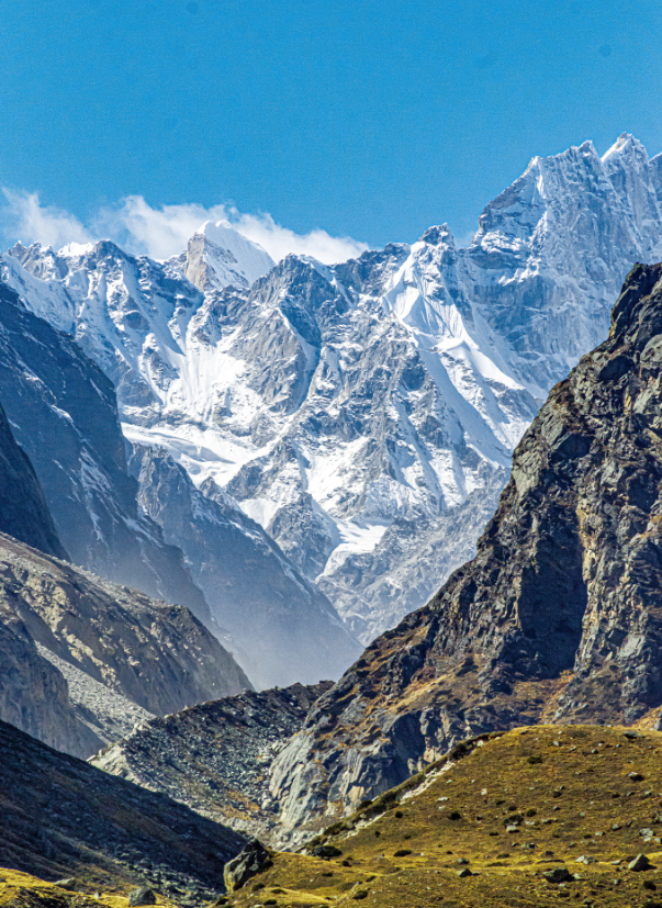
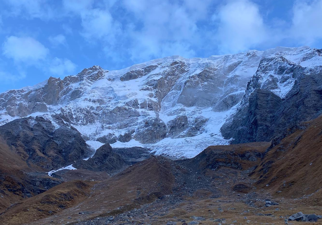
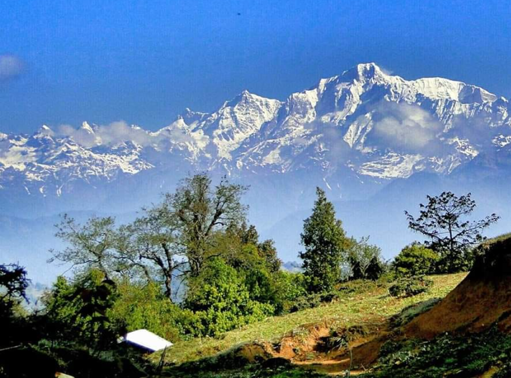
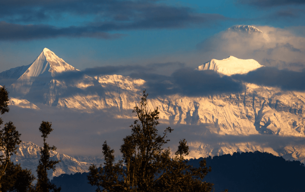
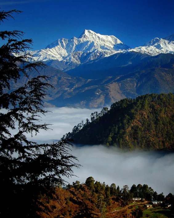
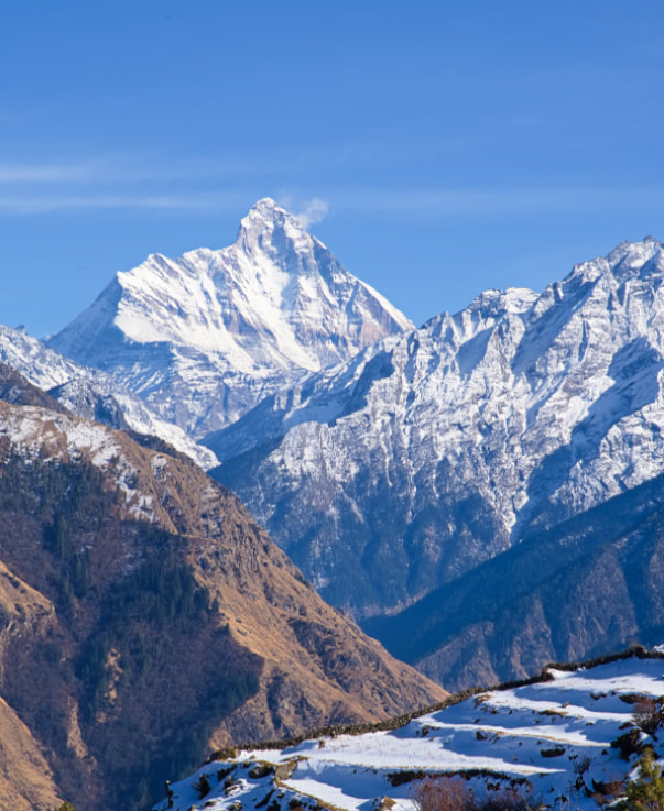
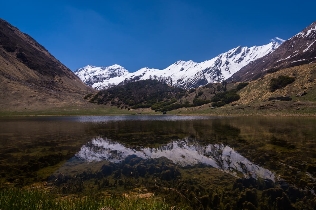
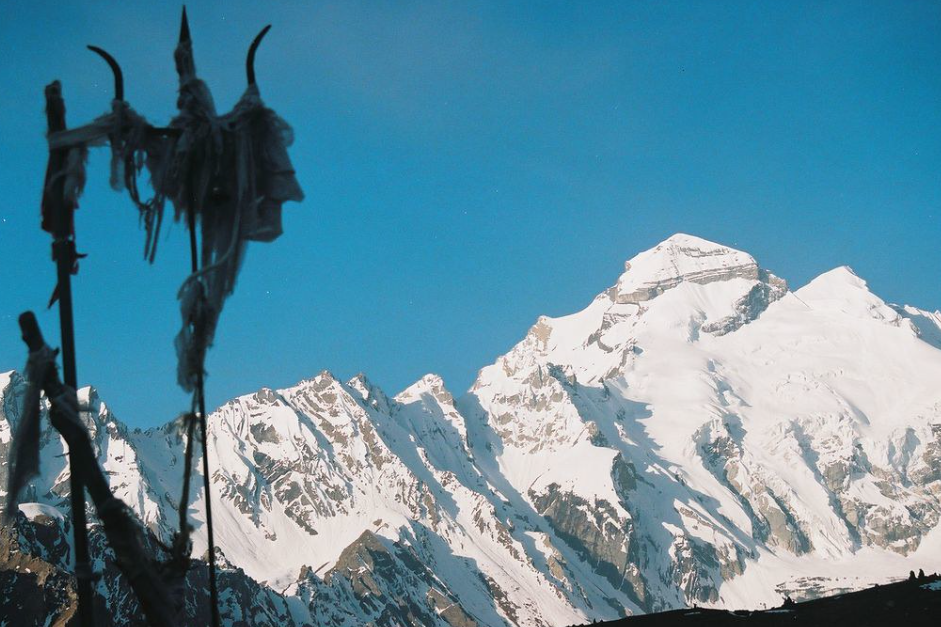
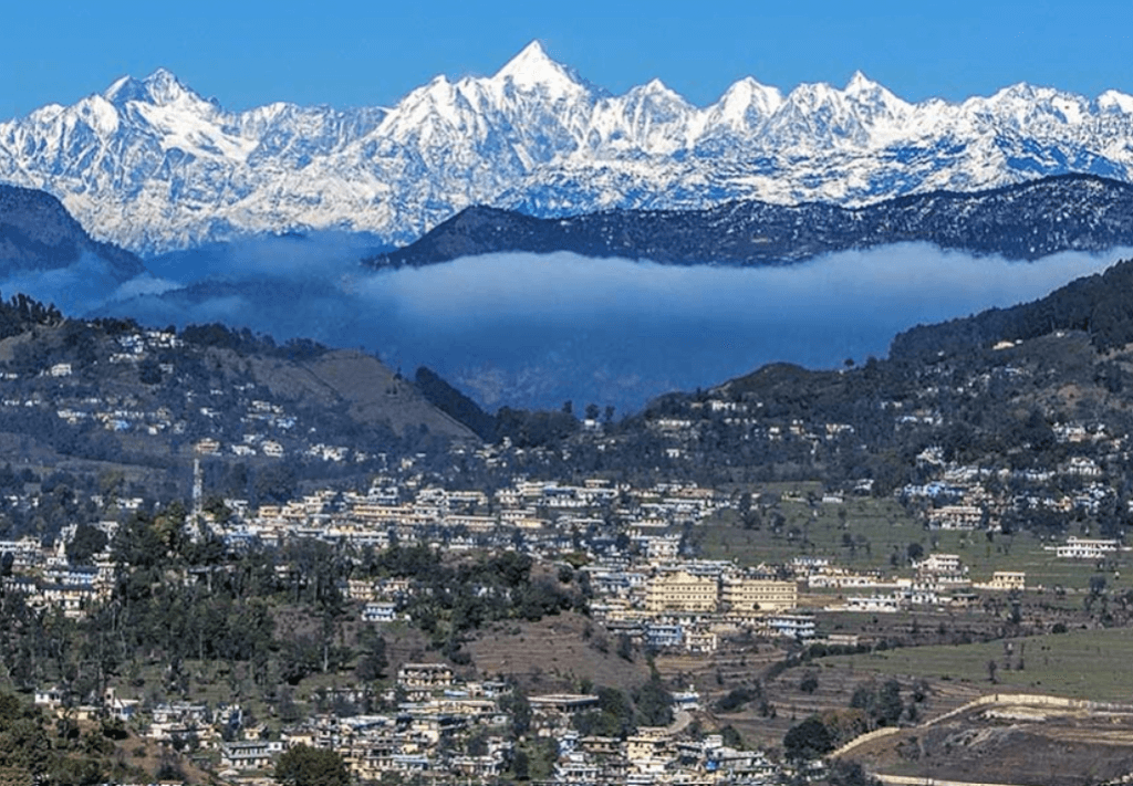
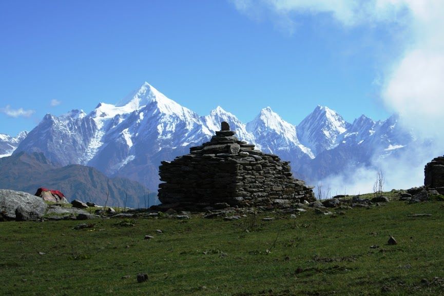
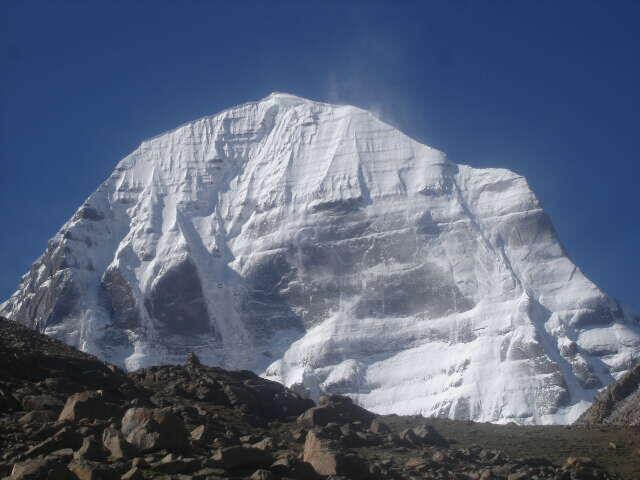
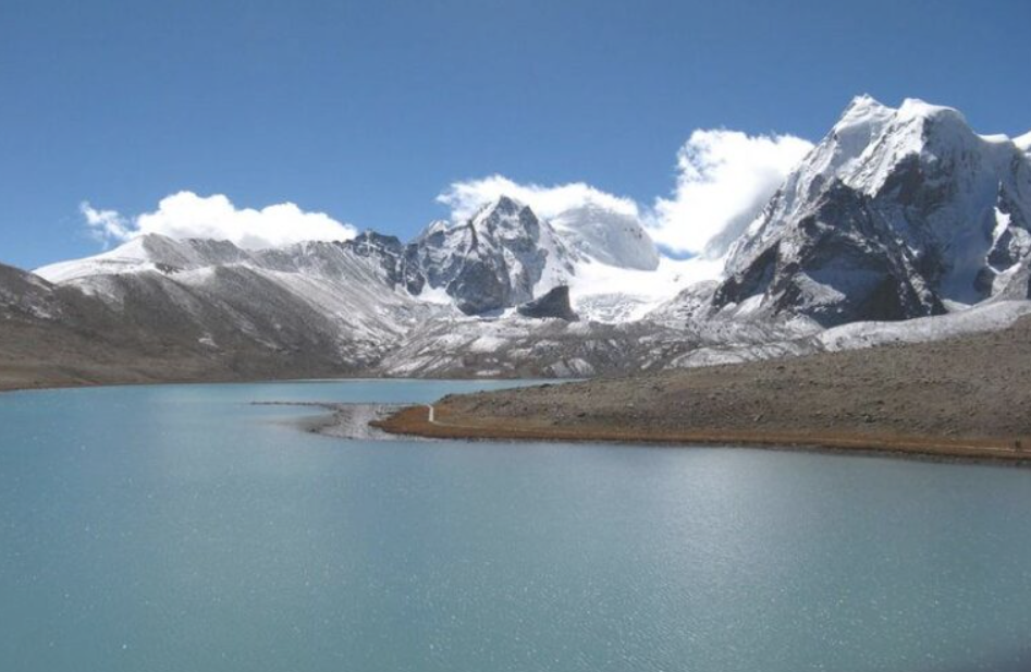
Shivling is a stunning peak located in the Garhwal region of the Indian state of Uttarakhand. It’s one of the most iconic and revered peaks in the Indian Himalayas, standing tall at an elevation of 6,543 meters (21,467 feet). The mountain is named after Lord Shiva’s iconic symbol, the Shivling, due to its resemblance to the image of Shiva’s lingam (a symbol of Hindu god Shiva).
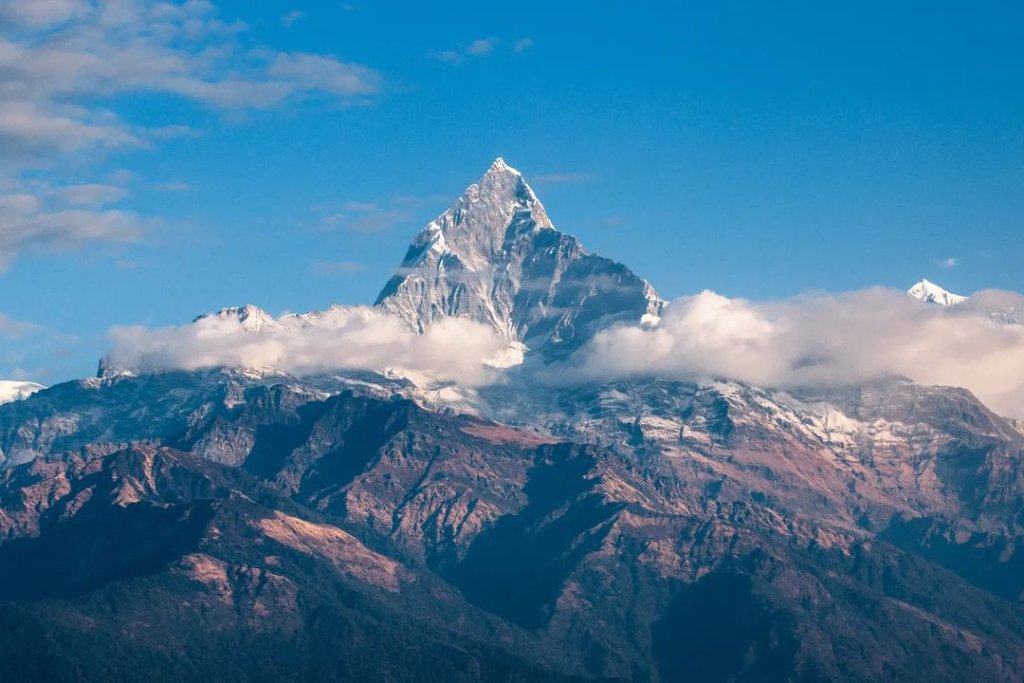
Location           Uttarkashi
Parent range          Garhwal Himalayas
Altitude         6,543 meters (21,467 feet)
First ascentIn 1974 by an Indian expedition led by Hukam Singh.
Best time to visit         May, Jun, Sep, Oct

Mythology About Shivling

In Uttarakhand, the Shivling holds significant mythological and religious importance. The Shivling, essentially a representation of Lord Shiva, is worshipped fervently by Hindus. Here’s a popular mythology associated with the Shivling in Uttarakhand:
Legend has it that during the period of the great churning of the ocean (Samudra Manthan) by the Devas (celestial beings) and Asuras (demons), a pot of poison (halahala) emerged from the depths of the ocean. This poison was so potent that it threatened to destroy the universe. Terrified, the Devas and Asuras sought Lord Shiva’s help.

Instead of swallowing it, he held it in his throat, which turned blue due to the poison’s effect. This is why Lord Shiva is often depicted with a blue throat, earning him the name Neelkanth (the one with a blue throat).

Peaks of Uttarakhand
sankri

How To Reach Sankri

Sankri is a picturesque village located in the Uttarkashi district of the Indian state of Uttarakhand. It serves as a…

uttarakhand maiktoli

Maiktoli

Maiktoli is a mountain located in the Kumaon Himalayas of Uttarakhand, India. It is part of the Nanda Devi Sanctuary,…

uttarakhand MANA PEAK

Mana Peak

Mana Peak, located in the Uttarakhand region of India, is a majestic mountain nestled in the Himalayas. Standing at 7,274…

uttarakhand Bandarpunch Peak 22

Bandarpunch Peak

Bandarpunch Peak is a prominent mountain peak in the Garhwal Himalayas of Uttarakhand, India. It stands at an elevation of…

uttarakhand Bhagirathi peak22

Bhagirathi Peak

Bhagirathi Peak is a prominent mountain peak located in the Garhwal Himalayas of Uttarakhand, India. It is part of a…

Neelkantha Peak123

Neelkantha Peak

Neelkantha Peak, also known as the “Garhwal Queen,” is a majestic mountain located in the Garhwal region of the Indian…

Chopta trekking 2022, Uttarakhand

Chandrashila Peak

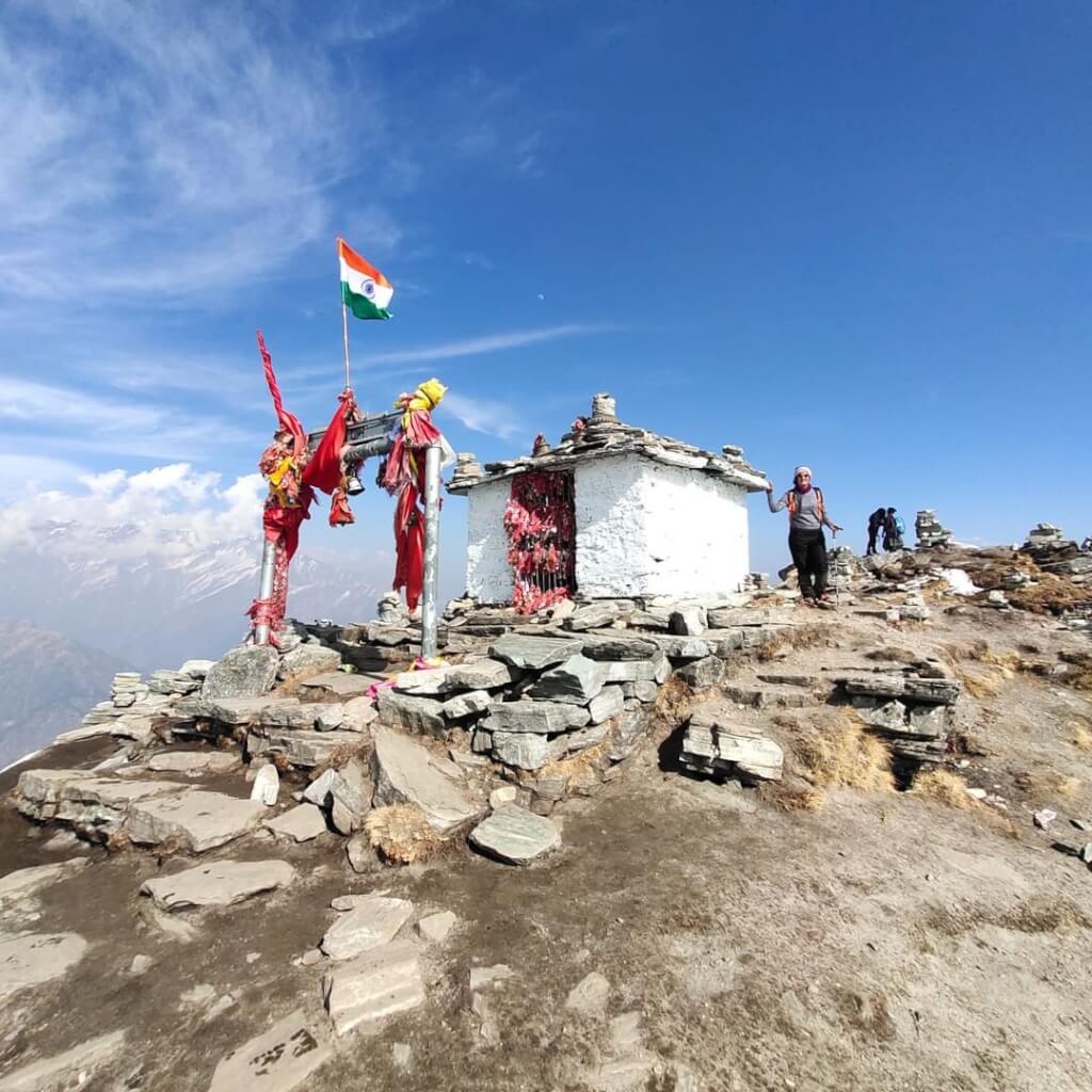
Chandrashila, translating to the ‘Moon Rock,’ crowns the Chandranath Parvat, home to the Tungnath temple of Panch Kedar. This majestic…

Gaumukh Peak

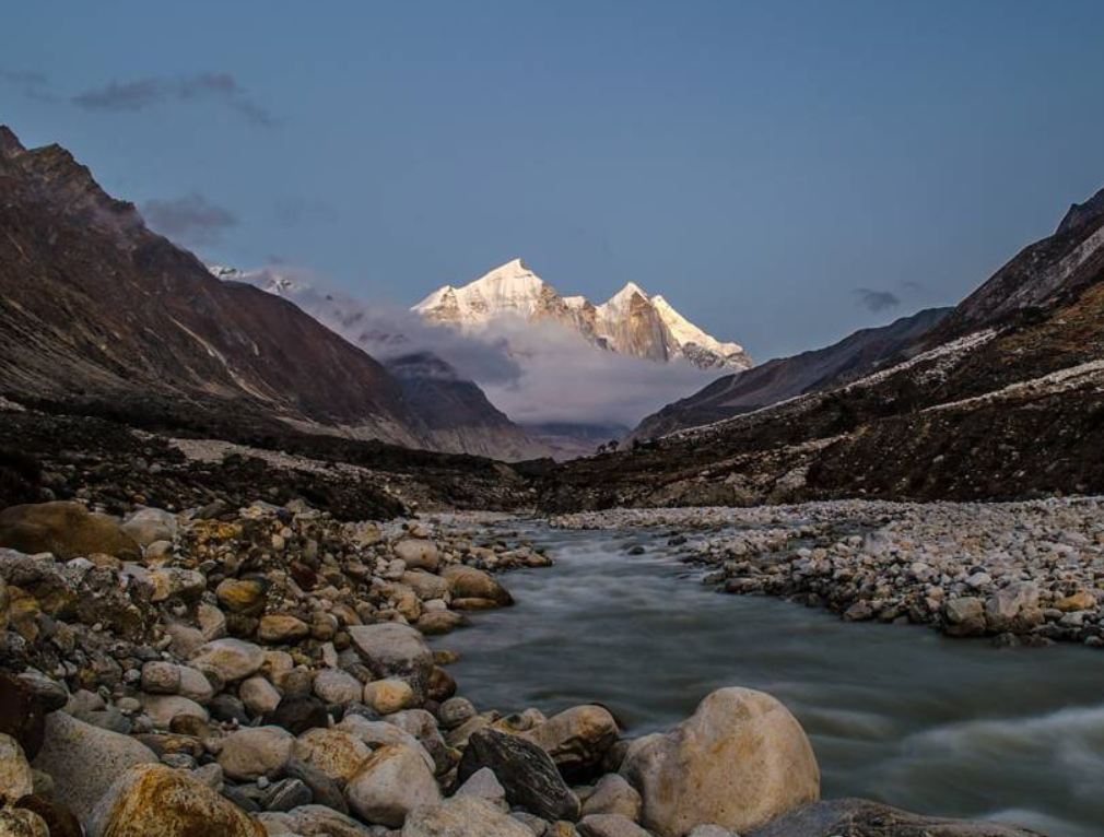
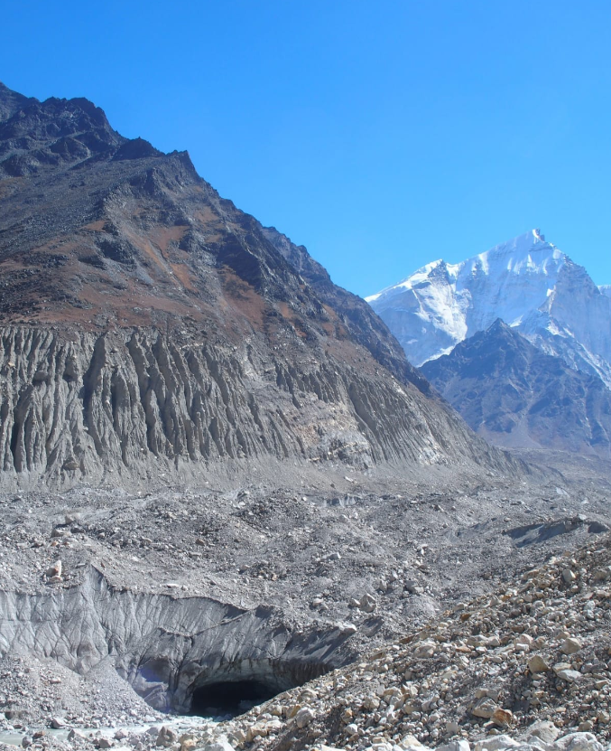
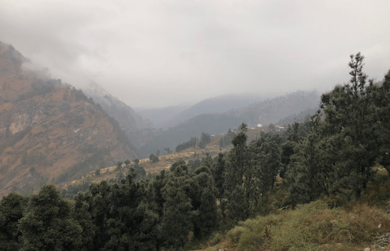
Gaumukh Peak is located in the Indian state of Uttarakhand, in the Garhwal Himalayas. It’s famous primarily because of its association with the Gangotri Glacier, which is one of the largest glaciers in the Himalayas and is the source of the Bhagirathi River, which eventually becomes the Ganges River. The peak itself is not very high compared to other Himalayan peaks, standing at an elevation of around 6,479 meters (21,250 feet).

Location          Uttarkashi
Parent range          Garhwal Himalayas
Altitude         6,479 meters (21,250 feet)
First ascentIn 1974 by a team of Indian mountaineers led by Hukam Singh.
Best time to visit         May, Jun, Sep, Oct

Mythology About Gaumukh peak

Gaumukh, located in the Indian state of Uttarakhand, holds immense significance in Hindu mythology and spirituality. It’s the terminus of the Gangotri Glacier and is considered the source of the Bhagirathi River, which eventually merges with the Alaknanda River to form the holy Ganges River.
One of the most popular myths associated with Gaumukh is its connection to Lord Shiva, one of the principal deities in Hinduism. According to Hindu mythology, it is believed that the Ganges River originally flowed in heaven and was brought down to earth by Lord Shiva to alleviate the suffering of humanity.
Gaumukh, which translates to “cow’s mouth” in Hindi, derives its name from the shape of the glacier, which resembles a cow’s mouth. It’s said that the Ganges emerges from a cavern shaped like a cow’s mouth at the snout of the glacier. The water that flows from Gaumukh is considered extremely sacred by Hindus, and many pilgrims undertake arduous journeys to reach this spot to bathe in its icy waters and perform religious rites.

Peaks of Uttarakhand
sankri

How To Reach Sankri

Sankri is a picturesque village located in the Uttarkashi district of the Indian state of Uttarakhand. It serves as a…

uttarakhand MANA PEAK

Mana Peak

Mana Peak, located in the Uttarakhand region of India, is a majestic mountain nestled in the Himalayas. Standing at 7,274…

uttarakhand Bandarpunch Peak 22

Bandarpunch Peak

Bandarpunch Peak is a prominent mountain peak in the Garhwal Himalayas of Uttarakhand, India. It stands at an elevation of…

uttarakhand Bhagirathi peak22

Bhagirathi Peak

Bhagirathi Peak is a prominent mountain peak located in the Garhwal Himalayas of Uttarakhand, India. It is part of a…

uttarakhand kedarnath peak

Kedarnath Peak

Kedarnath Peak is a majestic mountain located in the Garhwal Himalayas of Uttarakhand, India. It stands at an elevation of…

Neelkantha Peak123

Neelkantha Peak

Neelkantha Peak, also known as the “Garhwal Queen,” is a majestic mountain located in the Garhwal region of the Indian…

Chopta trekking 2022, Uttarakhand

Chandrashila Peak

Chandrashila, translating to the ‘Moon Rock,’ crowns the Chandranath Parvat, home to the Tungnath temple of Panch Kedar. This majestic…
Kedarnath Peak

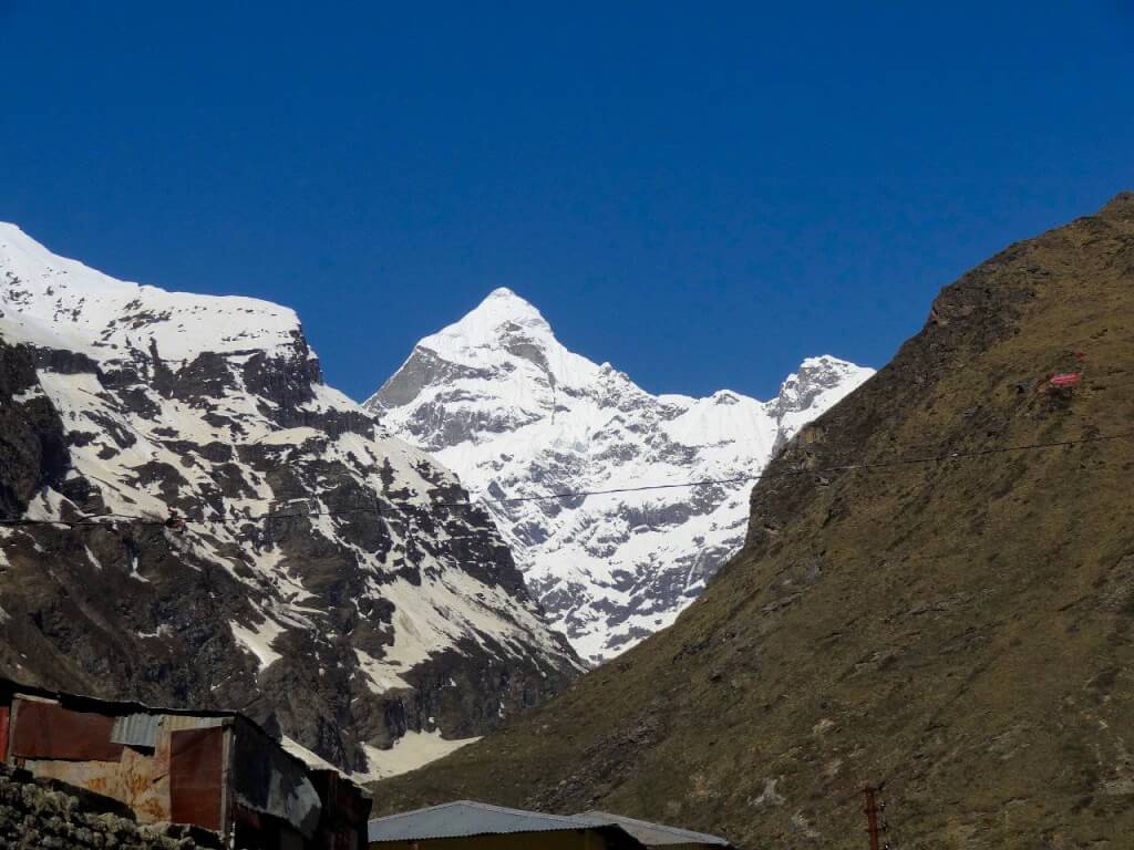
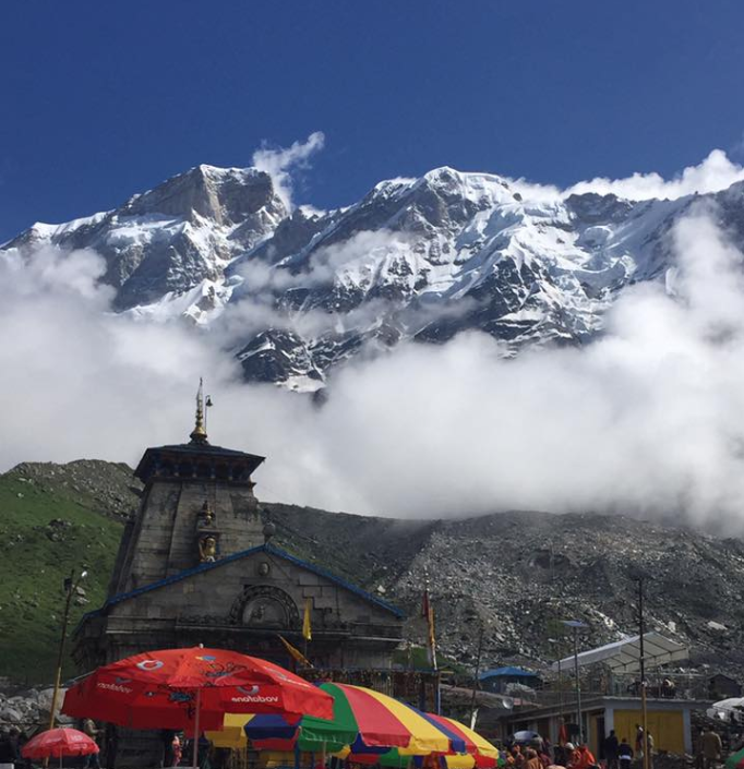
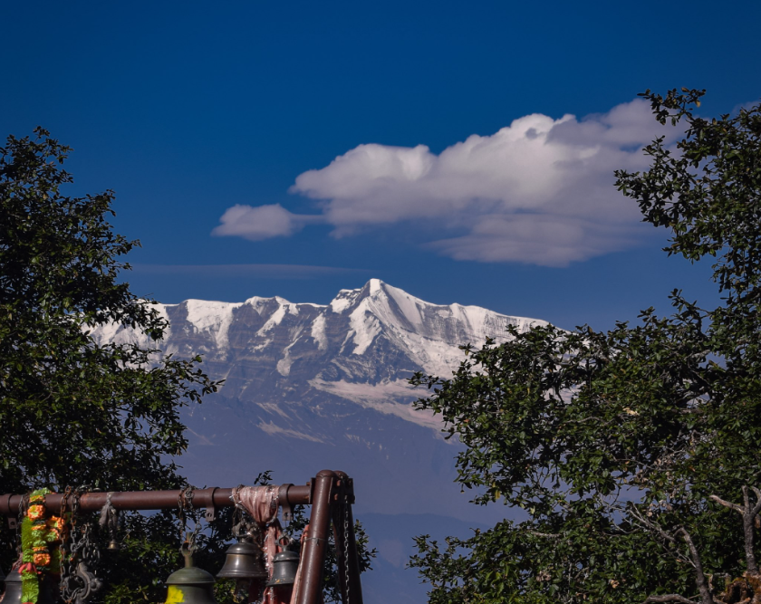
Kedarnath Peak is a majestic mountain located in the Garhwal Himalayas of Uttarakhand, India. It stands at an elevation of 6,940 meters (22,769 feet) above sea level, making it one of the highest peaks in the region. The peak holds significant religious and cultural importance as it is situated near the revered Kedarnath Temple, one of the holiest Hindu pilgrimage sites dedicated to Lord Shiva.

Location            Chamoli
Parent range          Garhwal Himalayas
Altitude         6,940 meters (22,769 feet)
First ascent   In 1947 by a Swiss team led by André Roch
Best time to visit         May, Jun, Sep, Oct

Kedarnath Peak In Garhwal

Kedarnath Peak is indeed located in the Garhwal Himalayas of Uttarakhand, India.As mentioned earlier, it is situated near the sacred Kedarnath Temple, which is dedicated to Lord Shiva and is one of the twelve Jyotirlingas, considered highly sacred in Hinduism.Kedarnath Peak is part of the Gangotri Group of mountains, which includes several other prominent peaks like Thalay Sagar, Meru, and Bhagirathi. It is known for its challenging climbing routes, attracting mountaineers and adventurers from around the world. The first ascent of Kedarnath Peak was made in 1947 by a Swiss team led by André Roch. Since then, various expeditions have been undertaken to conquer its summit.

The region around Kedarnath Peak offers breathtaking views of snow-capped peaks, glaciers, and alpine meadows, making it a popular destination for trekking and mountaineering enthusiasts.

Mythology About Kedarnath Peak

The mythology surrounding Kedarnath Peak is intricately linked to the story of the Pandavas, the central characters of the ancient Indian epic, the Mahabharata. It is believed that after the great Kurukshetra War, the Pandavas sought the blessings of Lord Shiva to absolve themselves of the sins they had committed during the war.

Legend has it that Lord Shiva, unwilling to forgive them immediately, assumed the form of a bull and fled to Kedarnath to evade them. The Pandavas, determined to seek redemption, pursued Lord Shiva, who eventually decided to hide in the form of a bull’s body parts. It is said that the hump of the bull appeared at Kedarnath, while the other parts manifested at different locations, collectively known as the Panch Kedar (five Kedars).

Peaks of Uttarakhand
sankri

How To Reach Sankri

Sankri is a picturesque village located in the Uttarkashi district of the Indian state of Uttarakhand. It serves as a…
uttarakhand MANA PEAK

Mana Peak

Mana Peak, located in the Uttarakhand region of India, is a majestic mountain nestled in the Himalayas. Standing at 7,274…

uttarakhand abi gami

Abi Gami

Abi Gami peak, also known as Abi Gamin, is a prominent mountain peak located in the Chamoli district of the…

nanda khat22

Nanda Khat

“Nanda Kot” is a prominent peak located in the Kumaon region of the Indian state of Uttarakhand. It is part…

uttarakhand nanda ghunti 22

Nanda Ghunti

Nanda Ghunti is a prominent peak located in the Garhwal region of the Indian state of Uttarakhand. It’s part of…

UTTARAKHAND Nanda Devi22

Nanda Devi

Nanda Devi is a significant mountain peak located in the Indian state of Uttarakhand, part of the Garhwal Himalayas. It’s…

uttarakhand Bhagirathi peak22

Bhagirathi Peak

Bhagirathi Peak is a prominent mountain peak located in the Garhwal Himalayas of Uttarakhand, India. It is part of a…

Ruinsara Tal

Ruinsara Tal is a picturesque lake nestled amidst the Himalayas in the Uttarkashi district of Uttarakhand, India. It is situated at an altitude of around 3,600 meters (11,800 feet) above sea level, making it a popular trekking destination for adventure enthusiasts and nature lovers alike.

Ruinsara Tal In Uttarkashi

Ruinsara Tal is a breathtaking glacial lake nestled amidst the Garhwal Himalayas in the Uttarkashi district of Uttarakhand, India. It is a popular trekking destination and a favored spot for nature enthusiasts.
The trek to Ruinsara Tal typically starts from the village of Taluka, which is accessible from Sankri. From Taluka, trekkers pass through dense forests, picturesque meadows, and charming villages, offering stunning views of snow-capped peaks such as Swargarohini and Bandarpoonch along the way.The area around the lake is rich in biodiversity, with a variety of flora and fauna adding to its charm.
Ruinsara Tal is not just a destination for adventure seekers; it’s also a place for solitude and reflection, offering a peaceful escape from the hustle and bustle of everyday life.

Some Key Points About Ruinsara Tal

Ruinsara Tal is a picturesque glacial lake situated in the Uttarkashi district of Uttarakhand, India. Here are some key points about Ruinsara Tal:

Location: Ruinsara Tal is located at an altitude of approximately 3,600 meters (11,811 feet) above sea level in the Garhwal Himalayas.

Scenic Beauty: The trek offers stunning views of the surrounding peaks, lush green meadows, dense forests, and pristine streams. The landscape is dotted with vibrant alpine flowers during the spring and summer months.

Flora and Fauna: The region around Ruinsara Tal is rich in biodiversity, with a variety of flora and fauna, including Himalayan birds like Himalayan Monal, Griffon vulture, and Himalayan black bear.

Spiritual Significance: The area holds spiritual significance for locals and is considered sacred by the indigenous communities living in the region.

Season: The best time to visit Ruinsara Tal is during the summer months, from May to June, and the post-monsoon season, from September to October, when the weather is relatively stable and the views are clear.

Activities In Ruinsara Tal

Trekking: Ruinsara Tal is a popular trekking destination, often included in the Har Ki Dun trekking route. The trek takes you through lush green meadows, dense forests, and quaint villages, offering mesmerizing views of the Himalayan peaks.

Camping: Set up your camp near the tranquil waters of Ruinsara Tal and spend a night under the starlit sky. Camping here allows you to immerse yourself in the serene ambiance of the Himalayas.

Bird Watching: The region around Ruinsara Tal is home to a diverse range of bird species. Bring your binoculars and spend some time observing the colorful birds amidst the pristine natural surroundings.

Photography: Whether you’re an amateur or professional photographer, Ruinsara Tal offers countless opportunities to capture stunning landscapes, vibrant flora, and glimpses of local life.

Nature Walks: Take leisurely walks around the lake and its surroundings to appreciate the beauty of the Himalayan ecosystem. You may encounter wildflowers, cascading streams, and perhaps even some wildlife.

Exploring Nearby Attractions: Besides Ruinsara Tal, there are several other attractions in the vicinity worth exploring, such as Kyarkoti, Bali Pass, and Osla village. Take some time to venture into these areas and discover more hidden gems.

sankri

How To Reach Sankri

Sankri is a picturesque village located in the Uttarkashi district of the Indian state of Uttarakhand. It serves as a…

harshil valley

Harsil

Harsil is a picturesque village situated in the Uttarkashi district of Uttarakhand, India. Nestled amidst the breathtaking beauty of the…

Char Dham Route, uttarakashi, Utarakhand

Uttarkashi

Char Dham Yatra          Do Dham Yatra          Panch Kedar Yatra          Adi…

uttarakhand Sahastra Tal

Sahastra Tal

Sahastra Tal is a high-altitude lake located in the Uttarkashi district of Uttarakhand, India. Situated amidst the stunning Himalayan peaks,…

How To Reach Ruinsara Tal

By Road

From Dehradun: You can reach Ruinsara Tal via road from Dehradun. Dehradun is well-connected to major cities in North India by road. From Dehradun, you can take a bus or hire a taxi to reach Uttarkashi.

From Uttarkashi: Uttarkashi is the nearest town to Ruinsara Tal, located approximately 180 kilometers away. From Uttarkashi, you can hire a taxi or take a shared jeep to reach the starting point of the trek, which is usually Taluka or Sankri village.

From Taluka/Sankri: These are the last accessible motorable points before the trek to Ruinsara Tal begins. You can reach Taluka or Sankri by hiring a taxi or taking a bus from Uttarkashi.

By Train

The nearest railway station to Ruinsara Tal is Dehradun Railway Station, which is well-connected to major cities like Delhi, Mumbai, Kolkata, etc. From Dehradun Railway Station, you can follow the road route mentioned above to reach Uttarkashi and then proceed further to Taluka or Sankri. Once you reach Taluka or Sankri, you’ll need to trek to Ruinsara Tal. The trek usually takes around 2-3 days depending on your pace and acclimatization.

By Air

The nearest airport to Ruinsara Tal is the Jolly Grant Airport in Dehradun, which is approximately 190 kilometers away. From the airport, you can hire a taxi or take a bus to reach Uttarkashi, which is the base camp for the trek to Ruinsara Tal.

Roopkund Lake

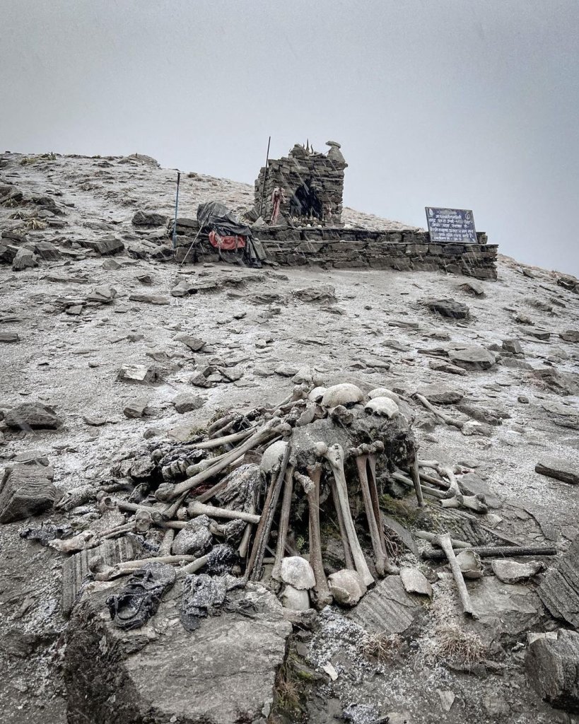
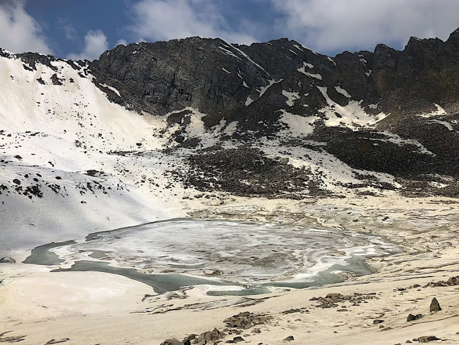
Roopkund Lake, also known as Skeleton Lake, is a high-altitude glacial lake located in the Himalayas, in the Uttarakhand state of India. It sits at an elevation of about 5,029 meters (16,499 feet) above sea level. The lake gained its eerie nickname due to the hundreds of human skeletons found scattered around its shores and at the bottom of the lake.

Roopkund Lake In Chamoli

Roopkund Lake, located in the Chamoli district of Uttarakhand, India, is a high-altitude glacial lake renowned for its mysterious history and scenic beauty. Here’s a summary:

Location: Situated at an altitude of about 16,499 feet (5,029 meters) in the lap of the Himalayas, Roopkund Lake is surrounded by snow-capped peaks and lush green meadows.

Mystery: The lake gained fame due to the discovery of human skeletal remains in and around it. These skeletal remains, dating back to around the 9th century AD, have led to various theories about the cause of death, including a popular hypothesis that suggests they were victims of a sudden hailstorm.

Trekking Destination: Roopkund Lake is a popular trekking destination, attracting adventurers and nature enthusiasts from around the world. The trek to Roopkund is known for its challenging terrain, including steep ascents, rocky paths, and unpredictable weather conditions.

Flora and Fauna: The trek to Roopkund offers stunning views of the Himalayan flora and fauna. Trekkers may encounter diverse species of birds, alpine flowers, and if lucky, rare wildlife like the Himalayan musk deer and snow leopard.

Cultural Significance: Apart from its natural beauty, Roopkund holds cultural significance for the indigenous communities of the region. Local folklore and legends add to the mystique surrounding the lake.

Conservation Efforts: Due to the increasing number of trekkers and tourists visiting Roopkund, conservation efforts are underway to preserve its fragile ecosystem. Authorities have implemented measures to regulate tourism and minimize environmental impact.

Overall, Roopkund Lake offers a captivating blend of natural beauty, adventure, and historical intrigue, making it a must-visit destination for those seeking an unforgettable Himalayan experience.

sankri

How To Reach Sankri

Sankri is a picturesque village located in the Uttarkashi district of the Indian state of Uttarakhand. It serves as a…

uttarakhand Homkund Lake

Homkund Lake

Homkund Lake, also known as “Mystery Lake,” is a high-altitude lake located in the Garhwal Himalayas of Uttarakhand, India. It…

uttarakhand lohajung

Lohajung

Lohajung is a scenic village located in the Chamoli district of Uttarakhand, India. Situated at an altitude of around 2,330…

The panch DHARA

Chamoli

Chamoli District, located in the northern state of Uttarakhand, India, is a picturesque region known for its stunning landscapes, diverse…

How To Reach Roopkund Lake

By Road

Once you reach Kathgodam or Ranikhet, you’ll need to hire a taxi or take a bus to Lohajung, which is the base camp for the Roopkund trek. Lohajung is approximately 200 km from Kathgodam and the journey takes around 8-10 hours by road.

By Train

The nearest railway station to Roopkund Lake is Kathgodam Railway Station, which is well-connected to major cities like Delhi and Kolkata. From Kathgodam, you’ll need to proceed by road.

By Air

By Air: The nearest airport to Roopkund Lake is the Jolly Grant Airport in Dehradun, Uttarakhand. From there, you can either hire a taxi or take a bus to reach the nearest major town, which is usually Kathgodam or Ranikhet.

Parvati Sarovar

Parvati Sarovar is a picturesque lake located in the Uttarkashi district of Uttarakhand, India. Situated amidst the breathtaking Himalayan landscape, this serene lake holds great religious significance in Hindu mythology and is often visited by devotees and tourists alike.

Parvati Sarovar In Adi Kailash

Parvati Sarovar is a sacred lake located near Adi Kailash, which is also known as Chhota Kailash. Adi Kailash is situated in the Indian state of Uttarakhand, in the eastern part of the Kumaon region. It holds great significance for Hindu pilgrims as it is considered to be the earthly abode of Lord Shiva. The area around Adi Kailash is known for its stunning natural beauty and spiritual aura, attracting devotees and trekkers alike. Parvati Sarovar adds to the spiritual ambiance of the region, often visited by pilgrims on their journey to Adi Kailash.

Mythology About Parvati Sarovar

Parvati Sarovar is not as widely known as some other mythological sites, but there are mentions of Parvati Sarovar in Hindu scriptures and mythology.

According to Hindu mythology, it is believed that Parvati, the consort of Lord Shiva, used to bathe in this lake, hence the name “Parvati Sarovar” (Sarovar meaning lake in Hindi). The lake is also surrounded by several temples and ashrams, adding to its spiritual aura.
Apart from its religious significance, Parvati Sarovar is also renowned for its natural beauty. Surrounded by lush greenery and towering mountains, it offers a tranquil retreat for those seeking solace amidst nature’s bounty. Visitors can indulge in activities like trekking, camping, and photography while exploring the scenic surroundings.

Overall, Parvati Sarovar is not only a place of religious importance but also a haven for nature lovers, offering a perfect blend of spirituality and natural beauty in the lap of the Himalayas.

Activities In Parvati Sarovar

Trekking: The Parvati Valley offers several trekking routes of varying difficulty levels. You can trek around the lake itself or explore further into the surrounding mountains.

Nature Walks: Take leisurely walks around the lake and immerse yourself in the natural beauty of the surroundings. You’ll encounter lush greenery, towering mountains, and pristine streams along the way.

Photography: Parvati Sarovar provides excellent opportunities for photography, with its picturesque landscapes and stunning views. Capture the reflections of the mountains on the clear waters of the lake or the vibrant hues of the surrounding flora.

Picnicking: Pack a picnic and enjoy a relaxing afternoon by the lake. There are plenty of scenic spots where you can sit back, relax, and enjoy a meal amidst nature.

Camping: Set up camp near Parvati Sarovar and spend a night under the starry sky. Camping here offers a unique opportunity to experience the tranquility of the Himalayas away from the hustle and bustle of city life.

sankri

How To Reach Sankri

Sankri is a picturesque village located in the Uttarkashi district of the Indian state of Uttarakhand. It serves as a…

uttarakhand Pithoragarh

Pithoragarh

Pithoragarh is a district located in the northern state of Uttarakhand, India. It is situated in the Kumaon region and…

uttrakhand Munsiyari1

Munsiyari

Munsiyari is a picturesque hill station nestled in the Pithoragarh district of Uttarakhand, India. Situated at an elevation of around…

Aadi Kailash

Adi Kailash

Adi Kailash, also known as Chhota Kailash, is a sacred mountain located in the Indian state of Uttarakhand. Standing tall…

How To Reach Parvati Sarovar

By Road

Parvati Sarovar is well-connected by road network. You can drive to Parvati Sarovar from nearby cities like Dehradun, Rishikesh, Haridwar, or Kathgodam. Regular bus services are also available from these cities to Parvati Sarovar. The road journey offers breathtaking views of the Himalayan landscapes and lush greenery.

By Train

The nearest railway station to Parvati Sarovar is Kathgodam Railway Station, which is approximately 268 kilometers away. From Kathgodam, you can hire a taxi or take a bus to reach Parvati Sarovar. The journey from Kathgodam to Parvati Sarovar takes around 8-9 hours by road.

By Air

The nearest airport to Parvati Sarovar is the Jolly Grant Airport in Dehradun, which is about 260 kilometers away. From the airport, you can hire a taxi or take a bus to reach Parvati Sarovar. The journey from Dehradun to Parvati Sarovar takes around 7-8 hours by road.

Nandi Kund Lake

Nandi Kund Lake is a beautiful high-altitude lake located in the Indian state of Uttarakhand, nestled amidst the majestic peaks of the Garhwal Himalayas. Situated at an elevation of around 4,300 meters (about 14,100 feet) above sea level, it’s renowned for its stunning natural beauty and tranquil surroundings.

Nandi Kund Lake In Chamoli

Nandi Kund Lake is indeed a breathtaking destination nestled in the Chamoli district of Uttarakhand, India. It’s renowned for its pristine beauty, surrounded by snow-capped peaks and lush greenery. The trek to Nandi Kund Lake is not only a treat for adventure enthusiasts but also for those seeking solace in nature’s embrace. The journey to the lake takes you through picturesque landscapes, dense forests, and rugged terrains, offering a memorable experience for trekkers. Nandi Kund Lake holds cultural significance for locals as well, adding a layer of spiritual charm to its already mesmerizing allure.

Mythology About Nandi Kund Lake

Nandi Kund Lake is a sacred water body nestled in the Himalayas, particularly renowned in Hindu mythology and folklore. Here’s a mythical narrative associated with Nandi Kund Lake:
According to legend, Nandi Kund is believed to be the abode of Nandi, the sacred bull and mount of Lord Shiva. It is said that Nandi, deeply devoted to Lord Shiva, sought a tranquil and serene place to meditate and perform penance. As a result, Lord Shiva granted him Nandi Kund as his personal abode.

Devotees and pilgrims believe that bathing in the sacred waters of Nandi Kund holds great spiritual significance and purifies one’s soul. It is also believed that taking a dip in the lake can wash away sins and bestow blessings from Lord Shiva.
Nandi Kund Lake stands as a testament to the rich mythological tapestry woven around the Himalayan landscape, captivating the imagination of believers and spiritual seekers alike.

Activities In Nandi Kund Lake

Nandi Kund Lake, nestled in the serene surroundings of the Indian Himalayas, offers a range of activities for nature enthusiasts and adventure seekers. Here are some activities you might enjoy around Nandi Kund Lake:

Trekking: Nandi Kund Lake is often a destination for trekkers. The trek to the lake itself is a beautiful journey, offering stunning views of the surrounding mountains, valleys, and meadows.

Camping: Set up camp by the lakeside and immerse yourself in the tranquility of the Himalayan wilderness. Camping under the starry sky beside the pristine lake is an unforgettable experience.

Picnicking: Pack a picnic basket with your favorite snacks and enjoy a leisurely meal amidst the picturesque scenery. Find a cozy spot near the lake shore and savor the tranquility.

Exploring Nearby Attractions: Nandi Kund Lake is often part of larger trekking routes that encompass other scenic spots. Explore nearby attractions such as Bedni Bugyal, Ali Bugyal, and Roopkund Lake, each offering its own unique charm and natural beauty.

Yoga and Meditation: The peaceful ambiance of Nandi Kund Lake makes it an ideal location for yoga and meditation practice. Find a quiet spot by the lake, breathe in the fresh mountain air, and rejuvenate your mind, body, and soul.

sankri

How To Reach Sankri

Sankri is a picturesque village located in the Uttarkashi district of the Indian state of Uttarakhand. It serves as a…

uttarakhand Marinda Tal

Marinda Tal

Marinda Tal, also known as Morinda Tal, is a stunning high-altitude lake nestled within the Har Ki Dun valley. Situated…

kedartal trek uttarakhand 22

Kedartal Lake

Kedartal Lake, also known as Shiva’s Lake, is a stunning high-altitude glacial lake nestled in the Garhwal Himalayas of Uttarakhand,…

uttarakhand Kagbhusandi Tal

Kagbhusandi Tal

Kagbhusandi Tal is a stunning glacial lake nestled in the Indian state of Uttarakhand, within the Garhwal region of the…

The panch DHARA

Chamoli

Chamoli District, located in the northern state of Uttarakhand, India, is a picturesque region known for its stunning landscapes, diverse…

How To Reach Nandi Kund Lake

By Road

Joshimath is well-connected by road to major cities in Uttarakhand. You can either drive from nearby cities or take a bus to reach Joshimath. From Joshimath, the trek to Nandi Kund Lake starts.Once you reach Joshimath, you need to trek to Nandi Kund Lake. The trek is moderately difficult and takes around 2-3 days to complete, depending on your pace and weather conditions.

By Train

The nearest major railway station is in Haridwar, which is well-connected to major cities like Delhi, Mumbai, Kolkata, etc. From Haridwar, you can either hire a taxi or take a bus to Joshimath.

By Air

The nearest airport to Nandi Kund Lake is the Jolly Grant Airport in Dehradun. From there, you can hire a taxi or take a bus to Joshimath, which serves as the base camp for the trek to Nandi Kund Lake.

Nal Damyanti Tal

Nal Damyanti Tal is a pristine lake located in the Indian state of Uttarakhand, nestled amidst the picturesque surroundings of the Nanda Devi National Park. It holds significant cultural and mythological importance in India. The lake is named after the legendary characters Nala and Damayanti from the Indian epic, the Mahabharata. The lake is renowned for its crystal-clear waters, surrounded by lush greenery and snow-capped peaks, creating a breathtaking panorama.

Nal Damyanti Tal In Bhimtal

Nal Damyanti Tal is a beautiful lake located in Bhimtal, Uttarakhand, India. It’s named after the legendary characters Nal and Damayanti from the Indian epic Mahabharata. This serene lake is surrounded by lush greenery and offers a tranquil environment for visitors to relax and enjoy nature. Boating facilities are available, allowing visitors to explore the lake and its surroundings.

The lake is renowned for its crystal-clear waters, surrounded by lush greenery and snow-capped peaks, creating a breathtaking panorama. It’s a popular destination for nature lovers, photographers, and trekkers who visit to soak in its serene ambiance and natural beauty.

Activities In Nal Damyanti Tal

Nal Damyanti Tal is a serene lake located in Uttarakhand, India, surrounded by picturesque scenery and offering various activities for nature enthusiasts. Here are some activities you can enjoy there:

Boating: One of the most popular activities at Nal Damyanti Tal is boating. You can rent paddleboats or rowboats to explore the calm waters of the lake while soaking in the tranquility of the surroundings.

Bird Watching: The lake and its surrounding areas are home to a diverse range of bird species, making it an excellent spot for bird watching. Keep your binoculars handy and enjoy spotting both resident and migratory birds.

Nature Walks: Take leisurely strolls around the lake to immerse yourself in the natural beauty of the region. The walking trails offer scenic views of the surrounding forests, hills, and the lake itself.

Picnicking: Nal Damyanti Tal is an ideal destination for a relaxing picnic with family and friends. Pack some snacks and refreshments, spread out a picnic blanket, and enjoy a day surrounded by nature.

Photography: Whether you’re a professional photographer or just enjoy capturing beautiful moments, Nal Damyanti Tal provides plenty of opportunities for stunning photographs. From the reflections on the lake to the lush greenery, you’ll find many picture-perfect scenes to capture.

Fishing: Fishing enthusiasts can try their luck at angling in the lake. The lake is stocked with various fish species, offering a peaceful and rewarding fishing experience.

Relaxation: Sometimes, the best activity is simply to sit back, relax, and take in the serene atmosphere of Nal Damyanti Tal. Find a comfortable spot by the lakeside, breathe in the fresh air, and let all your worries melt away.

sankri

How To Reach Sankri

Sankri is a picturesque village located in the Uttarkashi district of the Indian state of Uttarakhand. It serves as a…

UTTARAKHAND SATTAL NAINITAL

Sattal

Sattal is a freshwater lake located in the Indian state of Uttarakhand, near the popular hill station of Nainital. The…

nainital Naukuchiatal

Naukuchiatal

Naukuchiatal is a picturesque lake located in the Indian state of Uttarakhand, specifically in the Nainital district. The name “Naukuchiatal”…

BHIMTAL

Bhimtal

Bhimtal is a picturesque town located in the Nainital district of the Indian state of Uttarakhand. It’s renowned for its…

Nainital

Nainital

Nainital is a popular hill station and tourist destination located in the Kumaon region of the Indian state of Uttarakhand….

How To Reach Nal Damyanti Tal

By Road

Nal Damyanti Tal is well-connected by roadways. You can reach here by bus, taxi, or private vehicle from nearby cities like Nainital, Almora, or Kathgodam. The road journey offers stunning views of the Himalayan mountains and lush green valleys.Once you reach the vicinity of Nal Damyanti Tal, you might need to hike or trek a bit to access the lake, depending on your exact starting point and mode of transportation.

By Train

The nearest railway station to Nal Damyanti Tal is Kathgodam Railway Station (KGM), which is about 105 kilometers away. From Kathgodam, you can take a taxi or bus to reach the lake.

By Air

The nearest airport to Nal Damyanti Tal is Pantnagar Airport, located around 117 kilometers away. From there, you can hire a taxi or use public transport to reach the lake.

Maheshwari Kund

Maheshwari Kund, also known as Mehasr Kund, by locals, is situated a few kilometers away from Munsiyari. This serene lake is steeped in Hindu legend, with a tale that tells of, who once dwelled within its pristine waters.

Maheshwari Kund In Pithoragarh

Maheshwari Kund, also known as Mehasr Kund, Messar Kund, or Meshar Kund, is indeed a notable spot near Munsiyari in Pithoragarh district, Uttarakhand, India. The legend associated with the lake adds to its mystique and cultural significance. According to local Hindu folklore, a Yaksha, a semi-divine being, resided in the serene waters of the lake. The story goes that the Yaksha cursed the Kund for some reason, adding an intriguing layer to the natural beauty of the area. Such legends often deepen the cultural and spiritual connection people feel with these natural landmarks.

Activities In Maheshwari Kund

Sightseeing: The lake itself is a sight to behold, with its crystal-clear waters and picturesque surroundings. Visitors can simply enjoy the tranquility and beauty of the area.

Trekking: The region around Mehasr Kund is likely to offer scenic trekking routes, allowing adventurers to explore the nearby hills and forests while taking in the stunning views.

Picnicking: The peaceful ambiance makes Mehasr Kund an ideal spot for picnics. Visitors can bring along some snacks and enjoy a relaxing day by the lake.

Photography: With its natural beauty and mythological significance, Mehasr Kund provides ample opportunities for photography enthusiasts to capture stunning shots of the landscape and local flora and fauna.

Camping: For those seeking a more immersive experience, camping near Mehasr Kund could be an excellent option. Spending a night under the starry sky amidst the peaceful ambiance of nature can be a truly memorable experience.

Cultural Exploration: Given the Hindu legend associated with the lake, visitors might be interested in learning more about the local culture and traditions. Interacting with locals or visiting nearby temples and shrines could provide insights into the area’s rich heritage.

sankri

How To Reach Sankri

Sankri is a picturesque village located in the Uttarkashi district of the Indian state of Uttarakhand. It serves as a…

PITHORAGARH DIDHAT

Didihat

Didihat is a town located in the Pithoragarh district of the Indian state of Uttarakhand. Situated amidst the picturesque Himalayan…

uttarakhand Pithoragarh

Pithoragarh

Pithoragarh is a district located in the northern state of Uttarakhand, India. It is situated in the Kumaon region and…

uttrakhand Munsiyari1

Munsiyari

Munsiyari is a picturesque hill station nestled in the Pithoragarh district of Uttarakhand, India. Situated at an elevation of around…

How To Reach Maheshwari Kund

By Road

Munsiyari is well-connected by road to major cities and towns in Uttarakhand and neighboring states. You can either drive to Munsiyari in your private vehicle or opt for bus services. Buses ply regularly from cities like Delhi, Dehradun, and Haldwani to Munsiyari. The road journey to Munsiyari can take varying durations depending on your starting point, but it’s an enchanting drive through picturesque landscapes.

By Train

The nearest railway station to Munsiyari is Kathgodam Railway Station, which is situated approximately 275 kilometers away. From Kathgodam, you can hire a taxi or take a bus to reach Munsiyari. The road journey from Kathgodam to Munsiyari takes around 9-10 hours.

By Air

The nearest airport to Munsiyari is Pantnagar Airport, which is located approximately 314 kilometers away. From Pantnagar, you can hire a taxi or take a bus to reach Munsiyari. The journey from Pantnagar to Munsiyari takes around 10-12 hours by road.

Chipla Kedar

The Chipla Kedar trek sounds like a thrilling adventure, especially with its challenging terrain and stunning views. The fact that it’s not heavily commercialized adds to its appeal, allowing trekkers to experience the raw beauty of the Kumaon Himalayas in Uttarakhand.
Reaching an altitude of 5200 meters above sea level is no small feat and adds an element of excitement and achievement to the journey.

Chipla Kedar In Kumaon

Chipla Kedar trek indeed sounds like an exhilarating adventure, especially with its combination of challenging terrain and breathtaking scenery. The fact that it remains relatively untouched by commercialization adds to its allure, offering a more authentic and pristine experience for trekkers.
Exploring the Kumaon Himalayas in Uttarakhand is always a treat, with its majestic peaks, serene meadows, and panoramic views. And reaching an altitude of 5200 meters above sea level promises a truly awe-inspiring perspective of the surrounding landscape.

Overall, Chipla Kedar trek seems like a perfect blend of adventure, spirituality, and natural beauty, making it a must-visit destination for trekking enthusiasts seeking an unforgettable Himalayan experience.

Activities In Chipla Kedar

Trekking: The primary activity is trekking through the Kumaon Himalayas, which is known for its rugged beauty and challenging terrain. The trek takes you through high altitude meadows, dense forests, and rocky paths, offering stunning views throughout the journey.

Pilgrimage: Chipla Kedar trek is considered a pilgrimage route, as it passes by sacred sites and temples. It offers a spiritual experience for those interested in combining adventure with religious significance.

Scenic Views: The trek offers breathtaking views of the surrounding Himalayan peaks, including peaks from the Nepal Himalayas. The landscape is dotted with snow-capped mountains, lush valleys, and pristine glaciers, making it a paradise for nature lovers and photographers.

Camping: Camping is an essential part of the trekking experience. You’ll get to spend nights under the starry sky, surrounded by the tranquility of the mountains. It’s an excellent opportunity to connect with nature and unwind from the hustle and bustle of city life.

Wildlife Spotting: The region is home to diverse flora and fauna, including rare species like the Himalayan musk deer, snow leopard, and various species of birds. Keep your eyes peeled for wildlife sightings during the trek.

Cultural Immersion: Along the way, you’ll have the chance to interact with local communities and learn about their unique culture and traditions. It’s a great way to gain insight into the lifestyle of people living in the remote Himalayan region.

Overall, Chipla Kedar trek offers a perfect blend of adventure, spirituality, and natural beauty, making it a memorable experience for trekkers of all levels.

sankri

How To Reach Sankri

Sankri is a picturesque village located in the Uttarkashi district of the Indian state of Uttarakhand. It serves as a…

PITHORAGARH DIDHAT

Didihat

Didihat is a town located in the Pithoragarh district of the Indian state of Uttarakhand. Situated amidst the picturesque Himalayan…

uttarakhand Pithoragarh

Pithoragarh

Pithoragarh is a district located in the northern state of Uttarakhand, India. It is situated in the Kumaon region and…

uttrakhand Munsiyari1

Munsiyari

Munsiyari is a picturesque hill station nestled in the Pithoragarh district of Uttarakhand, India. Situated at an elevation of around…

How To Reach Harshil

By Road

You can also reach Chipla Kedar by road. The nearest major town with good road connectivity is Almora. From Almora, you can either hire a private taxi or take a bus to reach the trek starting point. The roads in the mountainous regions can be winding and sometimes in rough condition, so plan your journey accordingly.

By Train

The nearest major railway station is Kathgodam Railway Station (station code: KGM), which is well-connected to various cities like Delhi, Kolkata, and Lucknow. From Kathgodam, you can hire a taxi or take a bus to reach the base camp or the starting point of the trek.

By Air

The nearest airport to Chipla Kedar is the Pantnagar Airport located in the Udham Singh Nagar district of Uttarakhand. From there, you can arrange for a taxi or private transport to drive you to the starting point of the trek.

Trekking Route

Once you reach the base camp or starting point of the trek, you’ll follow the designated trekking route that leads you through picturesque landscapes, high altitude meadows, and eventually to the Chipla Kedar peak at 5200 meters above sea level.

Contact Us