Neelkantha Peak FAQs

1. What is Neelkantha Peak?

Neelkantha Peak is a prominent mountain peak located in the Garhwal Himalayas of Uttarakhand, India. It rises to an elevation of 6,310 meters (20,700 feet) above sea level. The peak is part of the majestic range surrounding the Badrinath area and is known for its striking beauty and challenging climbing routes.

2. How do I get to Neelkantha Peak?

The base for the trek or expedition to Neelkantha Peak is generally Badrinath. From there, climbers and trekkers usually head to the base camp, which is situated at an altitude of around 4,200 meters (13,800 feet).

3. What is the best time to visit Neelkantha Peak?

The ideal time to visit Neelkantha Peak is between May and September. During these months, the weather is relatively stable, and the snow conditions are more favorable for climbing. The winter months (November-March) bring heavy snowfall and extreme cold, making climbing conditions difficult.

4. What level of difficulty is the climb?

Climbing Neelkantha Peak is considered to be of high difficulty and is suitable for experienced climbers. The ascent involves technical climbing skills, including ice and snow climbing, and navigating crevasses. It’s crucial to have prior experience with high-altitude climbs and glacier travel.

5. What kind of permits are required?
  • Climbing Permit: Issued by the Indian Mountaineering Foundation (IMF) or the Ministry of Home Affairs.
  • Trekking Permit: Generally arranged through local authorities or a registered trekking agency.
  • Inner Line Permit: If you’re a foreign national, you might need an Inner Line Permit for traveling in restricted areas.
6. Are there any facilities available during the climb?

Facilities on the climb are minimal. There are no established huts or lodges at higher altitudes, so climbers need to be self-sufficient. This includes carrying your own camping gear, food supplies, and other essentials. Base camp may have some basic facilities, but it’s essential to be prepared for high-altitude camping conditions.

7. What kind of gear and equipment do I need?
  • Technical Climbing Gear: Crampons, ice axes, ropes, harnesses, and carabiners.
  • Clothing: Warm, layered clothing suitable for extreme cold, including a down jacket and thermal layers.
  • Camping Gear: High-altitude tent, sleeping bag rated for extreme temperatures, and cooking equipment.
  • Safety Gear: Avalanche transceivers, first aid kit, and communication devices.
8. Is it necessary to have a guide or support team?

Yes, it is highly recommended to have an experienced guide or support team for climbing Neelkantha Peak. The climb involves technical challenges and potential hazards, so having professional support can enhance safety and increase the chances of a successful ascent.

9. What kind of wildlife might be encountered?

The region around Neelkantha Peak is home to a variety of Himalayan wildlife, including the Himalayan tahr, snow leopard (though sightings are rare), and various high-altitude bird species. However, wildlife encounters are less common during technical climbs.

10. Can I attempt the climb without prior high-altitude experience?

No, it is not advisable to attempt Neelkantha Peak without prior high-altitude climbing experience. The peak requires technical climbing skills and the ability to handle extreme weather conditions and high altitude. It is crucial to build up experience with easier climbs and develop necessary skills before attempting this peak.

Satopanth Lake FAQs

  1. What is Satopanth Lake?

Satopanth Lake is a high-altitude lake situated in the Indian state of Uttarakhand, at an elevation of approximately 4,620 meters (15,157 feet) above sea level. It is located in the Badrinath region of the Garhwal Himalayas. The lake is known for its pristine beauty and is considered sacred in Hindu mythology.

2. How do I get to Satopanth Lake?

The trek to Satopanth Lake generally starts from Badrinath. The usual route involves trekking through rugged terrain and high-altitude passes. The trek is approximately 22 kilometers (13.7 miles) one way and takes around 3 to 4 days to complete, depending on the pace and weather conditions.

3. What is the best time to visit Satopanth Lake?

The best time to visit Satopanth Lake is from late May to early October. During these months, the weather is relatively stable, and the snow on the trekking paths is minimal. The monsoon season (July-August) and winter months (November-March) are not ideal due to heavy snowfall and the risk of landslides.

4. What is the level of difficulty for the trek?

The trek to Satopanth Lake is considered moderate to challenging due to its high altitude and rugged terrain. Trekkers should be prepared for steep ascents, potential altitude sickness, and rapidly changing weather conditions. Prior trekking experience and good physical fitness are recommended.

5. What kind of permits are required?

For trekking to Satopanth Lake, you need to obtain a permit from the Forest Department. This is usually arranged through a registered trekking agency or guide. It’s also advisable to check for any additional regulations or requirements related to travel permits for foreign nationals.

6. Are there any facilities available during the trek?

Facilities along the trek are quite basic. There are a few temporary shelters and campsites, but amenities like electricity and modern sanitation are limited. Trekkers should carry their own food, cooking equipment, and camping gear.

7. What kind of wildlife can be seen in the area?

The area around Satopanth Lake is home to various species of Himalayan wildlife, including the Himalayan tahr, bharal (blue sheep), and several species of birds. While wildlife sightings are not guaranteed, the region’s natural beauty is a major attraction.

8. What should I pack for the trek?

Warm clothing and layers (even in summer, temperatures can be cold at high altitudes)
Waterproof jacket and pants
Trekking boots with good grip
Sleeping bag rated for cold temperatures
Trekking poles
High-energy food and snacks
Water purification tablets or filter
First aid kit

9. Is it necessary to have a guide?

While it’s technically possible to trek without a guide, it is highly recommended to go with an experienced guide or through a trekking agency. The high-altitude environment and remote location can make navigation and safety challenging for those unfamiliar with the area.

Charan Paduka FAQs

1. What is Charan Paduka?

Charan Paduka is a sacred site located near the Badrinath Temple in Uttarakhand, India. The name “Charan Paduka” translates to “footprints of the divine” in Hindi. The site features a rock that is believed to bear the divine footprints of Lord Vishnu, who is worshipped at the Badrinath Temple.

2. Where is Charan Paduka located?

Charan Paduka is situated about 4 kilometers from the Badrinath Temple, on the way to the Mana Village. It is positioned at an elevation, offering a panoramic view of the surrounding landscapes.

3. What is the significance of Charan Paduka?

The site is considered highly sacred in Hinduism. It is believed that Lord Vishnu’s footprints were left here when he visited the area. Pilgrims visit Charan Paduka to offer prayers and seek blessings from the divine.

4. How do I reach Charan Paduka from Badrinath Temple?

You can reach Charan Paduka by a short trek or drive from the Badrinath Temple. The trek is relatively easy and can be completed in about an hour. Local guides or signage can help direct you to the site.

5. What should I carry when visiting Charan Paduka?

Carry comfortable walking shoes for the trek, warm clothing (as temperatures can be cold), and some water. It’s also a good idea to bring a camera to capture the scenic views.

6. Is there accommodation available near Charan Paduka?

Accommodation is available in Badrinath, which is the nearest town to Charan Paduka. Various hotels and lodges are available in Badrinath, catering to different budgets.

7. Are there any special rituals or practices at Charan Paduka?

Visitors typically offer prayers and perform small rituals at the site. Many pilgrims take a moment to reflect and seek blessings while at Charan Paduka.

8. When is the best time to visit Charan Paduka?

The best time to visit is between May and October, when the weather is generally pleasant and suitable for trekking. The winter months can be harsh, with snow and cold temperatures potentially making the trek challenging.

9. Are there any entry fees or permits required to visit Charan Paduka?

No special permits or entry fees are required to visit Charan Paduka. However, it is always a good idea to check with local authorities for any updated information or regulations.

10. What other attractions are near Charan Paduka?
  • Badrinath Temple: A major pilgrimage site dedicated to Lord Vishnu.
  • Tapt Kund: Natural hot springs near the Badrinath Temple.
  • Mana Village: Known for its cultural significance and scenic beauty.
  • Panch Dhara: The Five Springs, considered sacred.
Adi Kailash Aadi Kailash

Adi Kailash

Adi Kailash, also known as Chhota Kailash, is a sacred mountain located in the Indian state of Uttarakhand. Standing tall…

Yogdhyan Badri Temple FAQs

1. What is the Yogdhyan Badri Temple?

The Yogdhyan Badri Temple is a Hindu temple dedicated to Lord Vishnu, located in the village of Pandukeshwar in the Chamoli district of Uttarakhand, India. It is one of the five Badri temples in the region.

2. Where is the Yogdhyan Badri Temple located?

The temple is situated in Pandukeshwar, approximately 23 kilometers from Joshimath, and about 36 kilometers from the Badrinath Temple. It is accessible via a scenic drive from Joshimath.

3. What is the significance of the Yogdhyan Badri Temple?

The temple is dedicated to Lord Vishnu and is believed to be the site where Lord Vishnu meditated in his yogic form. It holds religious significance as one of the five Badri temples associated with the Pandava brothers from the Mahabharata.

4. How do I reach Yogdhyan Badri Temple from Joshimath?

You can reach the temple by road from Joshimath. It is a drive of approximately 23 kilometers, and local taxis or private vehicles can be hired for the journey.

5. What should I carry when visiting Yogdhyan Badri Temple?

Carry comfortable walking shoes, warm clothing (as temperatures can be low), and any offerings if you plan to participate in rituals. Also, bring water and snacks for the journey.

6. Are there accommodation options near Yogdhyan Badri Temple?

Accommodation is available in Joshimath, which is the nearest major town to Pandukeshwar. Joshimath offers various lodging options, from budget guesthouses to mid-range hotels.

7. Are there any specific rituals or practices at the Yogdhyan Badri Temple?

Visitors often offer prayers and participate in traditional rituals. Local priests can guide you on specific practices and ceremonies held at the temple.

8. When is the best time to visit the Yogdhyan Badri Temple?

The best time to visit is between May and October, when the weather is pleasant and conducive for travel. The winter months can be cold, with possible snowfall, making travel challenging.

9. Are there any entry fees or permits required to visit the Yogdhyan Badri Temple?

No special permits or entry fees are required to visit the temple. However, it’s always a good idea to check with local authorities or temple management for any recent updates.

10. What other attractions are near Yogdhyan Badri Temple?
  • Badrinath Temple: A major pilgrimage site dedicated to Lord Vishnu.
  • Pandukeshwar Temple: Another important temple near Yogdhyan Badri.
  • Joshimath: Known for its scenic beauty and as a base for various treks.
Adi Kailash Aadi Kailash

Adi Kailash

Adi Kailash, also known as Chhota Kailash, is a sacred mountain located in the Indian state of Uttarakhand. Standing tall…

Brahma Kapal FAQs

1. What is Brahma Kapal?

Brahma Kapal is a sacred site located near the Badrinath Temple in Uttarakhand, India. It is an important pilgrimage spot where Hindus perform rituals and ceremonies for their deceased ancestors. The site is associated with the rites of Shraddha and Tarpan.

2. Where is Brahma Kapal located?

Brahma Kapal is situated in Badrinath, a prominent pilgrimage town in the Chamoli district of Uttarakhand. It is located near the banks of the Alaknanda River, not far from the Badrinath Temple.

3. What is the significance of Brahma Kapal?

The site is believed to be a place where Brahma, the creator god in Hindu mythology, performed rituals for his ancestors. It is considered auspicious for performing rites and ceremonies to honor and seek blessings for deceased relatives.

4. How do I reach Brahma Kapal from Badrinath Temple?

Brahma Kapal is a short walk from the Badrinath Temple. It is easily accessible, and local guides or signage can help direct visitors to the site.

5. What rituals are performed at Brahma Kapal?

Pilgrims perform rituals like Shraddha and Tarpan at Brahma Kapal to offer respect and prayers for their deceased ancestors. These rituals are believed to bring peace to the souls of the departed and seek blessings for the family.

6. What should I carry when visiting Brahma Kapal?

Carry comfortable walking shoes, warm clothing (as temperatures can be low), and any necessary items for performing rituals (such as offerings). It’s also useful to have some water and basic toiletries.

7. Is there any accommodation available near Brahma Kapal?

Accommodation is available in Badrinath, which is the nearest town to Brahma Kapal. There are various hotels and lodges ranging from budget to mid-range options.

8. Are there any specific guidelines for performing rituals at Brahma Kapal?

It is advisable to follow the guidance of local priests or pandits for performing the rituals. They can provide instructions on the proper procedures and necessary offerings.

9. When is the best time to visit Brahma Kapal?

The best time to visit is between May and October, when the weather is pleasant and the pilgrimage routes are accessible. The temple and its surroundings can be quite cold and challenging to visit during the winter months.

10. What other attractions are near Brahma Kapal?

Nearby attractions include:

  • Badrinath Temple: A major pilgrimage site dedicated to Lord Vishnu.
  • Panch Dhara: The Five Springs, considered sacred.
  • Mana Village: Known as the last Indian village before the Tibetan border.
  • Tapt Kund: Natural hot springs near the Badrinath Temple.
Adi Kailash Aadi Kailash

Adi Kailash

Adi Kailash, also known as Chhota Kailash, is a sacred mountain located in the Indian state of Uttarakhand. Standing tall…

Panch Dhara and Panch Shila FAQs

  1. What is Panch Shila?

Panch Shila refers to a group of five sacred stones or rock formations near the Badrinath Temple, each with religious significance. These stones are considered to be imbued with divine energy and are visited by pilgrims seeking blessings.

2. Where is Panch Shila located?

Panch Shila is situated near the Badrinath Temple in Uttarakhand. It is accessible from the temple area, with local guides available to help visitors find the site.

3. What is the significance of Panch Shila?

Each of the five stones in Panch Shila is associated with a specific deity or divine attribute. Pilgrims visit these stones to offer prayers and seek spiritual blessings.

4. How do I reach Panch Shila from Badrinath Temple?

Panch Shila is a short distance from the Badrinath Temple. You can walk to the site from the temple, and local directions or guides can assist in locating it.

5. What should I carry when visiting Panch Shila?

Carry comfortable walking shoes, warm clothing, and some water. It is also advisable to bring basic toiletries and a camera if you wish to capture the visit.

6. Is there accommodation available near Panch Shila?

Accommodation is available in Badrinath, which is the nearest town to Panch Shila. There are various options ranging from budget to mid-range hotels.

7. Are there any specific rituals or practices at Panch Shila?

Pilgrims typically offer prayers and perform rituals at the sacred stones. It is common to circumambulate the stones and offer offerings as part of the visit.

8. When is the best time to visit Panch Shila?

The ideal time to visit is between May and October, when the weather is favorable for travel and exploration in the region.

9. Are there any entry fees or permits required?

No special permits or entry fees are required to visit Panch Shila. However, it’s a good idea to confirm with local authorities for any updated information.

10. What other attractions are near Panch Shila?

Nearby attractions include the Badrinath Temple, Panch Dhara (Five Springs), and Mana Village.

Adi Kailash Aadi Kailash

Adi Kailash

Adi Kailash, also known as Chhota Kailash, is a sacred mountain located in the Indian state of Uttarakhand. Standing tall…

Saraswati River FAQs

1. Where is the Saraswati River located near Chamoli and Mana Village?

The Saraswati River is believed to flow through the region near Mana Village, located in the Chamoli district of Uttarakhand, India. It is a tributary of the Alaknanda River and is considered a sacred river in Hindu mythology.

2. How do I reach Mana Village to see the Saraswati River?

Mana Village is accessible via Joshimath, which is approximately 24 kilometers away. From Joshimath, you can take a local vehicle or trek to Mana Village.

3. What is the significance of the Saraswati River in this area?

In this region, the Saraswati River is considered a sacred stream mentioned in ancient texts and is revered by pilgrims. It is associated with the mythical Saraswati River of Hindu scriptures.

  • Saraswati Temple: Near Mana Village, dedicated to the goddess Saraswati.
  • The Confluence of Saraswati and Alaknanda Rivers: A significant site where the Saraswati River joins the Alaknanda.
5. When is the best time to visit the Saraswati River near Mana Village?

The best time to visit is between May and October when the weather is pleasant and conducive for travel and trekking in the region.

6. What should I carry when visiting the Saraswati River in this area?

Carry comfortable trekking shoes, warm clothing (as temperatures can be low), rain gear, water, and snacks. It’s also useful to have a guide or local map.

7. Is there accommodation available in Mana Village?

Yes, Mana Village offers basic accommodation options such as guesthouses and small lodges. For more amenities, you can stay in nearby Joshimath.

The festival of Vasant Panchami is celebrated with rituals and prayers dedicated to Goddess Saraswati. Pilgrims visit the area to pay their respects and seek blessings.

9. Is there any special preparation required to visit the Saraswati River?

It’s advisable to acclimatize to the high altitude, especially if you plan to trek or explore the region extensively. Carry essential items and check local travel advisories.

10. What other attractions are near Mana Village?

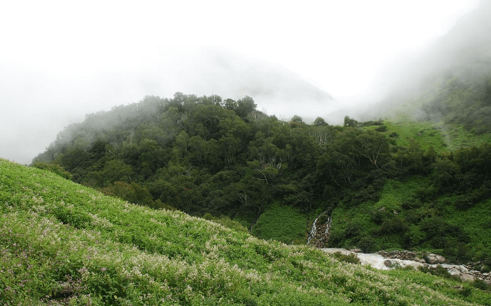
Valley of Flowers: A UNESCO World Heritage site famous for its diverse alpine flora.

Badrinath Temple: A major pilgrimage site dedicated to Lord Vishnu.

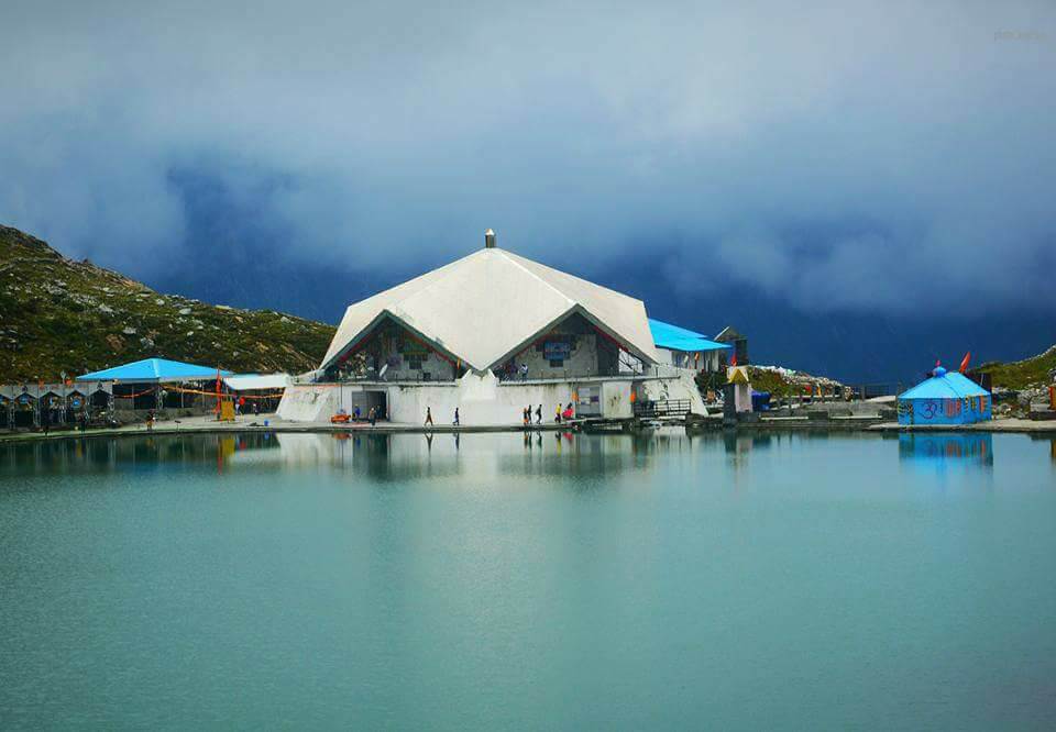
Hemkund Sahib: A revered Sikh pilgrimage site.

Adi Kailash Aadi Kailash

Adi Kailash

Adi Kailash, also known as Chhota Kailash, is a sacred mountain located in the Indian state of Uttarakhand. Standing tall…

Sheshnetra FAQs

  1. What is Sheshnetra?

Sheshnetra is a sacred rock formation located near Badrinath in Uttarakhand, India. The formation resembles the eye of the serpent, Sheshnag, which is believed to be a divine symbol in Hindu mythology.

  1. Where is Sheshnetra located?

Sheshnetra is situated close to the Badrinath Temple, which is in the Chamoli district of Uttarakhand. It is located about 1-2 kilometers from the temple, making it easily accessible for visitors.

  1. How do I reach Sheshnetra from Badrinath Temple?

From Badrinath Temple, Sheshnetra is a short walk or a short drive away. Local guides or transportation options can help you reach the site easily.

  1. What is the significance of Sheshnetra?

Sheshnetra is considered a sacred site where the eye of the serpent deity Sheshnag is believed to be located. It is an important pilgrimage spot and holds religious significance for devotees.

  1. When is the best time to visit Sheshnetra?

The best time to visit Sheshnetra is between May and October, which is the peak tourist season in Badrinath. The weather during these months is generally pleasant and suitable for travel.

  1. What should I carry for a visit to Sheshnetra?

Carry comfortable walking shoes, warm clothing (as temperatures can be low), and rain gear. It’s also wise to bring water and some snacks, as facilities may be limited.

  1. Is there any accommodation near Sheshnetra?

Accommodation is available in Badrinath, which is the nearest town to Sheshnetra. There are various hotels and lodges ranging from budget to mid-range.

  1. Are permits required to visit Sheshnetra?

No special permits are typically required for visiting Sheshnetra, but it’s always a good idea to check with local authorities or your travel guide for any specific regulations.

  1. Is the visit to Sheshnetra suitable for all visitors?

The visit to Sheshnetra is relatively easy and accessible for most visitors. It involves minimal walking from the Badrinath Temple, making it suitable for all, including families and the elderly.

  1. What other attractions are nearby?

Badrinath Temple: A major pilgrimage site dedicated to Lord Vishnu.
Tapt Kund: Hot springs located near the Badrinath Temple.
Mana Village: The last Indian village before the Tibetan border, offering cultural insights and scenic beauty.

Adi Kailash Aadi Kailash

Adi Kailash

Adi Kailash, also known as Chhota Kailash, is a sacred mountain located in the Indian state of Uttarakhand. Standing tall…

Vasudhara Falls FAQs

  1. Where is Vasudhara Falls located?

Vasudhara Falls is situated in the Indian state of Uttarakhand, in the district of Uttarkashi. It is located in the upper reaches of the Bhagirathi Valley, near the border with Tibet, and is part of the popular trekking route to the Valley of Flowers and the Hemkund Sahib.

  1. What is the height of Vasudhara Falls?

Vasudhara Falls has an approximate height of 400 feet (122 meters), making it one of the prominent waterfalls in the region.

  1. How do I reach Vasudhara Falls?

To reach Vasudhara Falls, you typically need to trek from the town of Joshimath. The trek to Vasudhara Falls starts from the village of Mana, which is about 24 kilometers from Joshimath. From Mana, it is a trek of approximately 6 kilometers to reach the falls.

  1. What is the best time to visit Vasudhara Falls?

The best time to visit Vasudhara Falls is between May and October when the weather is pleasant and the trekking conditions are favorable. During the winter months, the region experiences heavy snowfall, making the trek challenging and inaccessible.

  1. What should I carry for the trek?

Comfortable trekking shoes
Warm clothing (even in summer, temperatures can drop)
Rain gear (since the weather can be unpredictable)
Water bottles and snacks
A first aid kit
Sunscreen and sunglasses

  1. Is there any accommodation available near Vasudhara Falls?

There are no accommodations directly at Vasudhara Falls, but you can stay in Mana Village or Joshimath. Mana Village offers basic guesthouses, while Joshimath has more options ranging from budget to mid-range hotels.

  1. Are permits required to visit Vasudhara Falls?

No special permits are required to visit Vasudhara Falls, but it is essential to check with local authorities or travel guides for any recent regulations or changes in the area’s access requirements.

  1. Is the trek to Vasudhara Falls difficult?

The trek to Vasudhara Falls is considered moderate to difficult due to its altitude and the terrain. It involves a gradual ascent and may be challenging for those not accustomed to high-altitude trekking. Proper acclimatization and physical fitness are recommended.

  1. Can I visit Vasudhara Falls if I have altitude sickness?

If you suffer from altitude sickness or have any health concerns, it is advisable to consult with a healthcare professional before undertaking the trek. Adequate acclimatization and caution are essential for high-altitude trekking.

  1. What are some other attractions near Vasudhara Falls?

Mana Village: Known as the last Indian village on the border with Tibet, with cultural and scenic significance.
Hemkund Sahib: A revered Sikh pilgrimage site and a high-altitude lake.
Valley of Flowers: A UNESCO World Heritage site famous for its diverse flora.

Adi Kailash Aadi Kailash

Adi Kailash

Adi Kailash, also known as Chhota Kailash, is a sacred mountain located in the Indian state of Uttarakhand. Standing tall…

Contact Us