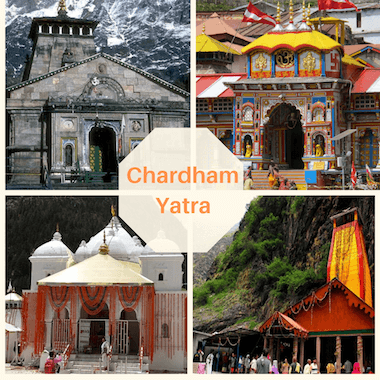
Char Dham Yatra 2025 Fixed Departure Date Ex Delhi
Char Dham Yatra 2025 From Delhi
May
June
July
August
September
October
May 09, 17, 24
June 07, 14
July 15
Aug 13, 18
Sep 06, 13, 20, 27
Oct 4,11, 18,26
Char Dham  Yatra Itinerary Ex Delhi
Yatra Cost :- ₹24500/- (5% GST will be extra Charge)
Day 1: Delhi to Haridwar Day 2: Haridwar to Barkot Day 3: Barkot – Yamunotri – Barkot Day 4: Barkot – Uttarkashi Day 5: Uttarkashi – Gangotri – Uttarkashi Day 6: Uttarkashi to Guptkashi Day 7: Guptkashi – Kedarnath – Guptkashi Day 8: Guptkashi to Badrinath Day 9: Badrinath to Rudraprayag Day 10: Rudraprayag to Rishikesh Day 11: Rishikesh to Delhi
Char Dham Yatra 2024 Fixed Departure Date Ex Haridwar
Char Dham Yatra 2025 From Haridwar
May
June
July
August
September
October
May 10, 18, 26
June 08, 15
July 15
Aug 13, 18
Sep 07, 14, 21, 28
Oct 5, 12, 19, 26
Char Dham  Yatra Itinerary Ex Delhi
Yatra Cost :- ₹20500/- (5% GST will be extra Charge)
Day 1: Haridwar to Barkot Day 2: Barkot – Yamunotri – Barkot Day 3: Barkot – Uttarkashi Day 4: Uttarkashi – Gangotri – Uttarkashi Day 5: Uttarkashi to Guptkashi Day 6: Guptkashi – Kedarnath Day 7: Kedarnath – Guptkashi Day 8: Guptkashi to Badrinath Day 9: Badrinath to Rudraprayag Day 10: Rudraprayag to Haridwar
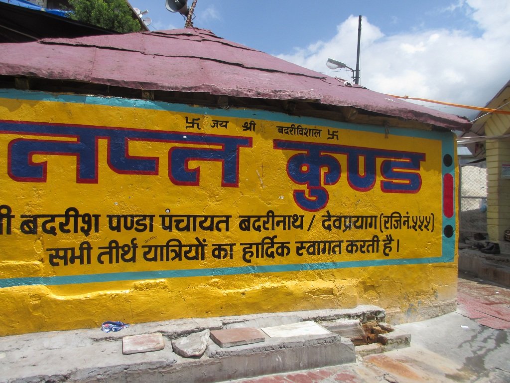
Surya Kund and Tapta Kund are both hot water springs located in Badrinath, a sacred town in Uttarakhand, India. They are significant pilgrimage sites and are often visited by tourists and devotees for their religious and therapeutic properties. Surya Kund is primarily known for its extremely hot water, with temperatures reaching nearly boiling point. It is customary for devotees to cook rice and potatoes in this hot water as an offering to the temple deity before offering it inside the Badrinath Temple.
The story behind Surya Kund is linked to the legend of Lord Vishnu in his form as Badrinarayan and Surya, the sun god.According to the mythology, Lord Vishnu as Badrinarayan sat in deep meditation at Badrinath. However, the place was extremely cold, and concerned for Lord Vishnu, Surya, the sun god, manifested himself as Surya Kund, a natural hot water spring, to provide warmth to the deity. The name “Surya Kund” translates to “the pond of the sun.” It is believed that taking a dip in the holy waters of Surya Kund before entering the Badrinath temple is auspicious and purifying. The water is naturally heated due to geothermal activity, and the high temperature is attributed to the benevolence of Surya, providing warmth in the frigid climate of the region.The association with Surya adds a layer of spiritual significance to the practice, symbolizing purification and invoking the blessings of the sun god before seeking the darshan (sight) of Lord Badrinarayan.
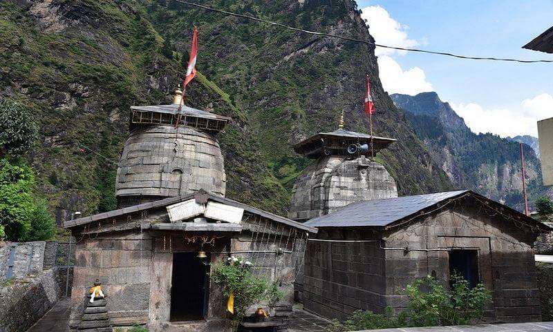
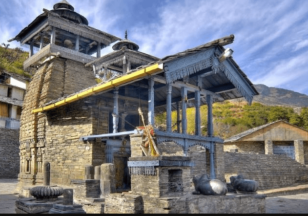
Pandukeshwar is a small village situated in the Chamoli district of Uttarakhand, India. It’s renowned for its cultural and religious significance, particularly due to its proximity to the holy town of Badrinath, which is just about 18 kilometers away. The village is famous for the ancient Pandukeshwar Temple, dedicated to Lord Yogadhyan Badri (a form of Lord Vishnu), which holds immense religious importance.
Pandukeshwar
Location
Chamoli Uttarakhand
Famous For
En route of Char Dham
Altitude
1829 mts
Badrinath Temple
18 Km From Badrinath Temple
Nearest Railway Station or Airport
Rishikesh, 250kms/ Jolly Grant Airport, 270 kms
Best time to visit Ukhimath
May, Jun, July, Aug, Sep, Oct,
Pandukeshwar in Badrinath ( Land of Pandu’s Meditation)
Pandukeshwar earned its name as King Pandu sought solace here to absolve the sin of inadvertently causing a sage’s death. Legend has it that, cursed by the dying sage, Pandu meditated, installing a bronze Vishnu image in Yogadhyan Badri. The curse led to his death upon intimacy, shaping the fate of the Pandavas
Mythology Facts
The village is famous for the ancient Pandukeshwar Temple, dedicated to Lord Yogadhyan Badri (a form of Lord Vishnu), which holds immense religious importance. According to Hindu mythology, it’s believed that the Pandavas, characters from the Indian epic Mahabharata, performed penance here after the Kurukshetra War.
How To Reach Pandukeshwar
By Road
From Delhi: Pandukeshwar is approximately 500 kilometers away from Delhi. You can drive or take a bus from Delhi to Rishikesh, which is the nearest major city. From Rishikesh, you can hire a taxi or take a bus to Pandukeshwar. The journey takes around 12-14 hours, depending on traffic and road conditions.
From Haridwar: If you’re coming from Haridwar, the distance to Pandukeshwar is around 310 kilometers. You can take a bus or hire a taxi from Haridwar to reach Pandukeshwar. The journey usually takes around 10-12 hours.
By Train
The nearest railway station to Pandukeshwar is Rishikesh Railway Station, which is around 274 kilometers away. From Rishikesh, you can hire a taxi or take a bus to Pandukeshwar. The journey by road takes around 9-10 hours.
By Air
The nearest airport to Pandukeshwar is the Jolly Grant Airport in Dehradun, which is approximately 290 kilometers away. From the airport, you can hire a taxi or take a bus to reach Pandukeshwar.
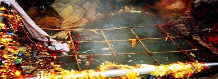
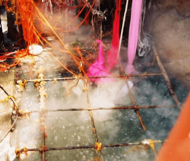
Tapta Kund is a natural hot water spring located in Badrinath, Uttarakhand, India. It holds religious significance and is a part of the revered Badrinath Temple complex. The name “Tapta Kund” translates to “hot spring” in Sanskrit, and the water here is naturally heated due to geothermal energy.
Tapta Kund is a natural thermal spring located in Badrinath, a holy town in the Chamoli district of Uttarakhand, India. It’s situated very close to the famous Badrinath Temple. The water in Tapta Kund remains hot throughout the year and is believed to have medicinal properties. Devotees visiting the Badrinath Temple often take a holy dip in this Kund before entering the temple complex as it’s considered purifying and spiritually significant. The water is naturally heated by the volcanic sources beneath the earth’s surface, making it a unique and revered spot for pilgrims.
A Mythology related to Tapta Kund
Pilgrims visiting Badrinath often take a ritualistic dip in Kund before entering the Badrinath Temple. The water is believed to have therapeutic properties and is considered sacred. It’s said that taking a bath in these hot waters cleanses the body and soul, purifying individuals before they seek the blessings of Lord Badri Vishal in the temple.The temperature of the water can be quite high, and visitors are advised to be cautious while taking a dip. The serene and spiritual ambiance surrounding Tapta Kund adds to its allure, making it not just a site for religious rituals but also a place for spiritual rejuvenation.
How To Reach Tapta Kund
By Road
Tapta Kund is accessible by road from major cities like Dehradun, Haridwar, and Rishikesh.
From Dehradun: Tapta Kund is approximately 200 kilometers away from Dehradun. You can hire a taxi or take a bus from Dehradun to Uttarkashi, and then further to Tapta Kund.
From Rishikesh or Haridwar: Buses and taxis are available from Rishikesh or Haridwar to Uttarkashi, from where you can proceed to Tapta Kund.
By Train
The nearest railway station to Tapta Kund is the Dehradun Railway Station. From Dehradun, you can either hire a taxi or take a bus to reach Tapta Kund via the road route described earlier.
By Air
The nearest airport to Tapta Kund is the Jolly Grant Airport in Dehradun. From the airport, you can hire a taxi or take a bus to reach Tapta Kund via the road route mentioned above.
How to Reach Tapta Kund
Badrinath is approximately 320-330 km away from both Haridwar and Rishikesh.
You can hire a taxi or take a bus from these places to reach Badrinath.
The Kund is just 0.5 km away from Badrinath.
The kund is located between Badrinath Temple and Alkananda river
.Walk to the Kund from Badrinath.
Kund is a natural hot water spring located in Badrinath,
This Temple is a sacred Hindu shrine located in the town of Badrinath, Uttarakhand, India. Dedicated to Mata Murti, the mother of Lord Badrinath (an incarnation of Lord Vishnu), this temple holds immense religious significance. According to Hindu mythology, it was Mata Murti’s penance that led Lord Vishnu to take the form of Badrinath to alleviate human suffering. Surrounded by the majestic Himalayas, the temple offers stunning views of the natural landscape. Devotees visit Mata Murti Temple to seek blessings for prosperity, well-being, and the strength to overcome challenges. The temple’s serene ambiance and breathtaking surroundings add to the spiritual experience, making it a revered pilgrimage site in the sacred town of Badrinath
If you’re traveling by road, you can reach Mata Murti Temple by taking a bus or driving. The temple is accessible via National Highway 58, which connects major cities like Haridwar, Rishikesh, and Dehradun to Badrinath. From Badrinath, Mata Murti Temple is around 3 kilometers away. You can hire a taxi or use local transportation to reach the temple from Badrinath.
By Train
The nearest railway station to Mata Murti Temple is in Rishikesh, which is approximately 295 kilometers away. From Badrinath, follow the road to Mata Murti Temple as mentioned earlier.
By Air
The nearest airport to Mata Murti Temple is the Jolly Grant Airport in Dehradun, which is approximately 320 kilometers away. From Dehradun, you can hire a taxi or take a bus to reach Badrinath. From Badrinath, follow the road to Mata Murti Temple as mentioned above.
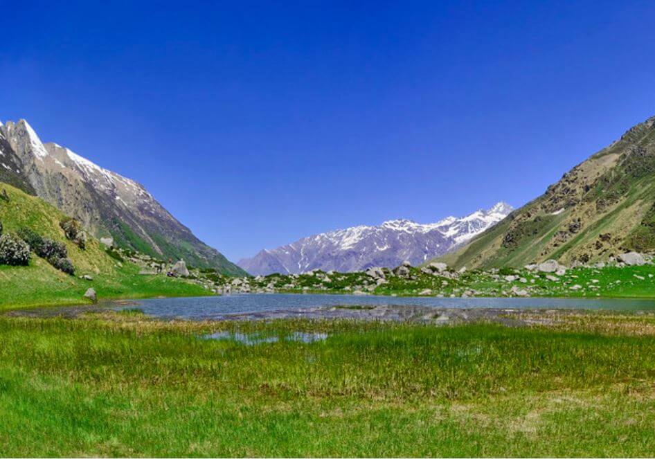
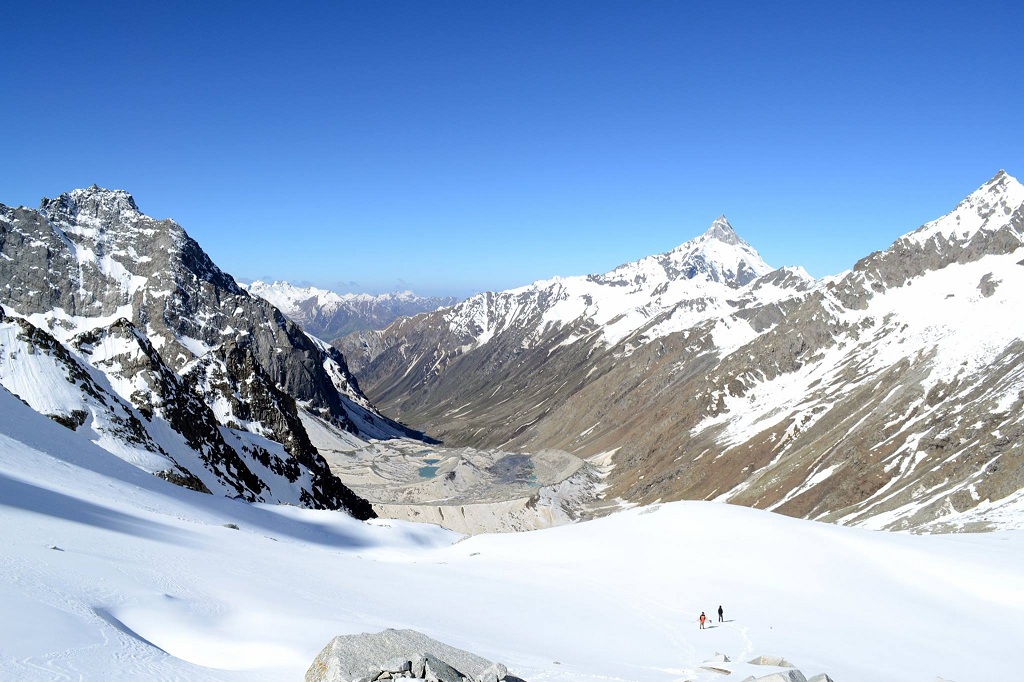
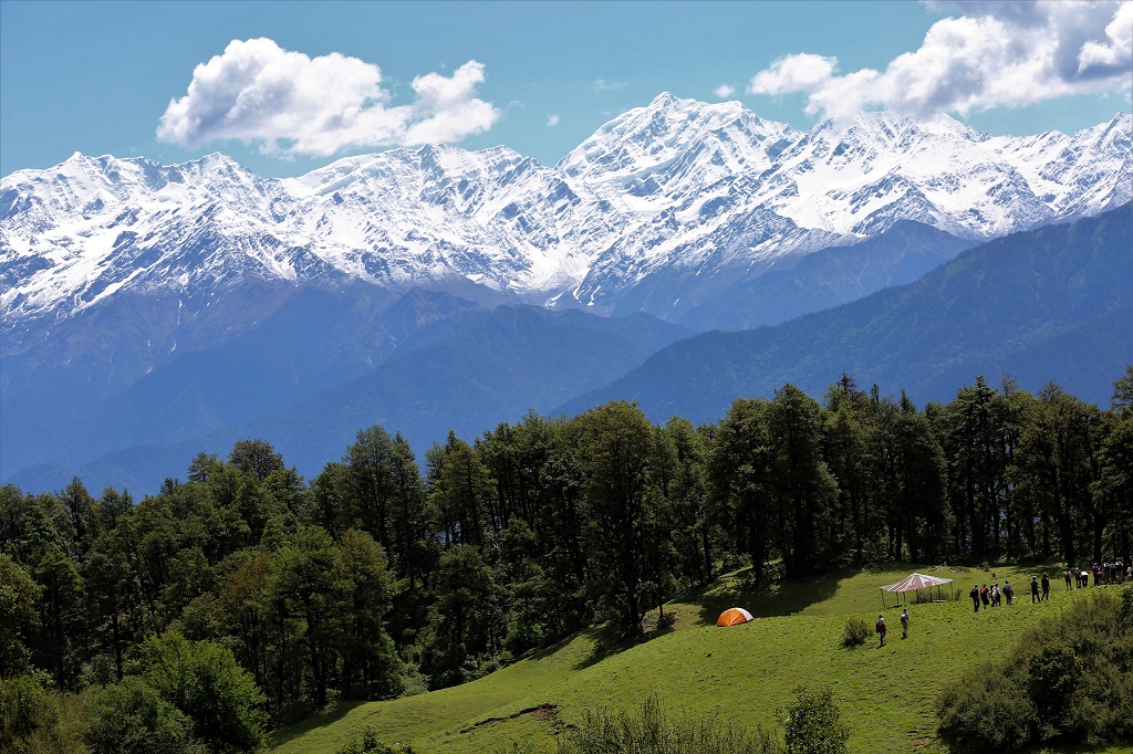
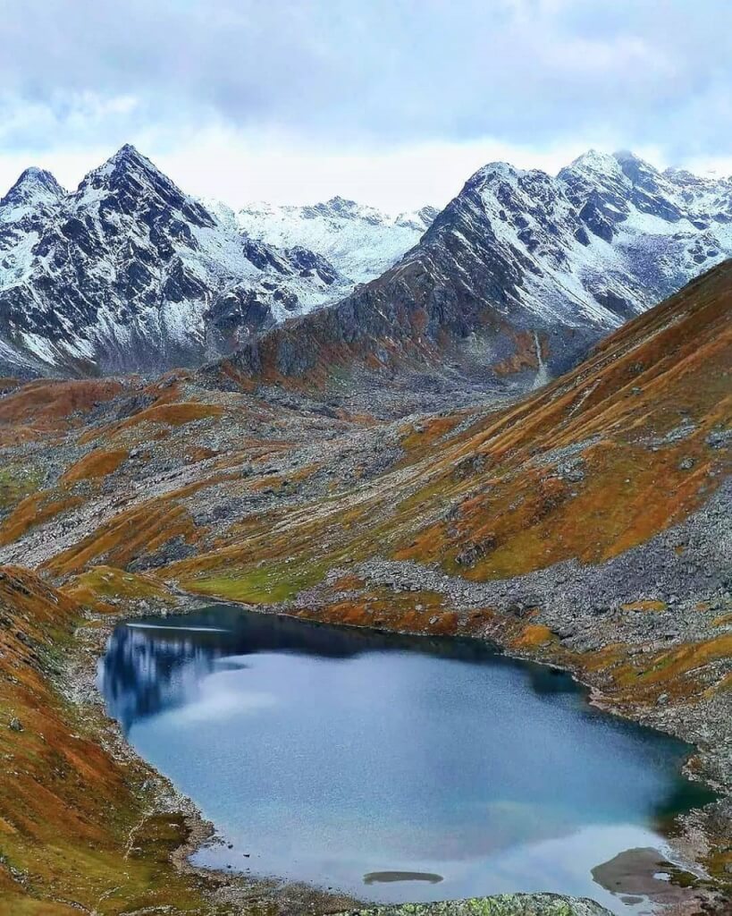
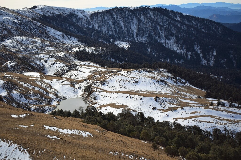
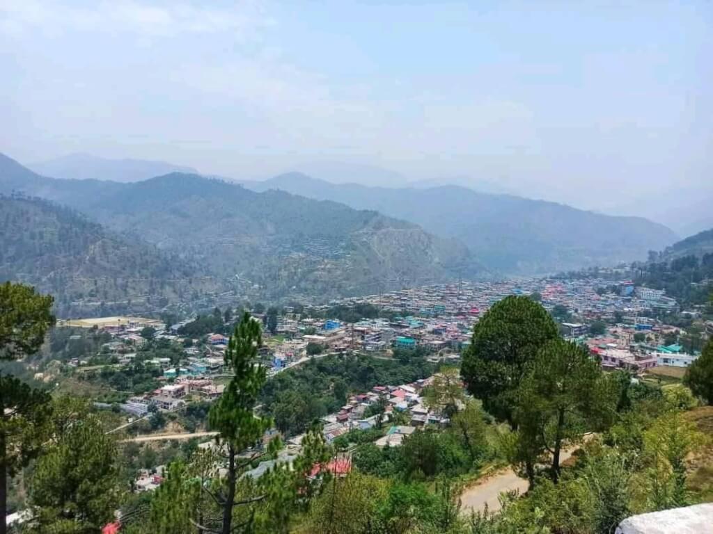
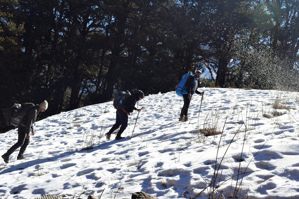
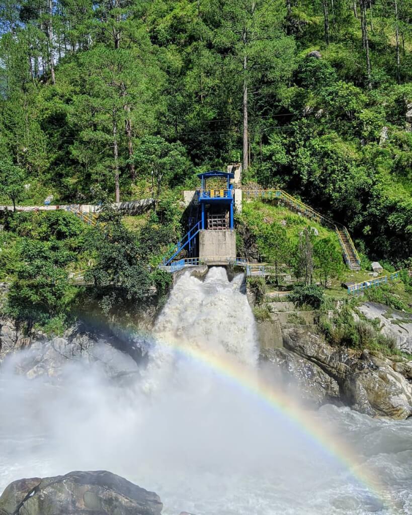
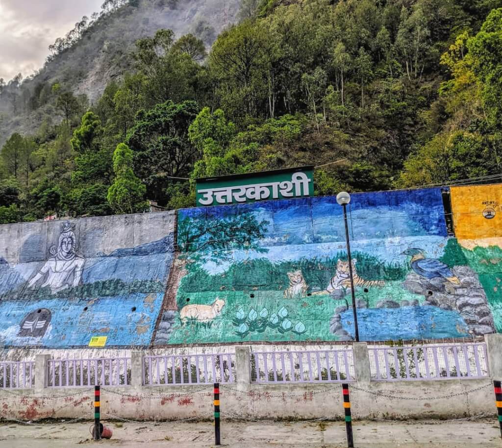
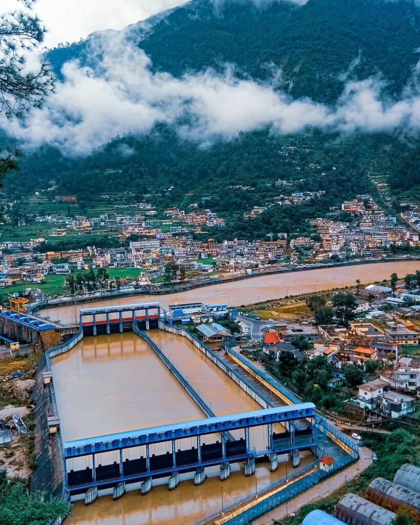
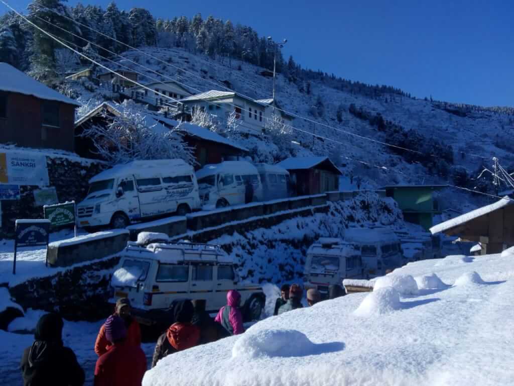
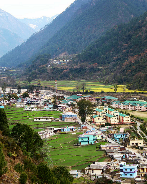
Uttarkashi, dubbed the “Kashi of the North,” beckons adventure enthusiasts to explore its Himalayan wonders. Nestled by the Bhagirathi River at 1352 meters, this serene town, also known as Shivnagri, boasts religious sanctuaries, ashrams, and architectural charm. Dive into trekking bliss with the Rupin Pass and Dayara Bugyal trails, offering enchanting Himalayan vistas. Barnala Tal, a natural lake, transforms into skiing slopes in winter. Experience Kedartal near Gangotri, guarded by snow-clad peaks, for an unparalleled trekking adventure. Uttarkashi unveils a tapestry of spiritual richness and natural allure, making it a haven for trekkers and nature enthusiasts alike.
The Vyas Cave, also known as Vyas Gufa, holds immense significance in Hindu mythology and is located near Badrinath in the Chamoli district of Uttarakhand, India. It is believed to be the place where Ved Vyas, the revered sage who compiled the ancient Indian scriptures, the Mahabharata, and the Puranas, resided and composed these texts.The cave is situated around 3 kilometers from Badrinath and is nestled amidst breathtaking natural beauty, surrounded by majestic mountains and lush greenery.
Vyas Cave, Uttarakhand
Location
Chamoli
Famous For
Bhim Pul, Saraswati River, Vyas Gufa
Altitude
3200 mts
Badrinath Temple
3 Km From Badrinath Temple
Nearest Railway Station or Airport
Rishikesh, 250kms/ Jolly Grant Airport, 270 kms
Best time to visit Ukhimath
May, Jun, Sep, Oct
Attractions in Ved Cave
Mana Village: Known as the last village before the Indo-China border, it’s associated with Ved Gufa. Visitors can find a small temple dedicated to him here.
Badrinath Temple: Though not directly linked to Ved Gufa, it’s close to places associated with him. It’s a significant Hindu temple in Uttarakhand.
How To Reach Vyas Cave
By Road
Ved Cave is accessible by road from major cities and towns in Uttarakhand. You can take a bus or hire a taxi from nearby towns like Chamoli, Joshimath, or Rishikesh. If you’re driving yourself, the nearest major city is Rishikesh, from where you can take NH7 towards Chamoli. From Chamoli, you’ll head towards Ved Cave.
Make sure to check the road conditions and plan your journey accordingly, especially during the monsoon season.
By Train
The nearest railway station to Ved Cave is Rishikesh Railway Station, located approximately 200 kilometers away. From Rishikesh, you can hire a taxi or take a bus to Chamoli or Joshimath and then proceed towards Ved Cave by road.
By Air
The nearest airport to Ved Cave is Jolly Grant Airport in Dehradun, which is about 220 kilometers away. From the airport, you can hire a taxi or take a bus to Chamoli or Joshimath.
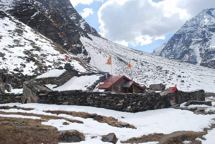
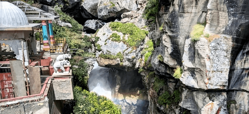
Gangotri and Yamunotri are prominent pilgrimage sites in Uttarkashi, India. Gangotri is revered as the source of the Ganges River, while Yamunotri is dedicated to the Yamuna River. Both Dhams hold cultural and spiritual significance, attracting devotees seeking blessings and purification in the Himalayan region
Location
Uttarakashi
Famous For
Gangotri Dham, Village Tourism, Trekking,
Altitude
1165 mts
Gangotri Temple
100 Km From Uttarakashi
Nearest Railway Station or Airport
Rishikesh, 200kms/ Jolly Grant Airport, 220 kms
Best time to visit Uttarakashi
Round the year
Gangotri and Yamunotri: Two holy places together in Uttarakashi district
Yamunotri Dham
Yamunotri Temple, nestled in the Garhwal Himalayas of Uttarakhand, India, is a sacred Hindu shrine dedicated to Goddess Yamuna. Perched at an altitude of 3,293 meters (10,804 feet), the temple marks the origin of the revered Yamuna River.
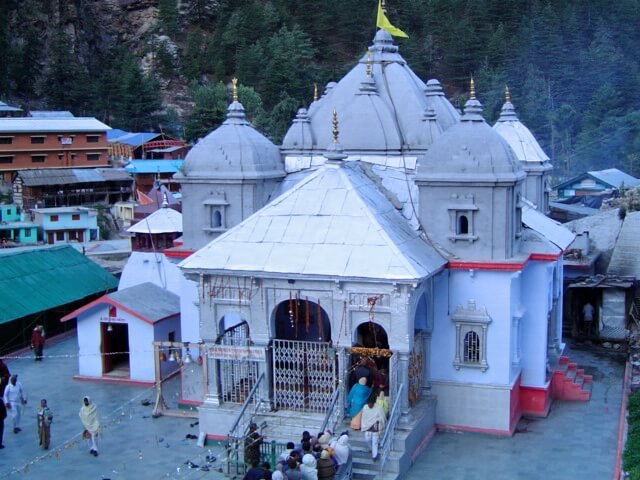
Gangotri Temple, nestled in Uttarkashi, India, is a sacred Hindu shrine dedicated to Goddess Ganga. Perched at an altitude of 3,100 meters, it marks the origin of the Ganges River. Pilgrims visit this revered site to seek blessings, particularly during the auspicious Char Dham Yatra, immersing in spiritual serenity
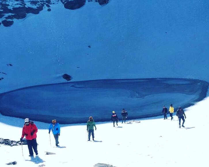
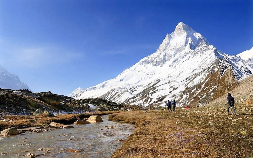
Uttarkashi boasts over 15 renowned trekking routes, offering breathtaking landscapes and adventure. Popular trails include the Gangotri-Gaumukh trek to the Ganges source, Dayara Bugyal for alpine meadows, and Dodital for its pristine lake. These diverse routes captivate trekking enthusiasts with their scenic beauty and challenging terrain.
Popullar Trekking Destination in Uttarakashi
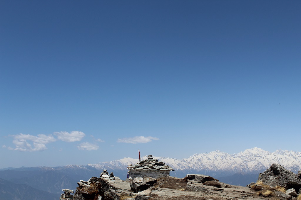
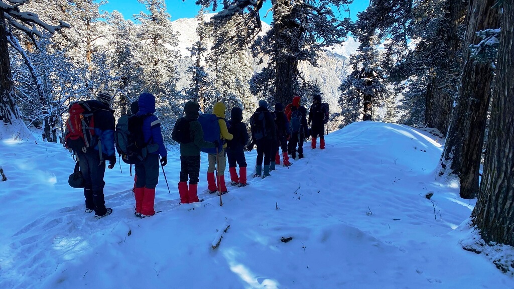
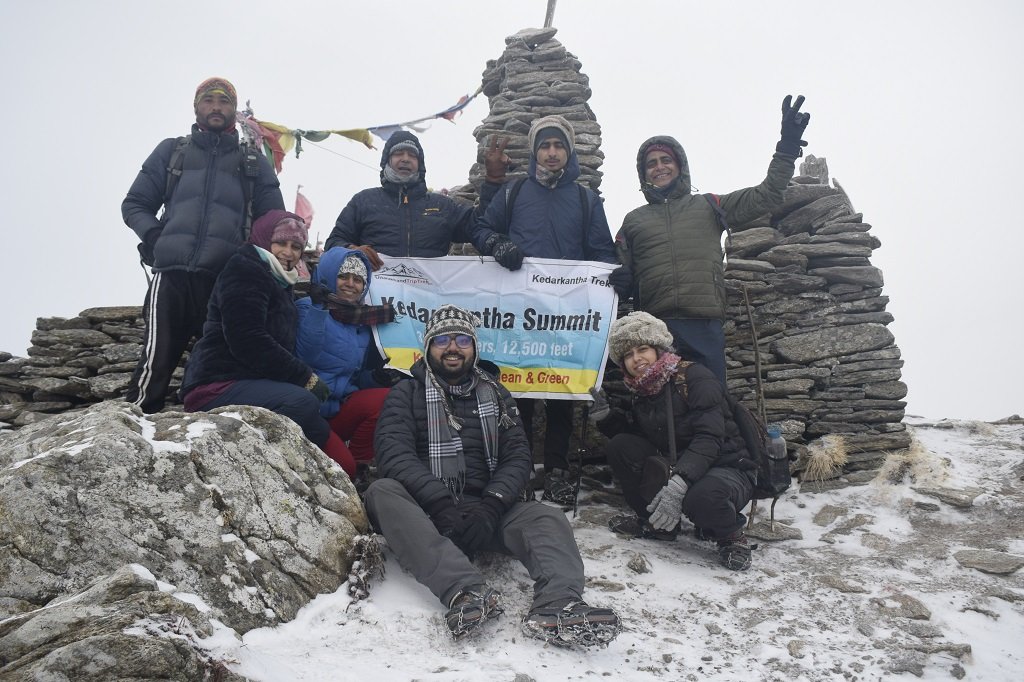
Kedarkantha Trek
Embark on the Kedarkantha trek, a winter wonderland adventure in Uttarakhand. This 5-day trek leads through dense pine forests to the summit, offering panoramic views of Himalayan peaks covered in snow, including the revered Kedarnath. The trek’s moderate difficulty level makes it suitable for both beginners and seasoned trekkers, making it a popular choice for those seeking a thrilling Himalayan
The Gaumukh-Tapovan trek in Uttarkashi unfolds a mesmerizing journey to the Ganges source. Trekkers traverse glaciers, witness the iconic “Cow’s Mouth” where the river emerges, and ascend to Tapovan’s high-altitude meadows. This challenging trek captivates adventurers with its panoramic views of Himalayan peaks and a spiritual ambiance.
Dayara Bugyal, a vast alpine meadow, awaits trekkers seeking tranquility and stunning vistas. This 4-day trek unveils breathtaking scenery with panoramic views of Himalayan peaks. The meadows, adorned with vibrant wildflowers in the spring, create a picturesque landscape that captures the hearts of nature enthusiasts.
Uttarkashi experiences a temperate climate with cool summers and cold winters. Summer temperatures range from 15°C to 30°C, while winter temperatures can drop to as low as 0°C or below.
4. What is the best time to visit Uttarkashi?
The best time to visit Uttarkashi is during the summer months, from April to June, and the post-monsoon season, from September to November, when the weather is pleasant and suitable for outdoor activities.
5. What are the best accommodations in Uttarkashi?
Uttarkashi offers various accommodation options including hotels, guesthouses, and lodges. Some popular choices include Hotel Shikhar, GMVN Tourist Rest House, and several budget guesthouses.
Bheem Pul is a historic site located in the Indian state of Uttarakhand. It’s an ancient stone bridge constructed over the Saraswati River in the town of Joshimath.Legend has it that this bridge was built by the mighty Pandavas from the Indian epic Mahabharata during their exile. The bridge is named after the powerful Pandava prince Bhima, known for his immense strength.Bheem Pul is not just a historical site but also a significant cultural and religious landmark for locals and tourists alike, attracting visitors interested in history, mythology, and the natural beauty of the region.
Several attractions in and around Mana village draw tourists and pilgrims alike:
Vyas Gufa (Vyas Cave): It is believed to be the place where Ved Vyasa, the sage who compiled the Vedas, dictated the epic Mahabharata to Lord Ganesha.
Bheem Shila: A huge rock where it’s believed Bhima rested and meditated.
Ganesh Gufa: A cave where Lord Ganesh is said to have written the Mahabharata as dictated by Sage Vyasa.
Vasudhara Falls: A stunning waterfall located a few kilometers from Mana village, known for its beauty and spiritual significance.
Badrinath Temple: Situated close to Mana, it’s one of the Char Dham pilgrimage sites in India and dedicated to Lord Vishnu.
Treks from Bheem Pul
Bheem Pul situated near the town of Mana, close to the Badrinath temple. The area offers several trekking opportunities for enthusiasts looking to explore the stunning Himalayan landscapes.
Valley of Flowers Trek: One of the most popular treks, it starts from Govindghat and leads to the Valley of Flowers National Park, famous for its diverse flora, meadows, and breathtaking views of the surrounding peaks.
Hemkund Sahib Trek: Also starting from Govindghat, this trek leads to the revered Sikh pilgrimage site of Hemkund Sahib, surrounded by seven snow-capped mountains. The trail passes through picturesque landscapes and alpine meadows.
Vasudhara Falls Trek: This trek starts from Mana village, close to Bheem Pul, and leads to the stunning Vasudhara Falls, believed to be associated with the Pandavas of the Mahabharata. It’s a relatively shorter trek compared to others in the region.
Satopanth Lake Trek: A challenging trek that begins from Mana, passing through Laxmi Van and Chakratirtha before reaching the sacred Satopanth Lake, known for its crystal-clear waters and panoramic views.
How To Reach Bheem Pul
By Road
Bheem Pul is a famous tourist spot in India, located in the state of Uttarakhand near Mana village. Mana is well-connected by road, and you can drive or take a bus from major cities in Uttarakhand. The journey involves passing through towns like Joshimath and Badrinath.Once you reach Mana village, Bheem Pul is a short walk away.
From Badrinath, Mana is just about 3 kilometers away. You can hire a local taxi or use shared vehicles for the short journey, and you reach Bheem Pul.
If you are traveling from Delhi, you can take a bus or drive to Haridwar or Rishikesh and then proceed towards Mana.
By Train
The nearest railway station to Bheem Pul is Rishikesh Railway Station. From Rishikesh, you can take a taxi or bus to reach Chamoli. The journey from Rishikesh to Chamoli by road takes around 7-8 hours.
By Air
The nearest airport to Bheem Pul is the Jolly Grant Airport in Dehradun. It’s approximately an 8-9 hour journey from Dehradun to Chamoli by road.
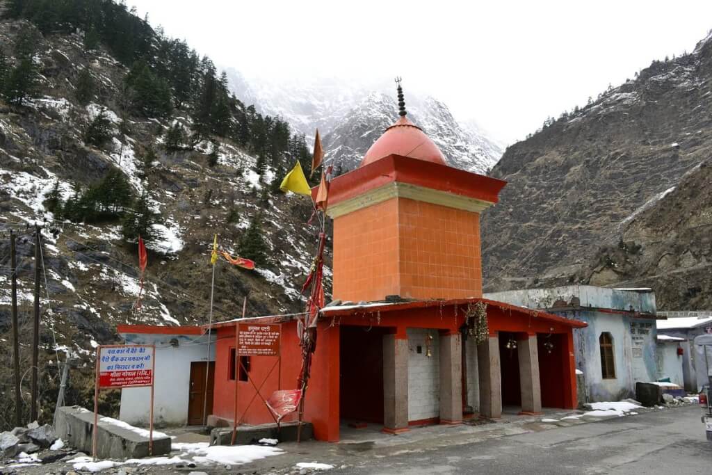
it is situated near the sacred Yamunotri Temple in Uttarakhand, is a natural thermal spring known for its scalding temperatures….
Some Trekking Destination Near Barkot
Barkot, surrounded by the majestic Himalayas, offers enticing trekking opportunities just a short distance away. Explore scenic trails like Dodital, Dayara Bugyal, Kedarkantha & etc, each promising breathtaking views and a connection with nature. These trekking routes near Barkot provide adventure enthusiasts with a thrilling escape into the pristine wilderness of Uttarakhand.